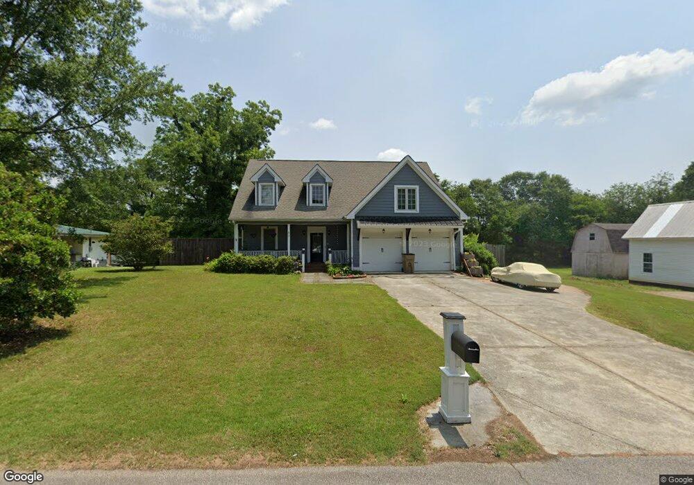
57 New St Hoschton, GA 30548
Estimated Value: $427,000 - $675,000
--
Bed
2
Baths
2,174
Sq Ft
$236/Sq Ft
Est. Value
About This Home
This home is located at 57 New St, Hoschton, GA 30548 and is currently estimated at $513,573, approximately $236 per square foot. 57 New St is a home located in Jackson County with nearby schools including West Jackson Elementary School, West Jackson Middle School, and Jackson County High School.
Ownership History
Date
Name
Owned For
Owner Type
Purchase Details
Closed on
Aug 30, 2019
Sold by
Clanton Daniel Kieth
Bought by
Bagala Frank J and Bagala Ellen F
Current Estimated Value
Home Financials for this Owner
Home Financials are based on the most recent Mortgage that was taken out on this home.
Original Mortgage
$265,500
Outstanding Balance
$233,032
Interest Rate
3.7%
Estimated Equity
$280,541
Purchase Details
Closed on
Jan 18, 2000
Sold by
Huntsinger Bobby and Huntsinger S
Bought by
Clanton Daniel Keith
Create a Home Valuation Report for This Property
The Home Valuation Report is an in-depth analysis detailing your home's value as well as a comparison with similar homes in the area
Home Values in the Area
Average Home Value in this Area
Purchase History
| Date | Buyer | Sale Price | Title Company |
|---|---|---|---|
| Bagala Frank J | $295,000 | -- | |
| Clanton Daniel Keith | $56,500 | -- |
Source: Public Records
Mortgage History
| Date | Status | Borrower | Loan Amount |
|---|---|---|---|
| Open | Bagala Frank J | $265,500 |
Source: Public Records
Tax History Compared to Growth
Tax History
| Year | Tax Paid | Tax Assessment Tax Assessment Total Assessment is a certain percentage of the fair market value that is determined by local assessors to be the total taxable value of land and additions on the property. | Land | Improvement |
|---|---|---|---|---|
| 2024 | $4,877 | $155,480 | $17,840 | $137,640 |
| 2023 | $4,877 | $142,136 | $17,840 | $124,296 |
| 2022 | $3,884 | $107,856 | $8,920 | $98,936 |
| 2021 | $3,487 | $107,856 | $8,920 | $98,936 |
| 2020 | $3,137 | $89,216 | $8,920 | $80,296 |
| 2019 | $2,810 | $80,348 | $8,920 | $71,428 |
| 2018 | $2,895 | $81,996 | $8,920 | $73,076 |
| 2017 | $2,687 | $75,669 | $7,147 | $68,522 |
| 2016 | $2,697 | $75,669 | $7,147 | $68,522 |
| 2015 | $2,708 | $75,669 | $7,147 | $68,522 |
| 2014 | $2,631 | $74,970 | $7,147 | $67,823 |
| 2013 | -- | $74,969 | $7,146 | $67,822 |
Source: Public Records
Map
Nearby Homes
- 74 White St
- 8422 Pendergrass Rd
- 49 Creekside Commons Dr
- 45 Creekside Commons Dr
- 41 Creekside Commons Dr
- 37 Creekside Commons Dr
- 21 Creekside Commons Dr
- 154 Serenity Ct
- 15 Creekside Commons Dr
- 11 Creekside Commons Dr
- 176 Bell Ave
- 22 Huntley Trace Unit 230
- 60 Huntley Trace
- 22 Huntley Trace
- 38 Huntley Trace
- 41 Huntley Trace
- 41 Huntley Trace Unit 5