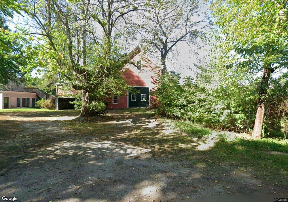
57 Oak Hill Rd Harvard, MA 01451
Estimated Value: $997,000 - $1,447,000
3
Beds
2
Baths
3,554
Sq Ft
$338/Sq Ft
Est. Value
About This Home
This home is located at 57 Oak Hill Rd, Harvard, MA 01451 and is currently estimated at $1,202,871, approximately $338 per square foot. 57 Oak Hill Rd is a home located in Worcester County with nearby schools including Immaculate Heart of Mary School.
Ownership History
Date
Name
Owned For
Owner Type
Purchase Details
Closed on
Mar 3, 1993
Sold by
Nesbeda Peter J and Nesbeda Lucy
Bought by
Nesbeda Lucy H
Current Estimated Value
Home Financials for this Owner
Home Financials are based on the most recent Mortgage that was taken out on this home.
Original Mortgage
$350,000
Interest Rate
7.96%
Mortgage Type
Purchase Money Mortgage
Create a Home Valuation Report for This Property
The Home Valuation Report is an in-depth analysis detailing your home's value as well as a comparison with similar homes in the area
Home Values in the Area
Average Home Value in this Area
Purchase History
| Date | Buyer | Sale Price | Title Company |
|---|---|---|---|
| Nesbeda Lucy H | $175,000 | -- |
Source: Public Records
Mortgage History
| Date | Status | Borrower | Loan Amount |
|---|---|---|---|
| Open | Nesbeda Lucy H | $300,000 | |
| Closed | Nesbeda Lucy H | $350,000 |
Source: Public Records
Tax History Compared to Growth
Tax History
| Year | Tax Paid | Tax Assessment Tax Assessment Total Assessment is a certain percentage of the fair market value that is determined by local assessors to be the total taxable value of land and additions on the property. | Land | Improvement |
|---|---|---|---|---|
| 2025 | $17,614 | $1,125,500 | $354,000 | $771,500 |
| 2024 | $16,187 | $1,086,400 | $340,600 | $745,800 |
| 2023 | $15,303 | $921,300 | $305,100 | $616,200 |
| 2022 | $14,505 | $809,900 | $265,500 | $544,400 |
| 2021 | $13,531 | $720,500 | $265,500 | $455,000 |
| 2020 | $12,329 | $667,500 | $270,200 | $397,300 |
| 2019 | $12,044 | $691,400 | $270,200 | $421,200 |
| 2018 | $12,082 | $704,500 | $270,200 | $434,300 |
| 2017 | $10,900 | $602,200 | $231,200 | $371,000 |
| 2016 | $11,249 | $623,200 | $221,500 | $401,700 |
| 2015 | $10,854 | $610,100 | $217,100 | $393,000 |
| 2014 | $10,427 | $610,100 | $217,100 | $393,000 |
Source: Public Records
Map
Nearby Homes
- 24 Fairbanks St
- 11 Fairbanks St Unit 2
- 4 Bolton Rd
- 5 Fairbank St
- 87 Ayer Rd
- 176 Swanson Rd Unit 309
- 166 Littleton Rd Unit 3
- 220 Swanson Rd Unit 605
- 220 Swanson Rd Unit 606
- 220 Swanson Rd Unit 604
- 42 Swanson Ct Unit 14A
- 53 Swanson Ct Unit 36C
- 50 Spencer Rd Unit 36
- 310 Codman Hill Rd Unit 35D
- 58 Spencer Rd Unit 18K
- 19 Barton Rd
- 25 Madigan Ln
- Lot 54 Prospect Hill Rd
- Lot 60 Prospect Hill Rd
- 19 Partridge Hill Rd
- 15 Woodchuck Hill Rd
- 55 Oak Hill Rd
- 55 Oak Hill Rd
- 55 Oak Hill Rd
- 43 Oak Hill Rd
- 73 Oak Hill Rd
- 12 Woodchuck Hill Rd
- 53 Oak Hill Rd
- 4 Woodchuck Hill Rd
- 51 Oak Hill Rd
- 75 Oak Hill Rd
- 8 Woodchuck Hill Rd
- 8 Woodchuck Hill Rd
- 8 Woodchuck Hill Rd Unit 8
- 44 Oak Hill Rd
- 18 Woodchuck Hill Rd
- 40 Oak Hill Rd
- 2 Slough Rd
- Lot 4 Slough Rd
- 20 Woodchuck Hill Rd