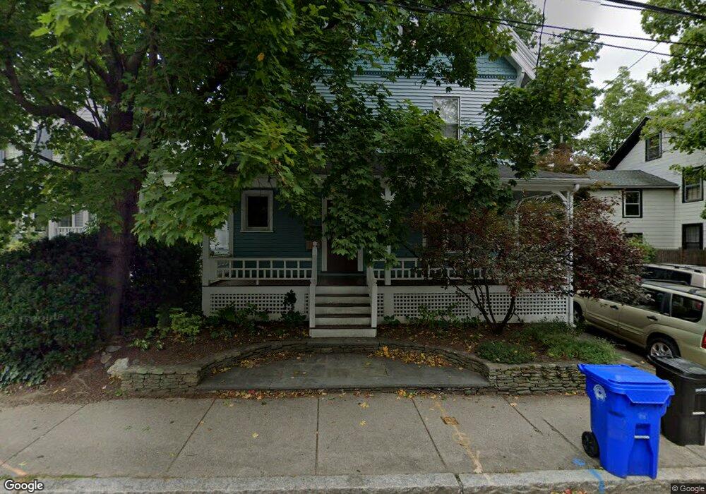
57 Perry St Brookline, MA 02446
Coolidge Corner NeighborhoodEstimated Value: $2,329,000 - $2,771,000
4
Beds
4
Baths
3,088
Sq Ft
$838/Sq Ft
Est. Value
About This Home
This home is located at 57 Perry St, Brookline, MA 02446 and is currently estimated at $2,588,134, approximately $838 per square foot. 57 Perry St is a home located in Norfolk County with nearby schools including Amos A. Lawrence School, Brookline High School, and St. Mary of the Assumption Elementary School.
Ownership History
Date
Name
Owned For
Owner Type
Purchase Details
Closed on
Nov 21, 1994
Sold by
Taylor Ann M
Bought by
Doughty Dennis
Current Estimated Value
Home Financials for this Owner
Home Financials are based on the most recent Mortgage that was taken out on this home.
Original Mortgage
$268,000
Interest Rate
8.9%
Mortgage Type
Purchase Money Mortgage
Create a Home Valuation Report for This Property
The Home Valuation Report is an in-depth analysis detailing your home's value as well as a comparison with similar homes in the area
Home Values in the Area
Average Home Value in this Area
Purchase History
| Date | Buyer | Sale Price | Title Company |
|---|---|---|---|
| Doughty Dennis | $335,000 | -- |
Source: Public Records
Mortgage History
| Date | Status | Borrower | Loan Amount |
|---|---|---|---|
| Open | Doughty Dennis | $216,000 | |
| Closed | Doughty Dennis | $227,000 | |
| Closed | Doughty Dennis | $268,000 |
Source: Public Records
Tax History
| Year | Tax Paid | Tax Assessment Tax Assessment Total Assessment is a certain percentage of the fair market value that is determined by local assessors to be the total taxable value of land and additions on the property. | Land | Improvement |
|---|---|---|---|---|
| 2025 | $21,617 | $2,190,200 | $1,124,100 | $1,066,100 |
| 2024 | $20,745 | $2,123,300 | $1,080,900 | $1,042,400 |
| 2023 | $19,097 | $1,915,400 | $893,000 | $1,022,400 |
| 2022 | $18,589 | $1,824,200 | $850,500 | $973,700 |
| 2021 | $17,190 | $1,754,100 | $817,800 | $936,300 |
| 2020 | $15,743 | $1,665,900 | $743,400 | $922,500 |
| 2019 | $14,866 | $1,586,600 | $708,000 | $878,600 |
| 2018 | $13,485 | $1,425,500 | $558,300 | $867,200 |
| 2017 | $13,460 | $1,362,300 | $526,500 | $835,800 |
| 2016 | $13,267 | $1,273,200 | $492,100 | $781,100 |
| 2015 | $12,262 | $1,148,100 | $418,100 | $730,000 |
| 2014 | $12,429 | $1,091,200 | $380,100 | $711,100 |
Source: Public Records
Map
Nearby Homes
- 106 Brook St
- 61 Toxteth St
- 37 Saint Paul St Unit 3
- 216 Aspinwall Ave
- 216 Aspinwall Ave Unit 3
- 65 Francis St Unit A
- 58 Kent St Unit 303
- 58 Kent St Unit 301
- 58 Kent St Unit 305
- 58 Kent St Unit 402
- 58 Kent St Unit 404
- 15 Kent Square
- 6 Parkway Rd Unit 6
- 45 Longwood Ave Unit 712
- 45 Longwood Ave Unit 812
- 370 Washington St
- 12 Thayer St
- 60 Longwood Ave Unit 802
- 60 Longwood Ave Unit 307
- 12 Goodwin Place Unit 12-1
- 63 Perry St
- 67 Perry St
- 150 Aspinwall Ave
- 152 Aspinwall Ave
- 160 Aspinwall Ave Unit 2
- 160 Aspinwall Ave Unit 1
- 56-58 Perry St Unit 1
- 56-58 Perry St Unit 3
- 56-58 Perry St Unit 2
- 73 Perry St
- 71 Perry St
- 71 Perry St Unit 4
- 56 Perry St Unit 4
- 56 Perry St Unit 3
- 56 Perry St
- 56 Perry St Unit 1
- 162 Aspinwall Ave
- 66 Perry St
- 66 Perry St Unit 4
- 66 Perry St Unit 2
Your Personal Tour Guide
Ask me questions while you tour the home.