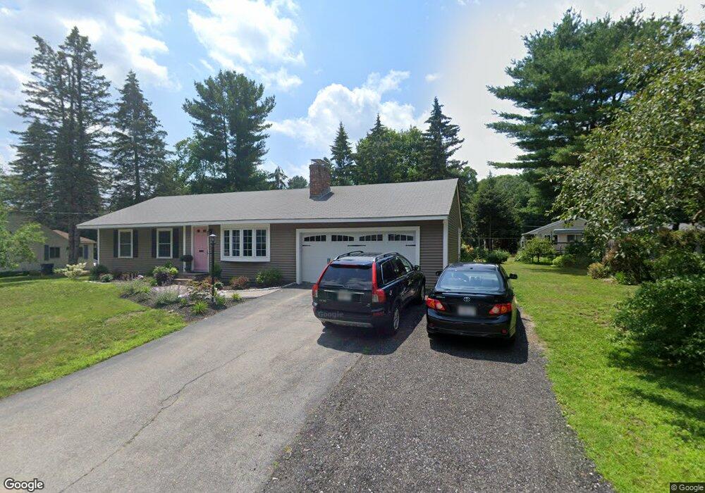
57 Powers Rd Holden, MA 01520
Estimated Value: $420,000 - $451,000
2
Beds
1
Bath
1,154
Sq Ft
$374/Sq Ft
Est. Value
About This Home
This home is located at 57 Powers Rd, Holden, MA 01520 and is currently estimated at $431,763, approximately $374 per square foot. 57 Powers Rd is a home located in Worcester County with nearby schools including Wachusett Regional High School, Holden Christian Academy, and Bancroft School.
Ownership History
Date
Name
Owned For
Owner Type
Purchase Details
Closed on
Mar 30, 2017
Sold by
Benson Roy and Wendell Janet
Bought by
Duchemin Susan B
Current Estimated Value
Home Financials for this Owner
Home Financials are based on the most recent Mortgage that was taken out on this home.
Original Mortgage
$181,600
Outstanding Balance
$150,870
Interest Rate
4.15%
Mortgage Type
New Conventional
Estimated Equity
$280,893
Purchase Details
Closed on
Feb 4, 1977
Bought by
Ewing Berwell F and Ewing Louise M
Create a Home Valuation Report for This Property
The Home Valuation Report is an in-depth analysis detailing your home's value as well as a comparison with similar homes in the area
Home Values in the Area
Average Home Value in this Area
Purchase History
| Date | Buyer | Sale Price | Title Company |
|---|---|---|---|
| Duchemin Susan B | $227,000 | -- | |
| Ewing Berwell F | -- | -- |
Source: Public Records
Mortgage History
| Date | Status | Borrower | Loan Amount |
|---|---|---|---|
| Open | Duchemin Susan B | $181,600 |
Source: Public Records
Tax History
| Year | Tax Paid | Tax Assessment Tax Assessment Total Assessment is a certain percentage of the fair market value that is determined by local assessors to be the total taxable value of land and additions on the property. | Land | Improvement |
|---|---|---|---|---|
| 2025 | $5,795 | $418,100 | $143,000 | $275,100 |
| 2024 | $5,361 | $378,900 | $138,800 | $240,100 |
| 2023 | $5,190 | $346,200 | $120,700 | $225,500 |
| 2022 | $5,054 | $305,200 | $94,200 | $211,000 |
| 2021 | $4,881 | $280,500 | $89,800 | $190,700 |
| 2020 | $4,498 | $264,600 | $85,500 | $179,100 |
| 2019 | $4,415 | $253,000 | $85,500 | $167,500 |
| 2018 | $3,876 | $220,100 | $81,400 | $138,700 |
| 2017 | $3,789 | $215,400 | $81,400 | $134,000 |
| 2016 | $3,560 | $206,400 | $77,600 | $128,800 |
| 2015 | $3,550 | $195,900 | $77,600 | $118,300 |
| 2014 | $3,477 | $195,900 | $77,600 | $118,300 |
Source: Public Records
Map
Nearby Homes
- 216 Reservoir St Unit 107
- 216 Reservoir St Unit 208
- 216 Reservoir St Unit 202
- 218 Reservoir St Unit 326
- 16 Pine Tree Rd Unit A
- 21 Pine Tree Rd Unit A
- 21 Pine Tree Rd Unit B
- 15 Pine Tree Rd Unit A
- 15 Pine Tree Rd Unit C
- 15 Pine Tree Rd Unit B
- 1 Kris Alan Dr
- 63 Walnut St
- 136 Winthrop Ln
- 135 Highland Ave
- 134 Jamieson Rd
- 81 Deanna Dr
- 131 Twinbrooke Dr
- 4 Deanna Dr
- 168 Twinbrooke Dr
- 64 Kendall Rd
Your Personal Tour Guide
Ask me questions while you tour the home.