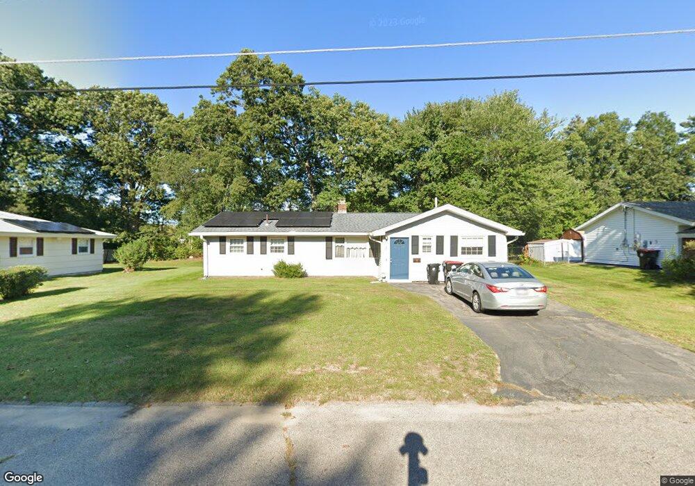
57 Robert Rd Brockton, MA 02302
Montello NeighborhoodEstimated Value: $491,000 - $501,000
4
Beds
2
Baths
1,340
Sq Ft
$371/Sq Ft
Est. Value
About This Home
This home is located at 57 Robert Rd, Brockton, MA 02302 and is currently estimated at $496,722, approximately $370 per square foot. 57 Robert Rd is a home located in Plymouth County with nearby schools including Brookfield Elementary School, Mary E. Baker Elementary School, and Downey Elementary School.
Create a Home Valuation Report for This Property
The Home Valuation Report is an in-depth analysis detailing your home's value as well as a comparison with similar homes in the area
Home Values in the Area
Average Home Value in this Area
Tax History
| Year | Tax Paid | Tax Assessment Tax Assessment Total Assessment is a certain percentage of the fair market value that is determined by local assessors to be the total taxable value of land and additions on the property. | Land | Improvement |
|---|---|---|---|---|
| 2025 | $5,225 | $431,500 | $162,800 | $268,700 |
| 2024 | $4,914 | $408,800 | $162,800 | $246,000 |
| 2023 | $4,599 | $354,300 | $113,200 | $241,100 |
| 2022 | $4,307 | $308,300 | $102,900 | $205,400 |
| 2021 | $4,246 | $292,800 | $96,400 | $196,400 |
| 2020 | $4,301 | $283,900 | $84,200 | $199,700 |
| 2019 | $4,016 | $258,400 | $80,700 | $177,700 |
| 2018 | $3,850 | $239,700 | $80,700 | $159,000 |
| 2017 | $3,653 | $226,900 | $80,700 | $146,200 |
| 2016 | $3,406 | $196,200 | $77,000 | $119,200 |
| 2015 | $3,040 | $167,500 | $77,000 | $90,500 |
| 2014 | $3,059 | $168,700 | $77,000 | $91,700 |
Source: Public Records
Map
Nearby Homes
- 1004 S Franklin St
- 45 Braintree Ave
- 12 Hamilton Way
- 170 Elsie Rd
- 719 S Franklin St Unit C Block 1
- 133 Ardsley Cir
- 31 Sprague St
- 40 Christopher Rd
- 61 Kent St
- 105 Oscar Ave
- 68 Spring St
- 265 Winter St
- 42 Pratt St
- 215 North Ave
- 95 Rindone St
- 97 Studley Ave
- 18 Banks St
- 35 Marion St
- 2 Glendower St
- 11 Winsten St