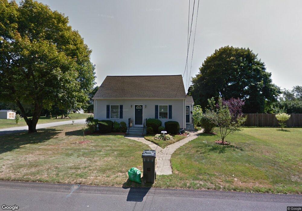
57 Swansom Rd Swansea, MA 02777
Northeast Swansea NeighborhoodEstimated Value: $438,000 - $520,000
3
Beds
2
Baths
1,123
Sq Ft
$423/Sq Ft
Est. Value
About This Home
This home is located at 57 Swansom Rd, Swansea, MA 02777 and is currently estimated at $475,262, approximately $423 per square foot. 57 Swansom Rd is a home located in Bristol County with nearby schools including Joseph Case High School, St. Michael's School, and Swansea Wood School.
Ownership History
Date
Name
Owned For
Owner Type
Purchase Details
Closed on
Jul 24, 2020
Sold by
Castonguay Joseph R and Castonguay Gary V
Bought by
Castonguay Gary V
Current Estimated Value
Home Financials for this Owner
Home Financials are based on the most recent Mortgage that was taken out on this home.
Original Mortgage
$127,000
Outstanding Balance
$112,364
Interest Rate
3.1%
Mortgage Type
New Conventional
Estimated Equity
$362,898
Purchase Details
Closed on
Dec 22, 2011
Sold by
Clement Rt and Castonguay
Bought by
Castonguay Gary V and Castonguay Joseph R
Home Financials for this Owner
Home Financials are based on the most recent Mortgage that was taken out on this home.
Original Mortgage
$153,000
Interest Rate
4%
Mortgage Type
Purchase Money Mortgage
Create a Home Valuation Report for This Property
The Home Valuation Report is an in-depth analysis detailing your home's value as well as a comparison with similar homes in the area
Home Values in the Area
Average Home Value in this Area
Purchase History
| Date | Buyer | Sale Price | Title Company |
|---|---|---|---|
| Castonguay Gary V | -- | None Available | |
| Castonguay Gary V | $191,500 | -- |
Source: Public Records
Mortgage History
| Date | Status | Borrower | Loan Amount |
|---|---|---|---|
| Open | Castonguay Gary V | $127,000 | |
| Previous Owner | Castonguay Gary V | $153,000 |
Source: Public Records
Tax History Compared to Growth
Tax History
| Year | Tax Paid | Tax Assessment Tax Assessment Total Assessment is a certain percentage of the fair market value that is determined by local assessors to be the total taxable value of land and additions on the property. | Land | Improvement |
|---|---|---|---|---|
| 2025 | $4,112 | $345,000 | $141,000 | $204,000 |
| 2024 | $4,089 | $341,000 | $141,000 | $200,000 |
| 2023 | $3,721 | $283,400 | $103,300 | $180,100 |
| 2022 | $3,606 | $250,600 | $94,000 | $156,600 |
| 2021 | $3,365 | $215,300 | $90,400 | $124,900 |
| 2020 | $3,353 | $215,200 | $90,400 | $124,800 |
| 2019 | $3,141 | $202,500 | $80,500 | $122,000 |
| 2018 | $3,068 | $200,800 | $78,800 | $122,000 |
| 2017 | $2,741 | $206,400 | $78,800 | $127,600 |
| 2016 | $2,624 | $194,100 | $68,100 | $126,000 |
| 2015 | $2,438 | $185,700 | $68,100 | $117,600 |
| 2014 | $2,347 | $182,800 | $68,100 | $114,700 |
Source: Public Records
Map
Nearby Homes
- 33 Rhinecliffe Rd
- 58 Randall Ave
- 197 Alberta Ave
- 0 Bark St Unit 1342599
- 0 Bark St Unit 73152576
- 265 Stevens Rd
- 60 Aetna St
- 80 Meadow Ln
- 66 Meadow Ln
- 34 Doherty Ave
- 34 Base Lodge Ln
- 1496 Riverside Ave
- 51 Linden Dr
- 675 Lees River Ave
- 24 Front St
- 30 Front St
- 1000 Riverside Ave
- 8 2nd St
- 105 Cornhill Rd
- 745 Bark St
- 43 Swansom Rd
- 104 Hinsdale St
- 111 Hinsdale St
- 105 Orlando St
- 71 Swansom Rd
- 50 Swansom Rd
- 66 Swansom Rd
- 118 Orlando St
- 38 Swansom Rd
- 99 Hinsdale St
- 92 Hinsdale St
- 104 Orlando St
- 83 Swansom Rd
- 76 Swansom Rd
- 0 E S Swansom Unit 72460432
- 19 Swansom Rd
- 86 Swansom Rd
- 95 Orlando St
- 87 Hinsdale St
- 123 Jaffrey St