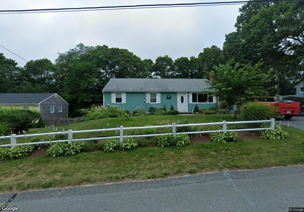
57 Thom Ave Bourne, MA 2532
Monument Beach NeighborhoodEstimated Value: $505,000 - $569,000
3
Beds
2
Baths
1,144
Sq Ft
$461/Sq Ft
Est. Value
About This Home
This home is located at 57 Thom Ave, Bourne, MA 2532 and is currently estimated at $526,924, approximately $460 per square foot. 57 Thom Ave is a home located in Barnstable County with nearby schools including Bourne High School, Cadence Academy Preschool - Bourne, and St Margaret Regional School.
Ownership History
Date
Name
Owned For
Owner Type
Purchase Details
Closed on
Aug 16, 2011
Sold by
Degregorio Albert A
Bought by
Degregorio Bryan and Degregorio Lauren
Current Estimated Value
Home Financials for this Owner
Home Financials are based on the most recent Mortgage that was taken out on this home.
Original Mortgage
$148,000
Outstanding Balance
$102,186
Interest Rate
4.51%
Mortgage Type
Purchase Money Mortgage
Estimated Equity
$424,738
Create a Home Valuation Report for This Property
The Home Valuation Report is an in-depth analysis detailing your home's value as well as a comparison with similar homes in the area
Home Values in the Area
Average Home Value in this Area
Purchase History
| Date | Buyer | Sale Price | Title Company |
|---|---|---|---|
| Degregorio Bryan | $185,000 | -- | |
| Degregorio Bryan | $185,000 | -- |
Source: Public Records
Mortgage History
| Date | Status | Borrower | Loan Amount |
|---|---|---|---|
| Open | Degregorio Bryan | $148,000 | |
| Closed | Degregorio Bryan | $148,000 | |
| Previous Owner | Degregorio Bryan | $67,000 | |
| Previous Owner | Degregorio Bryan | $69,000 |
Source: Public Records
Tax History Compared to Growth
Tax History
| Year | Tax Paid | Tax Assessment Tax Assessment Total Assessment is a certain percentage of the fair market value that is determined by local assessors to be the total taxable value of land and additions on the property. | Land | Improvement |
|---|---|---|---|---|
| 2025 | $3,390 | $434,100 | $194,300 | $239,800 |
| 2024 | $3,315 | $413,300 | $185,000 | $228,300 |
| 2023 | $3,223 | $365,800 | $163,800 | $202,000 |
| 2022 | $3,080 | $305,300 | $144,900 | $160,400 |
| 2021 | $2,993 | $277,900 | $131,900 | $146,000 |
| 2020 | $2,896 | $269,600 | $130,600 | $139,000 |
| 2019 | $2,752 | $261,800 | $130,600 | $131,200 |
| 2018 | $2,562 | $238,400 | $118,500 | $119,900 |
| 2017 | $2,432 | $236,100 | $117,400 | $118,700 |
| 2016 | $2,342 | $230,500 | $117,400 | $113,100 |
| 2015 | $2,321 | $230,500 | $117,400 | $113,100 |
Source: Public Records
Map
Nearby Homes