
Seller's Agent in 2026
Sandra Considine
S.C.E. Real Estate
(774) 289-6585
2 in this area
40 Total Sales
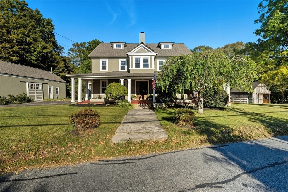
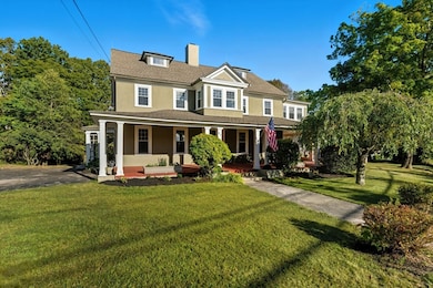
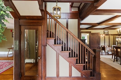
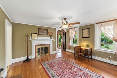
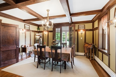
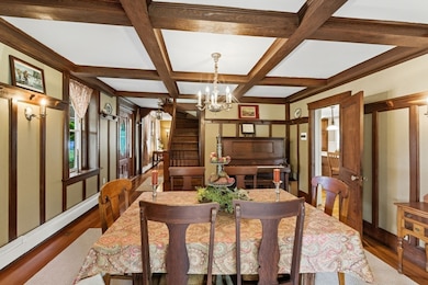
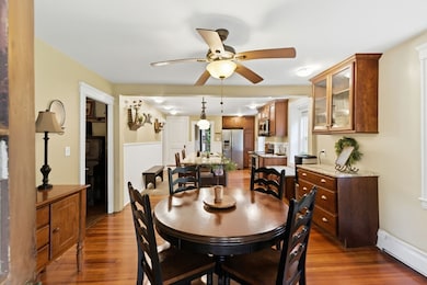
Remarkable New England estate on 5.94 acres PLUS an additional 1.08-acre lot, both bordering the Douglas State Forest. Set back among mature trees with distant views of Webster Lake, the home greets you with a gorgeous, wide wraparound porch that naturally blends indoor and outdoor living. Inside, a custom kitchen with an expansive center island, French doors, hardwood floors, rich woodwork, coffered ceilings, and fireplaces on both levels create timeless character throughout. Offering 4 bedrooms, 2.5 baths, and a light-filled third floor with great potential for future expansion, the home provides flexibility for many needs, including possible extended or multigenerational living. Equestrians or hobbyists will appreciate the 20’ x 20’ horse barn, fenced paddock, and oversized 2-car garage with full second story. NEW SEPTIC, NEW ROOF, and many additional updates throughout. A rare offering that delivers tremendous value at this price point. Minutes to restaurants, shopping, and major
Last Buyer's Agent
Courtney Ravenelle
RE/MAX Bell Park Realty
| Date | Type | Sale Price | Title Company |
|---|---|---|---|
| Deed | $649,900 | -- | |
| Deed | $4,850 | -- | |
| Deed | $2,200,000 | -- | |
| Deed | $450,000 | -- |
| Date | Status | Loan Amount | Loan Type |
|---|---|---|---|
| Previous Owner | $90,000 | Purchase Money Mortgage |
| Date | Event | Price | List to Sale | Price per Sq Ft |
|---|---|---|---|---|
| 01/12/2026 01/12/26 | Sold | $649,900 | 0.0% | $225 / Sq Ft |
| 12/09/2025 12/09/25 | Pending | -- | -- | -- |
| 11/12/2025 11/12/25 | Price Changed | $649,900 | -7.1% | $225 / Sq Ft |
| 09/23/2025 09/23/25 | For Sale | $699,900 | -- | $242 / Sq Ft |
| Year | Tax Paid | Tax Assessment Tax Assessment Total Assessment is a certain percentage of the fair market value that is determined by local assessors to be the total taxable value of land and additions on the property. | Land | Improvement |
|---|---|---|---|---|
| 2025 | $6,848 | $576,400 | $93,100 | $483,300 |
| 2024 | $6,759 | $554,900 | $89,400 | $465,500 |
| 2023 | $6,205 | $496,400 | $85,200 | $411,200 |
| 2022 | $6,098 | $436,800 | $82,800 | $354,000 |
| 2021 | $6,102 | $404,100 | $82,800 | $321,300 |
| 2020 | $5,953 | $395,300 | $82,800 | $312,500 |
| 2019 | $5,605 | $365,600 | $85,700 | $279,900 |
| 2018 | $5,468 | $355,300 | $85,700 | $269,600 |
| 2017 | $4,867 | $321,700 | $84,000 | $237,700 |
| 2016 | $4,653 | $307,300 | $84,000 | $223,300 |
| 2015 | $4,567 | $311,100 | $92,000 | $219,100 |
Seller's Agent in 2026
Sandra Considine
S.C.E. Real Estate
(774) 289-6585
2 in this area
40 Total Sales
C
Buyer's Agent in 2026
Courtney Ravenelle
RE/MAX
Source: MLS Property Information Network (MLS PIN)
MLS Number: 73434203
APN: WEBS-64 A 3 0
Disclaimer: Certain information contained herein is derived from information provided by parties other than Homes.com. All information provided is deemed reliable, but is not guaranteed to be accurate and should be independently verified.
![]() The property listing data and information, or the Images, set forth herein were provided to MLS Property Information Network, Inc. from third party sources, including sellers, lessors and public records, and were compiled by MLS Property Information Network, Inc. The property listing data and information, and the Images, are for the personal, non-commercial use of consumers having a good faith interest in purchasing or leasing listed properties of the type displayed to them and may not be used for any purpose other than to identify prospective properties which such consumers may have a good faith interest in purchasing or leasing. MLS Property Information Network, Inc. and its subscribers disclaim any and all representations and warranties as to the accuracy of the property listing data and information, or as to the accuracy of any of the Images, set forth herein.
The property listing data and information, or the Images, set forth herein were provided to MLS Property Information Network, Inc. from third party sources, including sellers, lessors and public records, and were compiled by MLS Property Information Network, Inc. The property listing data and information, and the Images, are for the personal, non-commercial use of consumers having a good faith interest in purchasing or leasing listed properties of the type displayed to them and may not be used for any purpose other than to identify prospective properties which such consumers may have a good faith interest in purchasing or leasing. MLS Property Information Network, Inc. and its subscribers disclaim any and all representations and warranties as to the accuracy of the property listing data and information, or as to the accuracy of any of the Images, set forth herein.
Ask me questions while you tour the home.