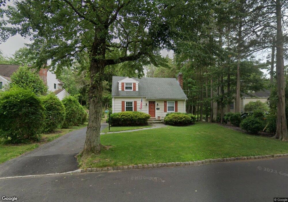
57 W End Ave Summit, NJ 07901
Estimated Value: $790,179 - $1,290,000
--
Bed
--
Bath
1,116
Sq Ft
$902/Sq Ft
Est. Value
About This Home
This home is located at 57 W End Ave, Summit, NJ 07901 and is currently estimated at $1,006,795, approximately $902 per square foot. 57 W End Ave is a home located in Union County with nearby schools including L C Johnson Summit Middle School, Summit Sr High School, and Kent Place School.
Ownership History
Date
Name
Owned For
Owner Type
Purchase Details
Closed on
Sep 19, 2005
Sold by
Walsh Susan M
Bought by
Bowlin Brian L
Current Estimated Value
Home Financials for this Owner
Home Financials are based on the most recent Mortgage that was taken out on this home.
Original Mortgage
$432,000
Interest Rate
5.87%
Mortgage Type
Adjustable Rate Mortgage/ARM
Purchase Details
Closed on
May 18, 1994
Sold by
Cawley James Michael and Cawley Bernadine A
Bought by
Walsh Susan M
Create a Home Valuation Report for This Property
The Home Valuation Report is an in-depth analysis detailing your home's value as well as a comparison with similar homes in the area
Home Values in the Area
Average Home Value in this Area
Purchase History
| Date | Buyer | Sale Price | Title Company |
|---|---|---|---|
| Bowlin Brian L | $540,000 | -- | |
| Walsh Susan M | $215,000 | Chicago Title Insurance Co |
Source: Public Records
Mortgage History
| Date | Status | Borrower | Loan Amount |
|---|---|---|---|
| Previous Owner | Bowlin Brian L | $432,000 |
Source: Public Records
Tax History Compared to Growth
Tax History
| Year | Tax Paid | Tax Assessment Tax Assessment Total Assessment is a certain percentage of the fair market value that is determined by local assessors to be the total taxable value of land and additions on the property. | Land | Improvement |
|---|---|---|---|---|
| 2025 | $9,435 | $216,600 | $153,300 | $63,300 |
| 2024 | $9,372 | $216,600 | $153,300 | $63,300 |
| 2023 | $9,372 | $216,600 | $153,300 | $63,300 |
| 2022 | $9,277 | $216,600 | $153,300 | $63,300 |
| 2021 | $9,351 | $216,600 | $153,300 | $63,300 |
| 2020 | $9,444 | $216,600 | $153,300 | $63,300 |
| 2019 | $9,455 | $216,600 | $153,300 | $63,300 |
| 2018 | $9,394 | $216,600 | $153,300 | $63,300 |
| 2017 | $9,455 | $216,600 | $153,300 | $63,300 |
| 2016 | $9,316 | $216,600 | $153,300 | $63,300 |
| 2015 | $9,134 | $216,600 | $153,300 | $63,300 |
| 2014 | $8,898 | $216,600 | $153,300 | $63,300 |
Source: Public Records
Map
Nearby Homes
- 43 Passaic Ave
- 7 Carleen Ct
- 709 Springfield Ave Unit 4
- 709 Springfield Ave Unit 3
- 27 Beekman Rd
- 166 Colonial Rd
- 19 Division Ave
- 33 Cromwell Pkwy
- 146 Riveredge Dr
- 17 Valley View Ave
- 54 Canterbury Rd
- 55 River Rd
- 175 Terrace Dr
- 67 Laurel Dr
- 14A Kensington Rd Unit A
- 16 Lowell Ave
- 283 Riveredge Dr
- 15 Maple St
- 2F Terrace Dr Unit F
- 475 Morris Ave