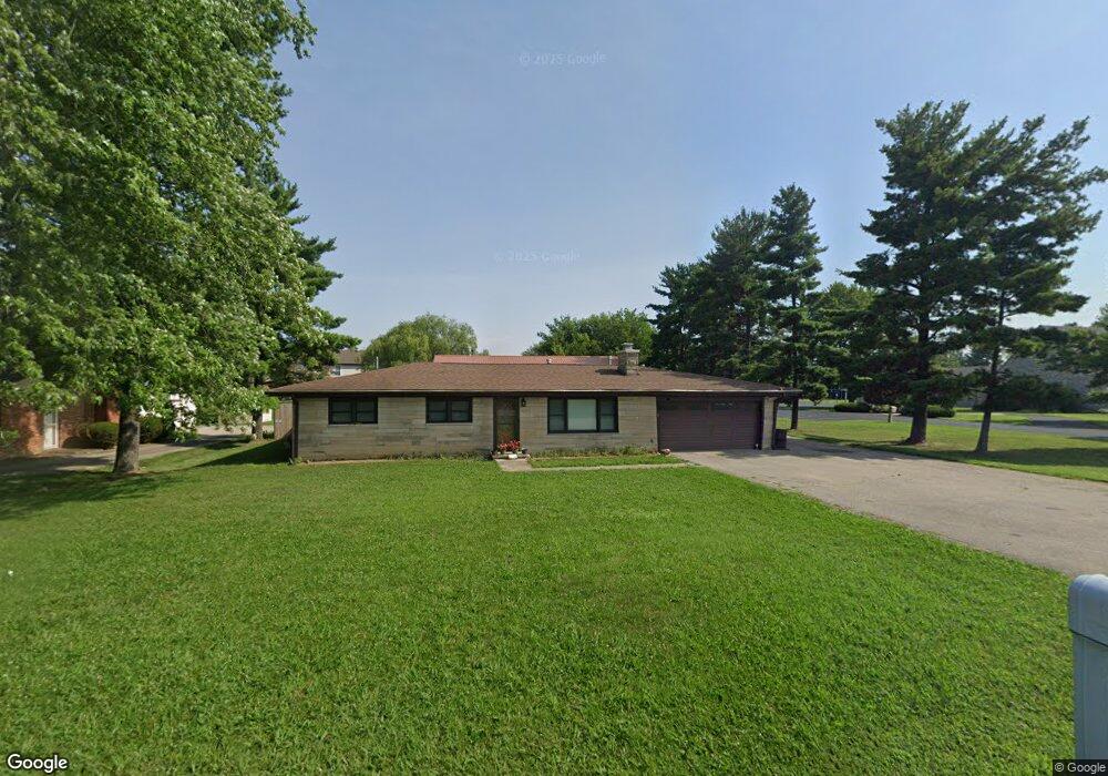
570 Paul Hand Blvd Franklin, IN 46131
Estimated Value: $261,000 - $286,544
3
Beds
2
Baths
1,386
Sq Ft
$196/Sq Ft
Est. Value
About This Home
This home is located at 570 Paul Hand Blvd, Franklin, IN 46131 and is currently estimated at $271,886, approximately $196 per square foot. 570 Paul Hand Blvd is a home located in Johnson County with nearby schools including Whiteland Elementary School, Clark-Pleasant Middle School, and Whiteland Community High School.
Ownership History
Date
Name
Owned For
Owner Type
Purchase Details
Closed on
Apr 28, 2016
Sold by
Bleke David W
Bought by
Doughrity James M
Current Estimated Value
Home Financials for this Owner
Home Financials are based on the most recent Mortgage that was taken out on this home.
Original Mortgage
$186,300
Outstanding Balance
$148,549
Interest Rate
3.71%
Mortgage Type
New Conventional
Estimated Equity
$123,337
Create a Home Valuation Report for This Property
The Home Valuation Report is an in-depth analysis detailing your home's value as well as a comparison with similar homes in the area
Home Values in the Area
Average Home Value in this Area
Purchase History
| Date | Buyer | Sale Price | Title Company |
|---|---|---|---|
| Doughrity James M | -- | Attorney |
Source: Public Records
Mortgage History
| Date | Status | Borrower | Loan Amount |
|---|---|---|---|
| Open | Doughrity James M | $186,300 |
Source: Public Records
Tax History Compared to Growth
Tax History
| Year | Tax Paid | Tax Assessment Tax Assessment Total Assessment is a certain percentage of the fair market value that is determined by local assessors to be the total taxable value of land and additions on the property. | Land | Improvement |
|---|---|---|---|---|
| 2025 | $2,322 | $276,500 | $45,000 | $231,500 |
| 2024 | $2,322 | $222,500 | $40,000 | $182,500 |
| 2023 | $2,571 | $222,500 | $40,000 | $182,500 |
| 2022 | $2,266 | $196,900 | $24,000 | $172,900 |
| 2021 | $2,056 | $174,800 | $24,000 | $150,800 |
| 2020 | $1,931 | $162,400 | $24,000 | $138,400 |
| 2019 | $1,779 | $148,900 | $24,000 | $124,900 |
| 2018 | $1,945 | $158,500 | $30,000 | $128,500 |
| 2017 | $1,897 | $157,000 | $30,000 | $127,000 |
| 2016 | $1,545 | $127,500 | $30,000 | $97,500 |
| 2014 | $1,492 | $115,100 | $30,000 | $85,100 |
| 2013 | $1,492 | $115,100 | $30,000 | $85,100 |
Source: Public Records
Map
Nearby Homes
- 0 Us 31 Unit MBR22038423
- 1410 Michigan Rd
- 600 West St
- 143 Davis Dr
- 4128 William Ave
- 3643 Hanford Rd
- Broadmoor Plan at Kingsbridge - SM Venture
- 3701 Jason Ave
- Alan Plan at Kingsbridge - SM Venture
- Paddington Plan at Kingsbridge - 3-Car Venture
- 3743 Jason Ave
- Kingston Plan at Kingsbridge - Venture
- 3673 Jason Ave
- 3771 Jason Ave
- Aspen Plan at Kingsbridge - SM Venture
- 3690 Jason Ave
- 3723 Hanford Rd
- Hampshire Plan at Kingsbridge - Venture
- Jasper Plan at Kingsbridge - 3-Car Venture
- Alan Plan at Kingsbridge - Venture
- 570 Paul Hand Blvd
- 560 Paul Hand Blvd
- 550 Paul Hand Blvd
- 786 West St
- 776 West St
- 767 West St
- 784 Hummingbird Ln
- 757 West St
- 774 Hummingbird Ln
- 540 Paul Hand Blvd
- 540 Paul Hand Blvd
- 764 Hummingbird Ln
- 747 West St
- 754 Hummingbird Ln
- 785 Hummingbird Ln
- 744 Hummingbird Ln
- 460 Paul Hand Blvd
- 765 Hummingbird Ln
- 726 West St
- 727 West St