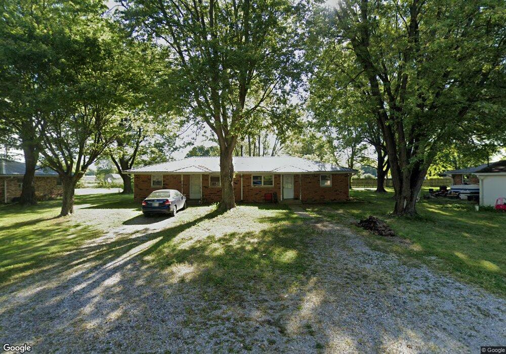
570 W Us Highway 52 Fountaintown, IN 46130
Estimated Value: $264,000 - $422,561
2
Beds
2
Baths
1,620
Sq Ft
$228/Sq Ft
Est. Value
About This Home
This home is located at 570 W Us Highway 52, Fountaintown, IN 46130 and is currently estimated at $369,187, approximately $227 per square foot. 570 W Us Highway 52 is a home located in Hancock County with nearby schools including Brandywine Elementary School, New Palestine Jr High School, and New Palestine High School.
Ownership History
Date
Name
Owned For
Owner Type
Purchase Details
Closed on
Feb 27, 2017
Sold by
Free Llc
Bought by
Christopher Monsour
Current Estimated Value
Home Financials for this Owner
Home Financials are based on the most recent Mortgage that was taken out on this home.
Original Mortgage
$470,000
Outstanding Balance
$316,633
Interest Rate
4.19%
Mortgage Type
Purchase Money Mortgage
Estimated Equity
$52,554
Purchase Details
Closed on
Dec 16, 2015
Sold by
First Financial Collateral Inc
Bought by
Free Bird Holdings
Purchase Details
Closed on
Feb 17, 2014
Sold by
First Na
Bought by
First Inc
Purchase Details
Closed on
Nov 1, 2013
Sold by
Finly Properties Llc
Bought by
First Financial Bank National Assn
Create a Home Valuation Report for This Property
The Home Valuation Report is an in-depth analysis detailing your home's value as well as a comparison with similar homes in the area
Home Values in the Area
Average Home Value in this Area
Purchase History
| Date | Buyer | Sale Price | Title Company |
|---|---|---|---|
| Christopher Monsour | $600,000 | -- | |
| Monsour Christopher | $600,000 | Stewart Title Company | |
| Free Bird Holdings | -- | Stewart Title Company | |
| First Inc | $435,600 | -- | |
| First Financial Bank National Assn | -- | None Available |
Source: Public Records
Mortgage History
| Date | Status | Borrower | Loan Amount |
|---|---|---|---|
| Open | Monsour Christopher | $470,000 |
Source: Public Records
Tax History Compared to Growth
Tax History
| Year | Tax Paid | Tax Assessment Tax Assessment Total Assessment is a certain percentage of the fair market value that is determined by local assessors to be the total taxable value of land and additions on the property. | Land | Improvement |
|---|---|---|---|---|
| 2024 | $5,599 | $427,200 | $85,000 | $342,200 |
| 2023 | $9,141 | $461,200 | $85,000 | $376,200 |
| 2022 | $4,752 | $338,200 | $47,000 | $291,200 |
| 2021 | $5,038 | $311,000 | $47,000 | $264,000 |
| 2020 | $4,657 | $311,000 | $47,000 | $264,000 |
| 2019 | $4,972 | $311,000 | $47,000 | $264,000 |
| 2018 | $4,171 | $289,000 | $47,000 | $242,000 |
| 2017 | $4,337 | $286,000 | $47,000 | $239,000 |
| 2016 | $5,062 | $308,000 | $47,000 | $261,000 |
| 2014 | $5,662 | $326,500 | $47,000 | $279,500 |
| 2013 | $5,662 | $215,500 | $47,000 | $168,500 |
Source: Public Records
Map
Nearby Homes
- 5 U S 52
- 1069 W Railroad St
- 5477 S Main St
- 6 U S 52
- 5465 S Greenfield St
- 661 W 500 S
- 4500 S 50 W
- 11546 N Shelby 300 W
- 83 E Walnut St
- 11497 N State Road 9
- 10686 N Division Rd
- 1546 E Osprey Dr
- 11131 N State Road 9
- 5555 S 200 E
- 11600 N 100 E
- 1556 E 400 S
- 256 E 1000 N
- 1162 E 300 S
- 0 S 300 East- 2
- 0 S 300 E
- 570 W Us Highway 52
- 570 W Us Highway 52
- 5776 S 50 W
- 571 W Us Highway 52
- 571 W Us Highway 52
- 5793 S 50 W
- 620 W Us Highway 52
- 5714 S 50 W
- 656 U S 52
- 656 W Us Highway 52
- 656 W Us Highway 52
- 688 W Us Highway 52
- 376 W Us Highway 52
- 376 U S 52
- 367 W Us Highway 52
- 367 W Us 52
- 762 W Us Highway 52
- 327 W Us Highway 52
- 327 W Us 52
- 804 W Us Highway 52