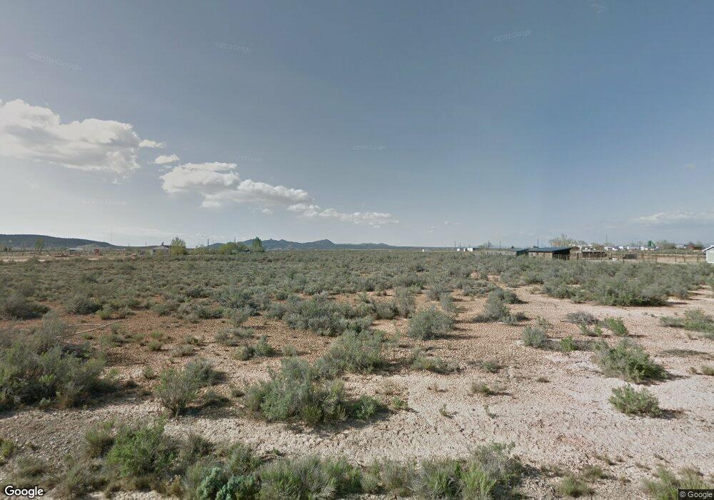
5700-5898 W 400 N Unit W 1/2 of 11 Cedar City, UT 84721
Estimated Value: $120,000 - $121,000
--
Bed
--
Bath
--
Sq Ft
4.55
Acres
About This Home
This home is located at 5700-5898 W 400 N Unit W 1/2 of 11, Cedar City, UT 84721 and is currently estimated at $120,500. 5700-5898 W 400 N Unit W 1/2 of 11 is a home located in Iron County with nearby schools including Cedar North School, Cedar Middle School, and Cedar City High School.
Ownership History
Date
Name
Owned For
Owner Type
Purchase Details
Closed on
Feb 9, 2024
Sold by
Cousin Lauren E
Bought by
Strand Amelia
Current Estimated Value
Purchase Details
Closed on
Apr 23, 2021
Sold by
Hibler Jeff H
Bought by
Cousin Lauren E
Home Financials for this Owner
Home Financials are based on the most recent Mortgage that was taken out on this home.
Original Mortgage
$82,500
Interest Rate
3%
Mortgage Type
New Conventional
Purchase Details
Closed on
Apr 20, 2021
Sold by
Hibler Jeffery H
Bought by
Cousin Lauren E
Home Financials for this Owner
Home Financials are based on the most recent Mortgage that was taken out on this home.
Original Mortgage
$82,500
Interest Rate
3%
Mortgage Type
New Conventional
Purchase Details
Closed on
May 24, 2010
Sold by
Patterson Dan L
Bought by
Awae Llc
Create a Home Valuation Report for This Property
The Home Valuation Report is an in-depth analysis detailing your home's value as well as a comparison with similar homes in the area
Home Values in the Area
Average Home Value in this Area
Purchase History
| Date | Buyer | Sale Price | Title Company |
|---|---|---|---|
| Strand Amelia | -- | American First Escrow & Title | |
| Cousin Lauren E | -- | Cedar Land Title Inc | |
| Cousin Lauren E | -- | Cedar Land Title | |
| Awae Llc | -- | None Available |
Source: Public Records
Mortgage History
| Date | Status | Borrower | Loan Amount |
|---|---|---|---|
| Previous Owner | Cousin Lauren E | $82,500 |
Source: Public Records
Tax History Compared to Growth
Tax History
| Year | Tax Paid | Tax Assessment Tax Assessment Total Assessment is a certain percentage of the fair market value that is determined by local assessors to be the total taxable value of land and additions on the property. | Land | Improvement |
|---|---|---|---|---|
| 2025 | $1,231 | $157,935 | $157,935 | -- |
| 2023 | $1,385 | $247,095 | $247,095 | $0 |
| 2022 | $928 | $103,715 | $103,715 | $0 |
| 2021 | $519 | $58,070 | $58,070 | $0 |
| 2020 | $519 | $51,350 | $51,350 | $0 |
| 2019 | $503 | $47,750 | $47,750 | $0 |
| 2018 | $515 | $47,750 | $47,750 | $0 |
| 2017 | $514 | $47,750 | $47,750 | $0 |
| 2016 | $510 | $42,750 | $42,750 | $0 |
| 2015 | $535 | $42,750 | $0 | $0 |
| 2014 | $566 | $42,750 | $0 | $0 |
Source: Public Records
Map
Nearby Homes
- 465 N 800 W Unit 3
- 465 N 800 W Unit 7
- 1120 Bulloch Cir
- 1137 Brook St
- 4.12 Acre Water Rights
- 370 N 1400 W
- 119 & 141 N 800 W Unit B
- 2904 W Oak Springs Rd
- 119 N 800 W Unit Building A
- 0 1 Af Water (Wr # 73-999) Unit 25-265506
- 374 N 1500 W
- 272 N 1500 W
- 373 N 400 W
- 457 N 400 W Unit 7
- 325 N 1500 W
- 6333 N 1600 W
- 1225 W Harding Ave Unit 8
- 1652 W Harding Ave
- 1770 W Harding Ave
- 171 N College Way Unit 7