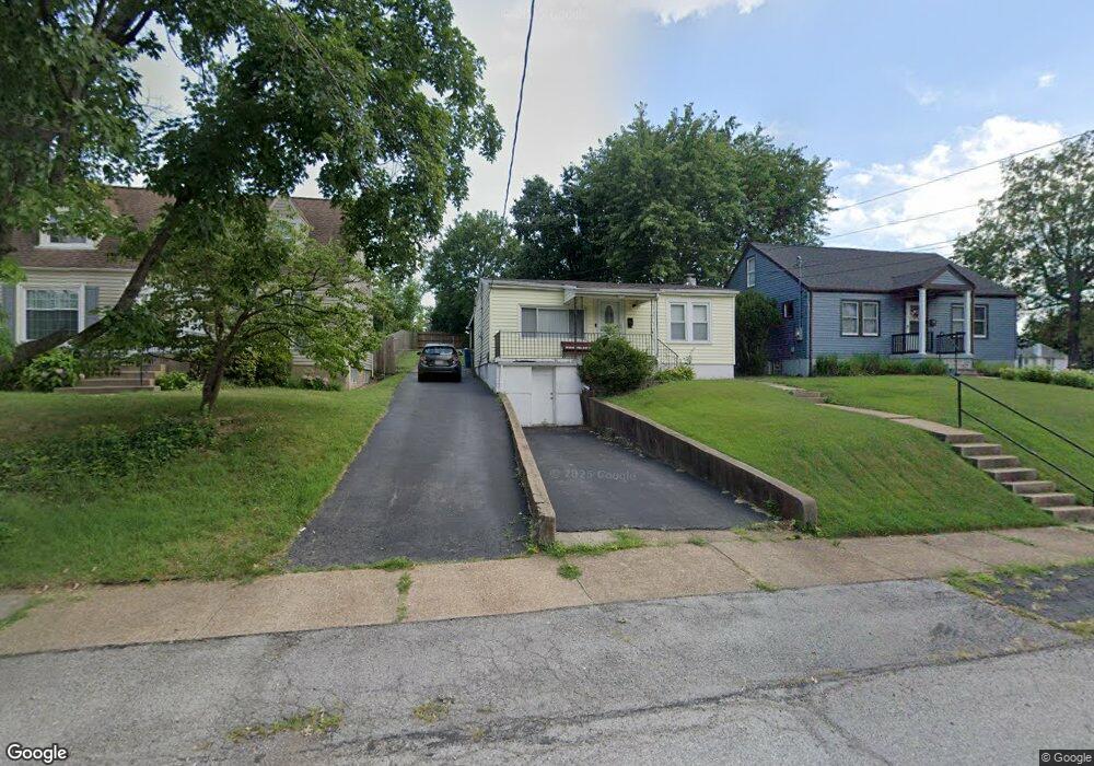
5700 Maxwell Ave Saint Louis, MO 63123
Estimated Value: $172,000 - $228,000
2
Beds
1
Bath
744
Sq Ft
$251/Sq Ft
Est. Value
About This Home
This home is located at 5700 Maxwell Ave, Saint Louis, MO 63123 and is currently estimated at $187,017, approximately $251 per square foot. 5700 Maxwell Ave is a home located in St. Louis County with nearby schools including Mesnier Primary School, Gotsch Intermediate School, and Rogers Middle School.
Ownership History
Date
Name
Owned For
Owner Type
Purchase Details
Closed on
Dec 10, 2009
Sold by
Bolden Deborah Kay and Bolden Deborah Kay
Bought by
Bolden Michael and Bolden Deborah Kay
Current Estimated Value
Home Financials for this Owner
Home Financials are based on the most recent Mortgage that was taken out on this home.
Original Mortgage
$93,733
Interest Rate
4.9%
Mortgage Type
FHA
Purchase Details
Closed on
Aug 29, 1997
Sold by
Bolden Michael E and Kay Deborah
Bought by
Bolden Deborah Kay
Home Financials for this Owner
Home Financials are based on the most recent Mortgage that was taken out on this home.
Original Mortgage
$36,600
Interest Rate
7.43%
Create a Home Valuation Report for This Property
The Home Valuation Report is an in-depth analysis detailing your home's value as well as a comparison with similar homes in the area
Home Values in the Area
Average Home Value in this Area
Purchase History
| Date | Buyer | Sale Price | Title Company |
|---|---|---|---|
| Bolden Michael | -- | Freedom Title Llc | |
| Bolden Deborah Kay | -- | -- |
Source: Public Records
Mortgage History
| Date | Status | Borrower | Loan Amount |
|---|---|---|---|
| Closed | Bolden Michael | $93,733 | |
| Closed | Bolden Deborah Kay | $36,600 |
Source: Public Records
Tax History
| Year | Tax Paid | Tax Assessment Tax Assessment Total Assessment is a certain percentage of the fair market value that is determined by local assessors to be the total taxable value of land and additions on the property. | Land | Improvement |
|---|---|---|---|---|
| 2025 | $2,174 | $30,800 | $14,970 | $15,830 |
| 2024 | $2,174 | $26,850 | $9,980 | $16,870 |
| 2023 | $2,174 | $26,850 | $9,980 | $16,870 |
| 2022 | $1,940 | $22,560 | $9,980 | $12,580 |
| 2021 | $1,895 | $22,560 | $9,980 | $12,580 |
| 2020 | $1,788 | $19,840 | $9,750 | $10,090 |
| 2019 | $1,784 | $19,840 | $9,750 | $10,090 |
| 2018 | $1,605 | $15,750 | $6,800 | $8,950 |
| 2017 | $1,595 | $15,750 | $6,800 | $8,950 |
| 2016 | $1,304 | $13,640 | $3,950 | $9,690 |
| 2015 | $1,310 | $13,640 | $3,950 | $9,690 |
| 2014 | $1,317 | $13,660 | $4,100 | $9,560 |
Source: Public Records
Map
Nearby Homes
- 8506 Mathilda Ave
- 8348 Vasel Dr
- 8615 Charlton Ln
- 8352 Lonkar Dr
- 9209 Lucia Dr
- 9028 Philo Ave
- 5315 Vine Ave
- 5138 Lode Ave
- 5846 Staely Ave
- 5837 Staely Ave
- 9320 Sterling Place
- 8520 Ava Dr
- 8019 Genesta St
- 8517 Ava Dr
- 9304 Aster Ave
- 5237 Heege Rd
- 9304 Lenard Ct
- 8042 Mackenzie Rd
- 6104 Heege Rd
- 7915 Elton St
- 5626 Maxwell Ave
- 5704 Maxwell Ave
- 5622 Maxwell Ave
- 8608 Elgin Ave
- 8610 Elgin Ave
- 8614 Elgin Ave
- 5616 Maxwell Ave
- 5701 Maxwell Ave
- 8616 Elgin Ave
- 5625 Maxwell Ave
- 5614 Maxwell Ave
- 5709 Maxwell Ave
- 8618 Elgin Ave
- 5619 Maxwell Ave
- 8551 Elsa Ave
- 8620 Elgin Ave
- 5612 Maxwell Ave
- 5615 Maxwell Ave
- 8554 Elgin Ave
- 8605 Elgin Ave
Your Personal Tour Guide
Ask me questions while you tour the home.