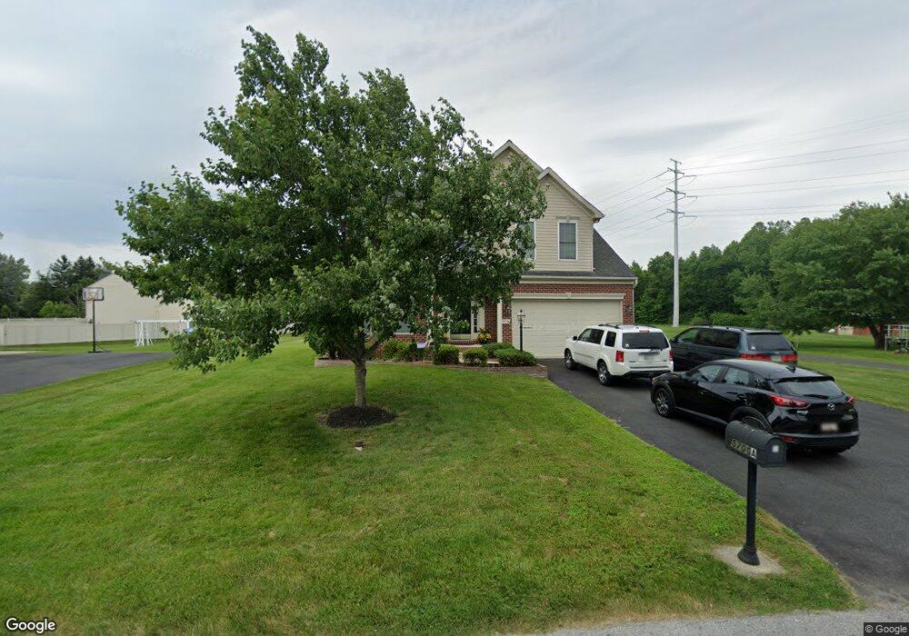
5700A Station Rd White Marsh, MD 21162
Estimated Value: $541,312 - $625,000
Studio
1
Bath
2,387
Sq Ft
$250/Sq Ft
Est. Value
About This Home
This home is located at 5700A Station Rd, White Marsh, MD 21162 and is currently estimated at $595,828, approximately $249 per square foot. 5700A Station Rd is a home located in Baltimore County with nearby schools including Chapel Hill Elementary School, Perry Hall Middle School, and Perry Hall High School.
Ownership History
Date
Name
Owned For
Owner Type
Purchase Details
Closed on
Mar 28, 2007
Sold by
Sierra Homes Inc
Bought by
Banes Silas T and Banes Michelle L
Current Estimated Value
Home Financials for this Owner
Home Financials are based on the most recent Mortgage that was taken out on this home.
Original Mortgage
$462,900
Interest Rate
6.25%
Mortgage Type
Purchase Money Mortgage
Purchase Details
Closed on
Mar 21, 2007
Sold by
Sierra Homes Inc
Bought by
Banes Silas T and Banes Michelle L
Home Financials for this Owner
Home Financials are based on the most recent Mortgage that was taken out on this home.
Original Mortgage
$462,900
Interest Rate
6.25%
Mortgage Type
Purchase Money Mortgage
Create a Home Valuation Report for This Property
The Home Valuation Report is an in-depth analysis detailing your home's value as well as a comparison with similar homes in the area
Home Values in the Area
Average Home Value in this Area
Purchase History
| Date | Buyer | Sale Price | Title Company |
|---|---|---|---|
| Banes Silas T | $225,000 | -- | |
| Banes Silas T | $225,000 | -- |
Source: Public Records
Mortgage History
| Date | Status | Borrower | Loan Amount |
|---|---|---|---|
| Closed | Banes Silas T | $462,900 | |
| Closed | Banes Silas T | $462,900 |
Source: Public Records
Tax History
| Year | Tax Paid | Tax Assessment Tax Assessment Total Assessment is a certain percentage of the fair market value that is determined by local assessors to be the total taxable value of land and additions on the property. | Land | Improvement |
|---|---|---|---|---|
| 2025 | $6,778 | $472,133 | -- | -- |
| 2024 | $6,778 | $471,367 | $0 | $0 |
| 2023 | $3,342 | $470,600 | $110,800 | $359,800 |
| 2022 | $6,265 | $439,933 | $0 | $0 |
| 2021 | $5,704 | $409,267 | $0 | $0 |
| 2020 | $6,052 | $378,600 | $110,800 | $267,800 |
| 2019 | $4,522 | $373,100 | $0 | $0 |
| 2018 | $5,491 | $367,600 | $0 | $0 |
| 2017 | $5,260 | $362,100 | $0 | $0 |
| 2016 | $6,617 | $350,400 | $0 | $0 |
| 2015 | $6,617 | $338,700 | $0 | $0 |
| 2014 | $6,617 | $327,000 | $0 | $0 |
Source: Public Records
Map
Nearby Homes
- 5706 Allender Rd
- 5703 Allender Rd
- 11604 Jerome Ave
- 11503 Jerome Ave
- 5662 Gunpowder Rd
- 11540 Philadelphia Rd Unit 5
- 11721 Hamilton Place
- 11400 Eunice Ct
- 5806 Dillon John Ct
- 5822 Dillon John Ct
- 0 New Forge Rd Unit MDBC2153490
- 5603 Overlook Ct
- 5113 Robins Perch Ln
- TBD Vista Reserve - Homesite Vista Unit 111
- TBD Vista Reserve - Homesite Vista Unit 82 - 3 Finished Leve
- 7 Bangert Ave
- 11272-Homesite #82 Davisar Rd
- 11258 Davisar Rd Unit 89
- 11279 Davisar Rd Unit 111
- 5850 Monk Ave
- 5700 Station Rd Unit A
- 5700 Station Rd
- 5704 Station Rd
- 5632 Allender Rd
- 5708 Allender Rd
- 5634 Allender Rd
- 56185620 Allender Rd
- 5710 Allender Rd
- 5701 Allender Rd
- 5706 Station Rd
- 5641 Allender Rd
- 5630 Allender Rd
- 5707 Allender Rd
- 5709 Allender Rd
- 5709 Allender Rd Unit B
- 5709 Allender Rd
- 5709 Allender Rd
- 5633 Allender Rd
- 5628 Allender Rd
- 5625 Carrington Dr
Your Personal Tour Guide
Ask me questions while you tour the home.