
5701 Smoke Ranch Rd Unit D Las Vegas, NV 89108
Michael Way NeighborhoodEstimated payment $1,216/month
Highlights
- Detached Carport Space
- East Facing Home
- 1-Story Property
- Central Heating and Cooling System
- Vinyl Flooring
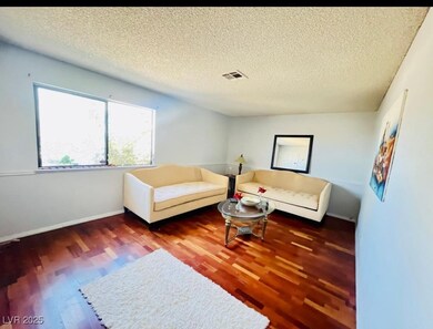
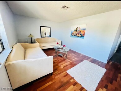
About This Home
beautiful townhouse at Ashford Park in Charleston Heights!
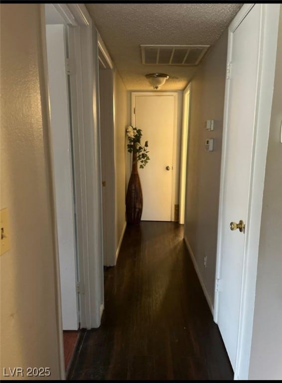
Great two bedrooms and one bath with a living room and separate dining area.
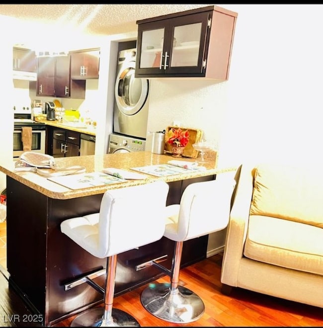
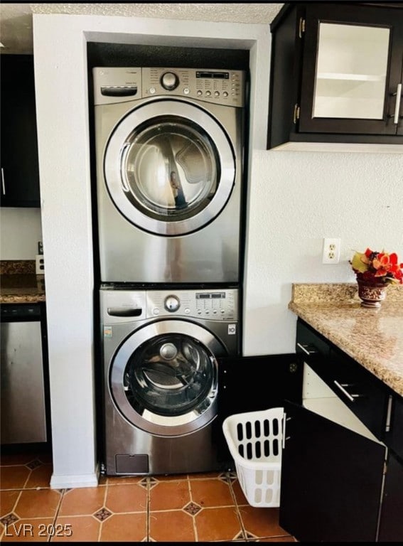
all appliances stay, including washer and dryer.
this community offers a pool.
easy access to the 1-11 and NV-599, Close to schools and restaurants, minutes from the North Las Vegas Airport and short commute to Downtown and the Strip. Don't miss this Opportunity.
Townhouse Details
Home Type
- Townhome
Est. Annual Taxes
- $897
Year Built
- Built in 1978
Lot Details
- 871 Sq Ft Lot
- East Facing Home
HOA Fees
- $195 Monthly HOA Fees
Home Design
- Frame Construction
- Shingle Roof
- Composition Roof
- Stucco
Interior Spaces
- 844 Sq Ft Home
- 1-Story Property
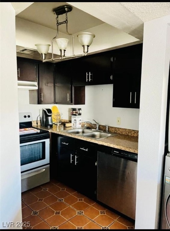
Kitchen
- Electric Cooktop
- Dishwasher
- Disposal
Flooring
- Linoleum
- Laminate
- Vinyl
Bedrooms and Bathrooms
- 2 Bedrooms
- 1 Full Bathroom
Laundry
- Laundry on main level
- Dryer
- Washer
Parking
- Detached Carport Space
- Assigned Parking
Schools
- Ronzone Elementary School
- Brinley J. Harold Middle School
- Western High School
Utilities
- Central Heating and Cooling System
- Above Ground Utilities
Community Details
- Association fees include water
- Ashford Park Association, Phone Number (702) 982-2517
- Charleston Heights Tr #50 E3 Subdivision
Map
Home Values in the Area
Average Home Value in this Area
Tax History
| Year | Tax Paid | Tax Assessment Tax Assessment Total Assessment is a certain percentage of the fair market value that is determined by local assessors to be the total taxable value of land and additions on the property. | Land | Improvement |
|---|---|---|---|---|
| 2025 | $897 | $29,152 | $16,100 | $13,052 |
| 2024 | $1,950 | $29,152 | $16,100 | $13,052 |
| 2023 | $588 | $25,827 | $13,300 | $12,527 |
| 2022 | $467 | $23,033 | $10,850 | $12,183 |
| 2021 | $433 | $20,691 | $10,500 | $10,191 |
| 2020 | $399 | $19,304 | $8,400 | $10,904 |
| 2019 | $374 | $16,960 | $5,950 | $11,010 |
| 2018 | $357 | $15,613 | $4,900 | $10,713 |
| 2017 | $518 | $15,227 | $4,900 | $10,327 |
| 2016 | $588 | $14,715 | $3,850 | $10,865 |
| 2015 | $581 | $13,116 | $3,150 | $9,966 |
| 2014 | $583 | $9,783 | $3,150 | $6,633 |
Property History
| Date | Event | Price | List to Sale | Price per Sq Ft |
|---|---|---|---|---|
| 12/02/2025 12/02/25 | For Sale | $179,900 | -- | $213 / Sq Ft |
Purchase History
| Date | Type | Sale Price | Title Company |
|---|---|---|---|
| Bargain Sale Deed | $120,000 | Lawyers Title Of Nevada | |
| Interfamily Deed Transfer | -- | -- |
Mortgage History
| Date | Status | Loan Amount | Loan Type |
|---|---|---|---|
| Open | $96,000 | Unknown |
Source: Las Vegas REALTORS®
MLS Number: 2738890
APN: 138-24-110-050
Disclaimer: Certain information contained herein is derived from information provided by parties other than Homes.com. All information provided is deemed reliable, but is not guaranteed to be accurate and should be independently verified.
![]() The data relating to real estate for sale on this web site comes in part from the INTERNET DATA EXCHANGE Program of the Greater Las Vegas Association of REALTORS® MLS. Real estate listings held by brokerage firms other than this site owner are marked with the IDX logo. Information is deemed reliable but not guaranteed. Copyright 2025 of the Greater Las Vegas Association of REALTORS® MLS. All rights reserved.
The data relating to real estate for sale on this web site comes in part from the INTERNET DATA EXCHANGE Program of the Greater Las Vegas Association of REALTORS® MLS. Real estate listings held by brokerage firms other than this site owner are marked with the IDX logo. Information is deemed reliable but not guaranteed. Copyright 2025 of the Greater Las Vegas Association of REALTORS® MLS. All rights reserved.
- 5705 Stallion Ave
- 2341 Canfield Dr Unit B
- 2349 Cardiff Ln Unit B
- 5817 Smoke Ranch Rd Unit B
- 5905 Smoke Ranch Rd Unit A
- 5600 W Bartlett Ave
- 5521 Auborn Ave
- 5917 Smoke Ranch Rd Unit B
- 5601 W Bartlett Ave
- 5604 Reiter Ave
- 5921 San Fernando Dr
- 5600 Balzar Ave
- 5537 Cleary Ct
- 3300 Michael Way
- 2334 N Michael Way
- 2499 N Jones Blvd
- 5486 Alfred Dr
- 5401 Geneive Ln Unit 101
- 5400 Tassara Way Unit 102
- 5400 Tassara Way Unit 101
- 5729 Smoke Ranch Rd Unit C
- 5717 Smoke Ranch Rd Unit A
- 5521 Seattle Slew Dr
- 5504 W Bartlett Ave
- 5813 Balzar Ave
- 2241 N Jones Blvd Unit 4
- 2217 N Jones Blvd Unit 4
- 2217 N Jones Blvd Unit 3
- 2213 N Jones Blvd Unit 2
- 2209 N Jones Blvd Unit 2
- 2129 N Michael Way
- 2121 N Jones Blvd
- 2021 Winwood St Unit 1
- 5709 Avenida Silla
- 2590 Apricot Ln
- 2571 Bonano Ct
- 2829 N Michael Way
- 1951 N Jones Blvd
- 2817 Porcupine Flat St
- 2800 Evelyn Lake Ct
