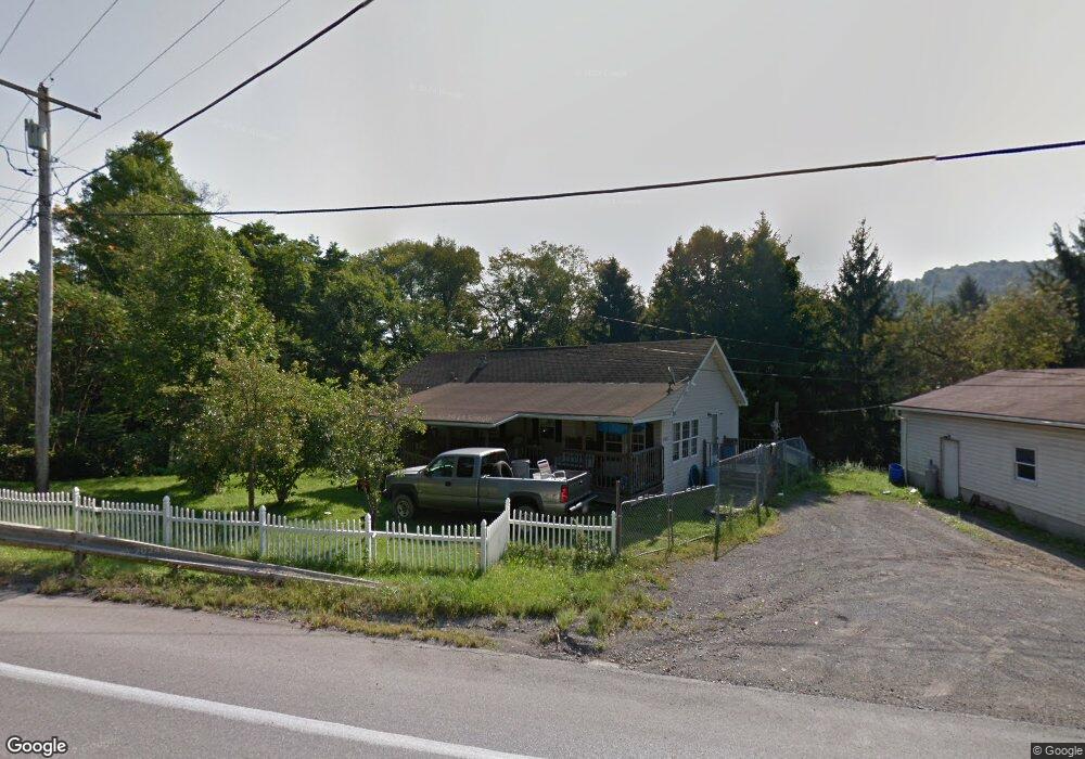
5704 Route 219 Brockport, PA 15823
Estimated Value: $140,000 - $157,295
3
Beds
2
Baths
1,455
Sq Ft
$102/Sq Ft
Est. Value
About This Home
This home is located at 5704 Route 219, Brockport, PA 15823 and is currently estimated at $148,074, approximately $101 per square foot. 5704 Route 219 is a home located in Elk County with nearby schools including Brockway Area Elementary School, Brockway Area Junior/Senior High School, and Hillside School.
Ownership History
Date
Name
Owned For
Owner Type
Purchase Details
Closed on
Apr 24, 2013
Sold by
Hynds Richard and Hynds Sharon
Bought by
Shank Timothy C
Current Estimated Value
Home Financials for this Owner
Home Financials are based on the most recent Mortgage that was taken out on this home.
Original Mortgage
$78,452
Interest Rate
3.25%
Mortgage Type
FHA
Purchase Details
Closed on
Jul 7, 2010
Sold by
Krieg Jeffrey C
Bought by
Federal National Mortgage Association
Create a Home Valuation Report for This Property
The Home Valuation Report is an in-depth analysis detailing your home's value as well as a comparison with similar homes in the area
Home Values in the Area
Average Home Value in this Area
Purchase History
| Date | Buyer | Sale Price | Title Company |
|---|---|---|---|
| Shank Timothy C | $79,900 | None Available | |
| Federal National Mortgage Association | -- | None Available |
Source: Public Records
Mortgage History
| Date | Status | Borrower | Loan Amount |
|---|---|---|---|
| Previous Owner | Shank Timothy C | $78,452 |
Source: Public Records
Tax History Compared to Growth
Tax History
| Year | Tax Paid | Tax Assessment Tax Assessment Total Assessment is a certain percentage of the fair market value that is determined by local assessors to be the total taxable value of land and additions on the property. | Land | Improvement |
|---|---|---|---|---|
| 2025 | $1,549 | $30,200 | $1,300 | $28,900 |
| 2024 | $1,549 | $30,200 | $1,300 | $28,900 |
| 2023 | $1,495 | $30,200 | $1,300 | $28,900 |
| 2022 | $1,485 | $30,200 | $1,300 | $28,900 |
| 2021 | $1,459 | $30,200 | $1,300 | $28,900 |
| 2020 | $1,459 | $30,200 | $1,300 | $28,900 |
| 2019 | $1,407 | $30,200 | $1,300 | $28,900 |
| 2018 | $1,407 | $30,200 | $1,300 | $28,900 |
| 2013 | -- | $30,200 | $1,300 | $28,900 |
Source: Public Records
Map
Nearby Homes
- 101 Howard Rd
- 425 Zuccolotto Ln
- 47 Caruso Rd
- 3323 Mount Daniels Rd
- 3585 Shawmut Rd
- 1083 Rattlesnake Rd
- 924 Elm St
- 1549 Main St
- 970 Baghdad Rd
- 0 U S 219
- 1074 10th Ave
- 7956 U S 219
- 266 South St
- 601 Sandbank Rd
- 0 Cap Haitien Rd Unit SEC 17 LOT 14
- 598 Sandbank Rd
- 537 Lynyard Ln Bonefish Rd
- Section 19 Lot 181 Dolphin Head Rd
- 181 Dolphin Head Rd
- 129 Dolphin Head Rd
- 140 Mclaughlin Rd
- 5705 Route 219
- 5754 Route 219
- 5739 Route 219
- 5620 Route 219
- 128 Mclaughlin Rd
- 5774 Route 219
- 5604 Route 219
- 5767 Route 219
- 115 Mclaughlin Rd
- 45 Mountain Church Rd
- 56 Mclaughlin Rd
- 52 Mountain Church Rd
- 89 Mclaughlin Rd
- 57 Mclaughlin Rd
- 75 Mclaughlin Rd
- 79 Mclaughlin Rd
- 50 Whites Rd
- 118 Mountain Church Rd
- 106 Mountain Church Rd