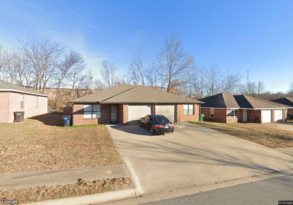
5705 Samantha St Unit A & B Fayetteville, AR 72704
Estimated Value: $274,185 - $344,000
--
Bed
4
Baths
2,098
Sq Ft
$149/Sq Ft
Est. Value
About This Home
This home is located at 5705 Samantha St Unit A & B, Fayetteville, AR 72704 and is currently estimated at $313,546, approximately $149 per square foot. 5705 Samantha St Unit A & B is a home located in Washington County with nearby schools including Asbell Elementary School, Holt Middle School, and Woodland Junior High School.
Ownership History
Date
Name
Owned For
Owner Type
Purchase Details
Closed on
May 24, 2005
Sold by
High Ronald L and High Evelyn J
Bought by
Ceola Rob
Current Estimated Value
Home Financials for this Owner
Home Financials are based on the most recent Mortgage that was taken out on this home.
Original Mortgage
$121,600
Outstanding Balance
$73,712
Interest Rate
8.59%
Mortgage Type
Purchase Money Mortgage
Estimated Equity
$239,834
Purchase Details
Closed on
Sep 22, 1992
Bought by
High Ronald and High Evelyn
Purchase Details
Closed on
Apr 27, 1992
Bought by
Bayyari Fadil and Mathias Samuel
Create a Home Valuation Report for This Property
The Home Valuation Report is an in-depth analysis detailing your home's value as well as a comparison with similar homes in the area
Home Values in the Area
Average Home Value in this Area
Purchase History
| Date | Buyer | Sale Price | Title Company |
|---|---|---|---|
| Ceola Rob | $128,000 | -- | |
| High Ronald | $60,000 | -- | |
| Bayyari Fadil | $90,000 | -- |
Source: Public Records
Mortgage History
| Date | Status | Borrower | Loan Amount |
|---|---|---|---|
| Open | Ceola Rob | $121,600 |
Source: Public Records
Tax History Compared to Growth
Tax History
| Year | Tax Paid | Tax Assessment Tax Assessment Total Assessment is a certain percentage of the fair market value that is determined by local assessors to be the total taxable value of land and additions on the property. | Land | Improvement |
|---|---|---|---|---|
| 2025 | $2,405 | $42,720 | $12,000 | $30,720 |
| 2024 | $2,221 | $42,720 | $12,000 | $30,720 |
| 2023 | $2,073 | $42,720 | $12,000 | $30,720 |
| 2022 | $1,861 | $32,560 | $6,000 | $26,560 |
| 2021 | $1,771 | $32,560 | $6,000 | $26,560 |
| 2020 | $1,623 | $32,560 | $6,000 | $26,560 |
| 2019 | $1,476 | $25,820 | $6,000 | $19,820 |
| 2018 | $1,476 | $25,820 | $6,000 | $19,820 |
| 2017 | $146 | $25,820 | $6,000 | $19,820 |
| 2016 | $1,463 | $25,820 | $6,000 | $19,820 |
| 2015 | $1,463 | $25,820 | $6,000 | $19,820 |
| 2014 | $1,427 | $25,190 | $6,000 | $19,190 |
Source: Public Records
Map
Nearby Homes
- 5541 Blake Ln
- 2704 Main Dr
- 4254 NE Meadow Creek Cir Unit 208
- 5511 Bryant Place
- 5048 Tall Pine Cir
- 205 Suttle Dr
- 2807 Foxwood Dr
- 2431 Indian Oaks Trail
- 2811 Essex Place
- 1911 Cypress Place
- 1909 Sycamore Place
- 6701 S Ball St
- 2300 Sycamore Place
- 5095 Saxon St
- 2803 Amberwood St
- 2300 Cottonwood Place
- 5111 Moose Hollow Terrace
- 3151 Woodbridge Rd
- 0 W van Asche Dr Unit 1299777
- 4730 Woodside Ln
- 5705 Samantha St
- 5703 Samantha St
- 5703 Samantha St Unit A/B
- 5703 Samantha St Unit A
- 5707 Samantha St
- 5701 Samantha St
- 5701 Samantha St Unit A & B
- 5701 Samantha St Unit A
- 5801 Samantha St
- 5704 Samantha St
- 5702 Samantha St
- 5706 Samantha St
- Lot 4 Hawks Landing St
- 0 Hawks Landing
- 0 Hawks Landing Dr Unit 1089684
- 0 Hawks Landing Dr Unit 1098464
- 5800 Samantha St
- 5700 Samantha St
- 5803 Samantha St
- 5803 Samantha St Unit A & B