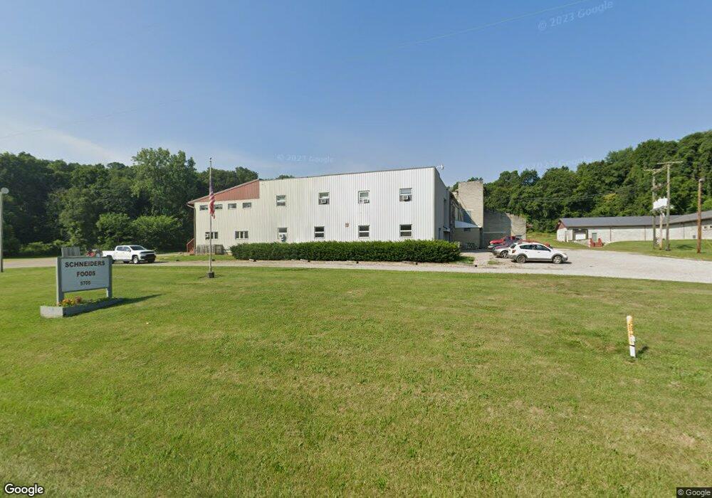
5705 State Route 204 NE Mount Perry, OH 43760
Estimated Value: $860,208
--
Bed
--
Bath
51,756
Sq Ft
$17/Sq Ft
Est. Value
About This Home
This home is located at 5705 State Route 204 NE, Mount Perry, OH 43760 and is currently estimated at $860,208, approximately $16 per square foot. 5705 State Route 204 NE is a home located in Perry County with nearby schools including Sheridan High School and Calvary Christian School.
Ownership History
Date
Name
Owned For
Owner Type
Purchase Details
Closed on
May 20, 2024
Sold by
Mt Perry Enterprises Llc
Bought by
Mt Perry 5705 Llc
Current Estimated Value
Home Financials for this Owner
Home Financials are based on the most recent Mortgage that was taken out on this home.
Original Mortgage
$600,000
Interest Rate
6.87%
Mortgage Type
Seller Take Back
Create a Home Valuation Report for This Property
The Home Valuation Report is an in-depth analysis detailing your home's value as well as a comparison with similar homes in the area
Home Values in the Area
Average Home Value in this Area
Purchase History
| Date | Buyer | Sale Price | Title Company |
|---|---|---|---|
| Mt Perry 5705 Llc | $824,500 | None Listed On Document | |
| Mt Perry 5705 Llc | $824,500 | None Listed On Document |
Source: Public Records
Mortgage History
| Date | Status | Borrower | Loan Amount |
|---|---|---|---|
| Previous Owner | Mt Perry 5705 Llc | $600,000 |
Source: Public Records
Tax History Compared to Growth
Tax History
| Year | Tax Paid | Tax Assessment Tax Assessment Total Assessment is a certain percentage of the fair market value that is determined by local assessors to be the total taxable value of land and additions on the property. | Land | Improvement |
|---|---|---|---|---|
| 2024 | $15,954 | $296,480 | $24,510 | $271,970 |
| 2023 | $15,954 | $296,480 | $24,510 | $271,970 |
| 2022 | $17,334 | $303,460 | $17,790 | $285,670 |
| 2021 | $15,222 | $303,460 | $17,790 | $285,670 |
| 2020 | $15,152 | $303,460 | $17,790 | $285,670 |
| 2019 | $14,712 | $303,460 | $17,790 | $285,670 |
| 2018 | $14,800 | $303,460 | $17,790 | $285,670 |
| 2017 | $14,645 | $303,460 | $17,790 | $285,670 |
| 2016 | $15,154 | $306,550 | $15,290 | $291,260 |
| 2015 | $1,509 | $306,550 | $15,290 | $291,260 |
| 2014 | $14,864 | $306,550 | $15,290 | $291,260 |
| 2013 | $15,133 | $306,550 | $15,290 | $291,260 |
| 2012 | -- | $306,550 | $15,290 | $291,260 |
Source: Public Records
Map
Nearby Homes
- 6335 Cimarron Rd
- 0 Us Highway 22
- 11284 State Route 668 N
- 9945 Wesley Chapel 47 Rd
- 10294 Township Road 57 NE
- 2105 Gard Ln
- 9758 Wesley Chapel Rd
- 10705 Township Road 92
- 16711 Bowser Rd
- 8045 Old Town Rd
- 12330 Palmer Rd
- 2128 County Road 51
- 2967 Opera Rd
- 0 Us-22
- 7170 Old Town Rd
- 11631 Rankin Rd
- 0 Rankin Rd
- 5540 Hoover St
- 11149 Rankin Rd
- 0 County Road 36
- 5791 State Route 204 NE
- 5791 Ohio 204
- 5445 State Route 204 NE
- 5421 State Route 204 NE
- 5871 State Route 204 NE
- 5908 State Route 204 NE
- 5380 Ohio 204
- 5380 State Route 204 NE
- 5888 Cimarron Rd
- 5325 State Route 204 NE
- 6025 Cimarron Rd
- 4128 Ohio 204
- 4350 Sr 204 NE
- 7005 County Road 54
- 6635 County Road 54
- 0 Cimarron Rd
- 7000 County Road 54
- 0 County Road 54
- 5279 State Route 204 NE
- 12590 Amish Ridge Rd