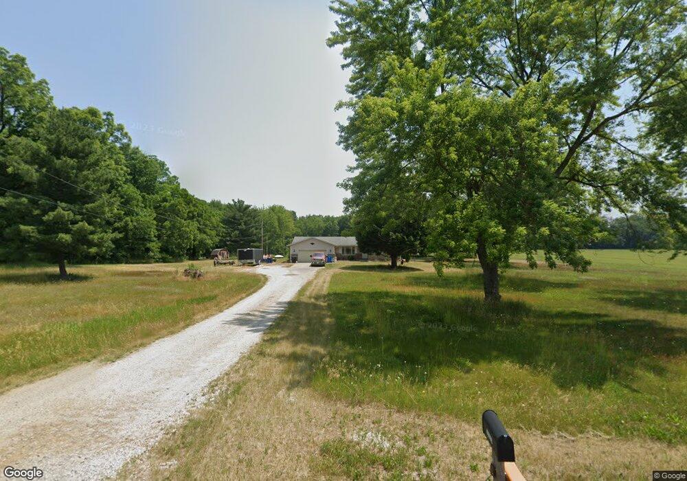
57070 Pear Rd South Bend, IN 46619
Estimated Value: $289,000 - $377,109
3
Beds
2
Baths
1,406
Sq Ft
$225/Sq Ft
Est. Value
About This Home
This home is located at 57070 Pear Rd, South Bend, IN 46619 and is currently estimated at $317,027, approximately $225 per square foot. 57070 Pear Rd is a home located in St. Joseph County with nearby schools including Paton-Churdan Elementary School, Wilson Elementary School, and Clay Intermediate Center.
Ownership History
Date
Name
Owned For
Owner Type
Purchase Details
Closed on
Apr 20, 2016
Sold by
Egyed Lyndelle M and Egyed Steven E
Bought by
Egyed Steven E and Egyed Anita L
Current Estimated Value
Home Financials for this Owner
Home Financials are based on the most recent Mortgage that was taken out on this home.
Original Mortgage
$96,800
Interest Rate
3.68%
Mortgage Type
New Conventional
Purchase Details
Closed on
Oct 27, 2011
Sold by
Egyed Rosanne
Bought by
Egyed Lyndell M and Egyed Steven E
Create a Home Valuation Report for This Property
The Home Valuation Report is an in-depth analysis detailing your home's value as well as a comparison with similar homes in the area
Home Values in the Area
Average Home Value in this Area
Purchase History
| Date | Buyer | Sale Price | Title Company |
|---|---|---|---|
| Egyed Steven E | -- | -- | |
| Egyed Lyndell M | -- | None Available |
Source: Public Records
Mortgage History
| Date | Status | Borrower | Loan Amount |
|---|---|---|---|
| Closed | Egyed Steven E | $96,800 |
Source: Public Records
Tax History Compared to Growth
Tax History
| Year | Tax Paid | Tax Assessment Tax Assessment Total Assessment is a certain percentage of the fair market value that is determined by local assessors to be the total taxable value of land and additions on the property. | Land | Improvement |
|---|---|---|---|---|
| 2024 | $5,125 | $314,100 | $157,500 | $156,600 |
| 2023 | $5,064 | $326,400 | $157,500 | $168,900 |
| 2022 | $5,309 | $326,400 | $157,500 | $168,900 |
| 2021 | $3,097 | $216,000 | $59,500 | $156,500 |
| 2020 | $2,474 | $180,100 | $49,600 | $130,500 |
| 2019 | $1,914 | $168,500 | $46,400 | $122,100 |
| 2018 | $1,878 | $164,000 | $43,800 | $120,200 |
| 2017 | $1,919 | $160,600 | $43,800 | $116,800 |
| 2016 | $2,013 | $160,600 | $43,800 | $116,800 |
| 2014 | $784 | $113,000 | $17,300 | $95,700 |
Source: Public Records
Map
Nearby Homes
- 57115 White Pine Trail
- 57223 Pine Needle Ct
- 57210 White Pine Trail
- 26541 Gaited Horse Trail
- 56451 Quince Rd
- 57248 Mcquade St
- 27180 Harrison Rd
- 57860 Crumstown Hwy
- 55629 Cardinal Dr
- 26366 Hummingbird Rd
- 57195 Pinewood Dr
- 55915 Dorn St
- 56435 Eastlea Dr
- 54962 Quince Rd
- 25260 Fillmore Rd
- 54483 Whitesell Dr
- 54520 Norwood Dr
- 54492 Avalon Dr
- 56915 Tulip Rd
- 56803 Tulip Rd
- 57048 Pear Rd
- 26602 Grant Rd
- 57075 Pear Rd
- 57061 Pear Rd
- 57119 Pear Rd
- 57188 Pear Rd
- 56993 Pear Rd
- 57131 Pine Needle Ct
- 26430 Grant Rd
- 57200 Pear Rd
- 57163 Pine Needle Ct
- 26469 Grant Rd
- 57183 Pine Needle Ct
- 26410 Grant Rd
- 57222 Pear Rd
- 57191 Pear Rd
- 57203 Pine Needle Ct
- 26435 Grant Rd
- 56965 Pear Rd
- 57180 Pine Needle Ct