Estimated Value: $290,222 - $346,000
3
Beds
2
Baths
1,436
Sq Ft
$221/Sq Ft
Est. Value
About This Home
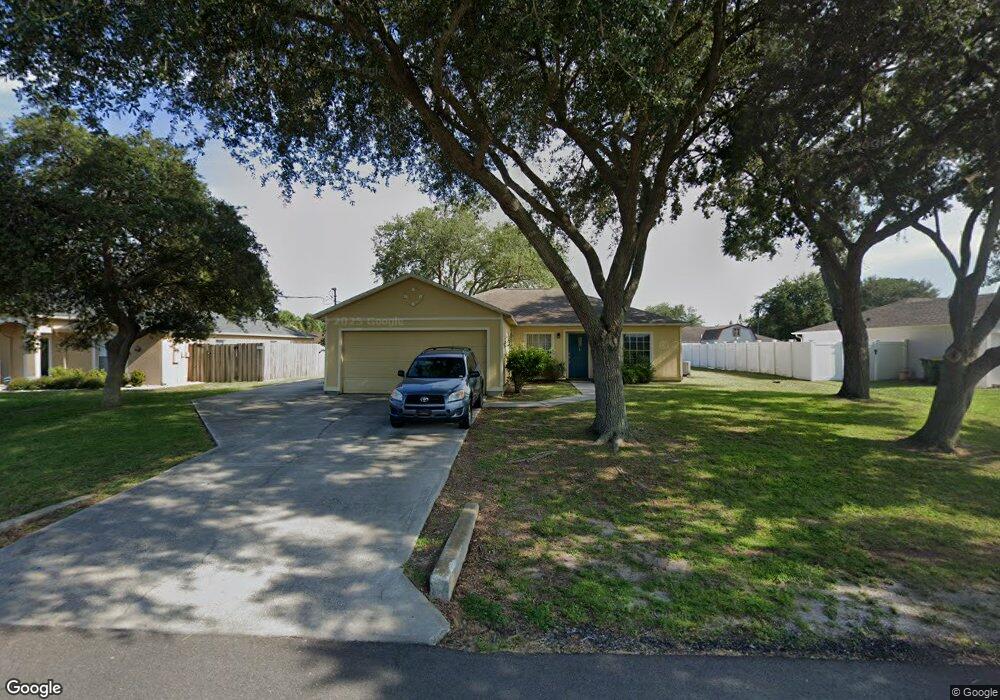
This home is located at 5709 Beaverbrook St, Cocoa, FL 32927 and is currently estimated at $316,806, approximately $220 per square foot. 5709 Beaverbrook St is a home located in Brevard County with nearby schools including Enterprise Elementary School, Space Coast Junior/Senior High School, and East Atlantic Prep of Brevard County.
Ownership History
Date
Name
Owned For
Owner Type
Purchase Details
Closed on
Jun 18, 1996
Sold by
Mercedes Homes Inc
Bought by
Cutter Roschelle L
Current Estimated Value
Home Financials for this Owner
Home Financials are based on the most recent Mortgage that was taken out on this home.
Original Mortgage
$70,150
Outstanding Balance
$4,568
Interest Rate
8.21%
Estimated Equity
$312,238
Purchase Details
Closed on
Apr 2, 1996
Sold by
Atlantic Gulf Com Corp
Bought by
Mercedes Homes Inc
Create a Home Valuation Report for This Property
The Home Valuation Report is an in-depth analysis detailing your home's value as well as a comparison with similar homes in the area
Home Values in the Area
Average Home Value in this Area
Purchase History
| Date | Buyer | Sale Price | Title Company |
|---|---|---|---|
| Cutter Roschelle L | $68,900 | -- | |
| Mercedes Homes Inc | $9,300 | -- |
Source: Public Records
Mortgage History
| Date | Status | Borrower | Loan Amount |
|---|---|---|---|
| Open | Cutter Roschelle L | $70,150 |
Source: Public Records
Tax History
| Year | Tax Paid | Tax Assessment Tax Assessment Total Assessment is a certain percentage of the fair market value that is determined by local assessors to be the total taxable value of land and additions on the property. | Land | Improvement |
|---|---|---|---|---|
| 2025 | $1,147 | $81,030 | -- | -- |
| 2024 | $1,111 | $78,750 | -- | -- |
| 2023 | $1,111 | $76,460 | $0 | $0 |
| 2022 | $1,038 | $74,240 | $0 | $0 |
| 2021 | $1,039 | $72,080 | $0 | $0 |
| 2020 | $981 | $71,090 | $0 | $0 |
| 2019 | $928 | $69,500 | $0 | $0 |
| 2018 | $929 | $68,210 | $0 | $0 |
| 2017 | $928 | $66,810 | $0 | $0 |
| 2016 | $936 | $65,440 | $18,000 | $47,440 |
| 2015 | $944 | $64,990 | $15,000 | $49,990 |
| 2014 | $948 | $64,480 | $11,000 | $53,480 |
Source: Public Records
Map
Nearby Homes
- 5715 Fairbridge St
- 5680 Banos Ave
- 6481 La Brea Ave
- 6470 Bamboo Ave
- 6581 Bancroft Ave
- 6438 Hudson Rd
- 6365 Homestead Ave
- 23-35-21-JX-B-2 Aruin St
- 5720 Flint Rd
- 6545 Addie Ave
- 6615 Dock Ave
- 6665 Addie Ave
- 6450 Ember Ave
- 6105 Banyan St
- 6135 Allmont St
- 6010 Fay Blvd
- 23-35-21-J No Name
- 6177 Brandt St
- 6085 Edison St
- 5555 Brandon St
- 5697 Beaverbrook St
- 5721 Beaverbrook St
- 5710 Ada St
- 5698 Ada St
- 5722 Ada St
- 5685 Beaverbrook St
- 5708 Beaverbrook St
- 5720 Beaverbrook St
- 5696 Beaverbrook St
- 5686 Ada St
- 5734 Ada St
- 5732 Beaverbrook St
- 5684 Beaverbrook St
- 5673 Beaverbrook St
- 5674 Ada St
- 5757 Beaverbrook St
- 5725 Fairbridge St
- 5711 Ada St
- 5672 Beaverbrook St
- 5735 Fairbridge St
Your Personal Tour Guide
Ask me questions while you tour the home.