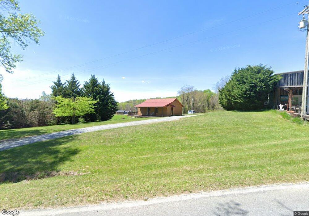
571 Andrews Ridge Rd Sparta, NC 28675
Estimated Value: $175,626 - $241,000
2
Beds
1
Bath
672
Sq Ft
$316/Sq Ft
Est. Value
About This Home
This home is located at 571 Andrews Ridge Rd, Sparta, NC 28675 and is currently estimated at $212,157, approximately $315 per square foot. 571 Andrews Ridge Rd is a home with nearby schools including Alleghany High School and Blue Ridge Christian School.
Ownership History
Date
Name
Owned For
Owner Type
Purchase Details
Closed on
Sep 26, 2008
Sold by
Atwood Larry T and Atwood Joy M
Bought by
Specht Randy Jay and Paglen Louise Marie
Current Estimated Value
Home Financials for this Owner
Home Financials are based on the most recent Mortgage that was taken out on this home.
Original Mortgage
$112,500
Outstanding Balance
$75,025
Interest Rate
6.49%
Mortgage Type
New Conventional
Estimated Equity
$137,132
Create a Home Valuation Report for This Property
The Home Valuation Report is an in-depth analysis detailing your home's value as well as a comparison with similar homes in the area
Home Values in the Area
Average Home Value in this Area
Purchase History
| Date | Buyer | Sale Price | Title Company |
|---|---|---|---|
| Specht Randy Jay | $126,500 | -- |
Source: Public Records
Mortgage History
| Date | Status | Borrower | Loan Amount |
|---|---|---|---|
| Open | Specht Randy Jay | $112,500 |
Source: Public Records
Tax History Compared to Growth
Tax History
| Year | Tax Paid | Tax Assessment Tax Assessment Total Assessment is a certain percentage of the fair market value that is determined by local assessors to be the total taxable value of land and additions on the property. | Land | Improvement |
|---|---|---|---|---|
| 2025 | $658 | $89,300 | $37,800 | $51,500 |
| 2024 | $658 | $89,300 | $37,800 | $51,500 |
| 2023 | $647 | $87,500 | $37,800 | $49,700 |
| 2022 | $647 | $87,500 | $37,800 | $49,700 |
| 2021 | $634 | $87,500 | $37,800 | $49,700 |
| 2020 | $607 | $83,100 | $27,400 | $55,700 |
| 2019 | $594 | $83,100 | $27,400 | $55,700 |
| 2018 | $530 | $83,100 | $27,400 | $55,700 |
| 2017 | $496 | $83,100 | $27,400 | $55,700 |
| 2016 | $496 | $83,100 | $27,400 | $55,700 |
| 2015 | $486 | $83,100 | $27,400 | $55,700 |
| 2014 | $466 | $86,400 | $30,900 | $55,500 |
| 2013 | -- | $86,400 | $30,900 | $55,500 |
Source: Public Records
Map
Nearby Homes
- 117 Andrews Ridge Rd
- 30 Boyer Ln
- Lot 16/17/18 River Run
- 61 Sheriff Rd
- TBD Fox Ridge Rd
- 111 Lynn Ln
- TBD Us Highway 21
- 10-K Alleghany Manor Rd
- 50 Millards Way
- 90 Millards Way
- 296 Silo Rd
- 23 Millards Way
- TBD Hwy 21 S
- Lot 26 Fox Run Ln Unit 26
- Tract 5 Millards Way
- Lot #15 River Walk Dr
- #49 River Walk Dr
- #44 River Walk Dr
- #45 River Walk Dr
- #40 River Walk Dr
- 547 Andrews Ridge Rd
- 497 Andrews Ridge Rd
- 473 Andrews Ridge Rd
- 470 Andrews Ridge Rd
- 429 Andrews Ridge Rd
- 185 View Point Ln
- 375 Andrews Ridge Rd
- 137 View Point Ln
- 17 Peaceful Dr
- 306 Andrews Ridge Rd
- 72 Peaceful Dr
- 281 Andrews Ridge Rd
- 233 Andrews Ridge Rd
- 90 Peaceful Dr
- 134 Harvest Ln
- 189 Andrews Ridge Rd
- 178 Andrews Ridge Rd
- 150 Truitt Mountain Dr
- TBD Harvest Ln
- 155 Andrews Ridge Rd