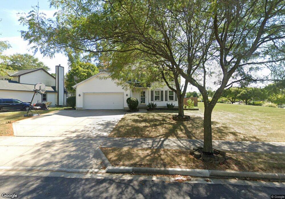
571 Birch St Westerville, OH 43082
Genoa NeighborhoodEstimated Value: $439,000 - $463,000
4
Beds
3
Baths
2,105
Sq Ft
$214/Sq Ft
Est. Value
About This Home
This home is located at 571 Birch St, Westerville, OH 43082 and is currently estimated at $451,112, approximately $214 per square foot. 571 Birch St is a home located in Delaware County with nearby schools including Robert Frost Elementary School, Heritage Middle School, and Westerville-North High School.
Ownership History
Date
Name
Owned For
Owner Type
Purchase Details
Closed on
Feb 1, 2002
Sold by
Lacy Jeffrey M
Bought by
Kirkland R Devray
Current Estimated Value
Home Financials for this Owner
Home Financials are based on the most recent Mortgage that was taken out on this home.
Original Mortgage
$184,300
Outstanding Balance
$77,282
Interest Rate
7.26%
Mortgage Type
New Conventional
Estimated Equity
$373,830
Purchase Details
Closed on
Nov 7, 1995
Sold by
Ho Patrick Doherty Finer
Bought by
Lacy Jeffrey M
Create a Home Valuation Report for This Property
The Home Valuation Report is an in-depth analysis detailing your home's value as well as a comparison with similar homes in the area
Home Values in the Area
Average Home Value in this Area
Purchase History
| Date | Buyer | Sale Price | Title Company |
|---|---|---|---|
| Kirkland R Devray | $190,000 | -- | |
| Lacy Jeffrey M | $149,960 | -- |
Source: Public Records
Mortgage History
| Date | Status | Borrower | Loan Amount |
|---|---|---|---|
| Open | Kirkland R Devray | $184,300 |
Source: Public Records
Tax History Compared to Growth
Tax History
| Year | Tax Paid | Tax Assessment Tax Assessment Total Assessment is a certain percentage of the fair market value that is determined by local assessors to be the total taxable value of land and additions on the property. | Land | Improvement |
|---|---|---|---|---|
| 2024 | $6,325 | $124,150 | $30,870 | $93,280 |
| 2023 | $6,253 | $124,150 | $30,870 | $93,280 |
| 2022 | $5,637 | $86,590 | $21,140 | $65,450 |
| 2021 | $5,685 | $86,590 | $21,140 | $65,450 |
| 2020 | $5,723 | $86,590 | $21,140 | $65,450 |
| 2019 | $4,952 | $71,580 | $18,380 | $53,200 |
| 2018 | $4,869 | $71,580 | $18,380 | $53,200 |
| 2017 | $4,830 | $66,050 | $13,370 | $52,680 |
| 2016 | $4,902 | $66,050 | $13,370 | $52,680 |
| 2015 | $4,689 | $66,050 | $13,370 | $52,680 |
| 2014 | $4,736 | $66,050 | $13,370 | $52,680 |
| 2013 | $4,524 | $63,070 | $13,370 | $49,700 |
Source: Public Records
Map
Nearby Homes
- 518 Kingfisher Dr
- 763 Kingsmead Rd
- 764 Mill Crossing Dr
- 267 Windemere Place
- 200 Matthew Ave
- 705 N State St Unit 211
- 137 Abbeycross Ln
- 6867 Sherbrook Dr
- 543 N State St
- 7356 Park Bend Dr
- 974 Lakeland Dr
- 6735 Alberta Place
- 66 Abbeycross Ln
- 389 Ridgemoor Ln
- 368 E College Ave
- 589 E College Ave
- 364 E College Ave
- 6618 Wild Rose Ln
- 768 Collingwood Dr
- 203 N Hempstead Rd
- 579 Birch St
- 503 Chestnut Ave
- 511 Chestnut Ave
- 521 Burns Dr N
- 513 Burns Dr N
- 519 Chestnut Ave
- 497 Chestnut Ave
- 574 Birch St
- 582 Birch St
- 507 Burns Dr N
- 586 Birch St
- 491 Chestnut Ave
- 0 Chestnut Ave Unit L438
- 499 Burns Dr N
- 535 Chestnut Ave
- 530 Radcliff Dr
- 520 Radcliff Dr
- 490 Burns Dr N
- 569 Elm Ct
- 532 Radcliff Dr