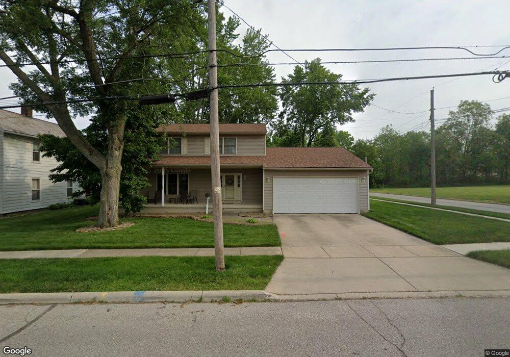
571 Franklin Ave Amherst, OH 44001
Estimated Value: $328,000 - $356,000
4
Beds
3
Baths
2,212
Sq Ft
$154/Sq Ft
Est. Value
About This Home
This home is located at 571 Franklin Ave, Amherst, OH 44001 and is currently estimated at $339,874, approximately $153 per square foot. 571 Franklin Ave is a home located in Lorain County with nearby schools including Powers Elementary School, Walter G. Nord Middle School, and Amherst Junior High School.
Ownership History
Date
Name
Owned For
Owner Type
Purchase Details
Closed on
Jun 27, 2005
Sold by
Ritter Daniel R and Ritter Michelle R
Bought by
Wallace John and Wallace Debra
Current Estimated Value
Home Financials for this Owner
Home Financials are based on the most recent Mortgage that was taken out on this home.
Original Mortgage
$164,000
Outstanding Balance
$86,713
Interest Rate
5.86%
Mortgage Type
Purchase Money Mortgage
Estimated Equity
$253,161
Purchase Details
Closed on
Feb 8, 2001
Sold by
Walker Mary S
Bought by
Ritter Daniel R and Ritter Michelle R
Purchase Details
Closed on
Jul 7, 2000
Sold by
Ralph L & Mary S Walker Family Trust
Bought by
Ralph L & Mary S Walker Family Trust
Create a Home Valuation Report for This Property
The Home Valuation Report is an in-depth analysis detailing your home's value as well as a comparison with similar homes in the area
Home Values in the Area
Average Home Value in this Area
Purchase History
| Date | Buyer | Sale Price | Title Company |
|---|---|---|---|
| Wallace John | $193,000 | First American | |
| Ritter Daniel R | $10,000 | -- | |
| Ralph L & Mary S Walker Family Trust | -- | -- |
Source: Public Records
Mortgage History
| Date | Status | Borrower | Loan Amount |
|---|---|---|---|
| Open | Wallace John | $164,000 |
Source: Public Records
Tax History
| Year | Tax Paid | Tax Assessment Tax Assessment Total Assessment is a certain percentage of the fair market value that is determined by local assessors to be the total taxable value of land and additions on the property. | Land | Improvement |
|---|---|---|---|---|
| 2024 | $4,163 | $103,086 | $14,658 | $88,428 |
| 2023 | $3,952 | $82,495 | $13,724 | $68,772 |
| 2022 | $3,789 | $82,495 | $13,724 | $68,772 |
| 2021 | $3,799 | $82,495 | $13,724 | $68,772 |
| 2020 | $3,630 | $69,970 | $11,640 | $58,330 |
| 2019 | $3,557 | $69,970 | $11,640 | $58,330 |
| 2018 | $3,653 | $69,970 | $11,640 | $58,330 |
| 2017 | $3,731 | $68,530 | $9,870 | $58,660 |
| 2016 | $3,761 | $68,530 | $9,870 | $58,660 |
| 2015 | $3,740 | $68,530 | $9,870 | $58,660 |
| 2014 | $3,447 | $62,880 | $9,060 | $53,820 |
| 2013 | $3,458 | $62,880 | $9,060 | $53,820 |
Source: Public Records
Map
Nearby Homes
- 2176 Myla Way
- 774 Tenney Ave
- 495 Church St
- 145 Pearl St
- 472 Sunset Dr
- 107 Keswick Ct
- 653 Brennan Dr
- 267 Milan Ave
- V/L Middle Ridge Rd
- 0 Middle Ridge Rd Unit 5180506
- 0 Middle Ridge Rd Unit 5102632
- 937 Longitude Ln
- 953 Longitude Ln
- 772 Shadow Creek Trail
- 621 Van Oaks Dr
- 812 Bearing Ct
- 578 N Main St
- 7475 S Dewey Rd
- 707 Lincoln St
- 335 Copper Creek
Your Personal Tour Guide
Ask me questions while you tour the home.