Estimated Value: $295,000 - $317,000
3
Beds
3
Baths
1,544
Sq Ft
$198/Sq Ft
Est. Value
About This Home
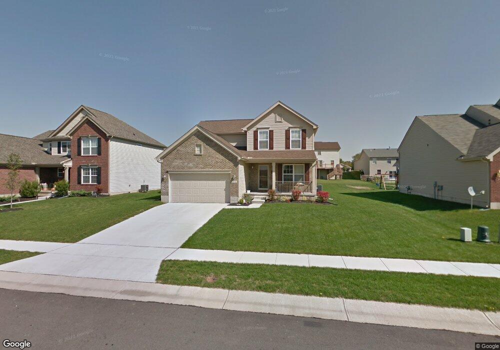
This home is located at 571 Jodee Dr, Xenia, OH 45385 and is currently estimated at $306,017, approximately $198 per square foot. 571 Jodee Dr is a home located in Greene County with nearby schools including Xenia High School and Summit Academy Community School for Alternative Learners - Xenia.
Ownership History
Date
Name
Owned For
Owner Type
Purchase Details
Closed on
Dec 31, 2020
Sold by
Tegtmeyer Brian M and Tegtmeyer Lauren J
Bought by
Conover Jeff W and Conover Sandra L
Current Estimated Value
Purchase Details
Closed on
Nov 1, 2012
Sold by
Tegtmeyer Brian M and Tegtmeyer Lauren J
Bought by
Tegtmeyer Brian M and Tegtmeyer Lauren J
Purchase Details
Closed on
Apr 20, 2010
Sold by
Inverness Group Incroporated
Bought by
Tegtmeyer Brian M and Tegtmeyer Lauren J
Home Financials for this Owner
Home Financials are based on the most recent Mortgage that was taken out on this home.
Original Mortgage
$146,044
Interest Rate
5.25%
Mortgage Type
FHA
Purchase Details
Closed on
Jan 18, 2010
Sold by
Xenia Development Co Llc
Bought by
Inverness Group Inc
Home Financials for this Owner
Home Financials are based on the most recent Mortgage that was taken out on this home.
Original Mortgage
$20,000,000
Interest Rate
5%
Mortgage Type
Unknown
Create a Home Valuation Report for This Property
The Home Valuation Report is an in-depth analysis detailing your home's value as well as a comparison with similar homes in the area
Home Values in the Area
Average Home Value in this Area
Purchase History
| Date | Buyer | Sale Price | Title Company |
|---|---|---|---|
| Conover Jeff W | $215,000 | First Ohio Title Insurance | |
| Tegtmeyer Brian M | -- | None Available | |
| Tegtmeyer Brian M | $148,800 | Attorney | |
| Inverness Group Inc | $27,000 | Attorney |
Source: Public Records
Mortgage History
| Date | Status | Borrower | Loan Amount |
|---|---|---|---|
| Previous Owner | Tegtmeyer Brian M | $146,044 | |
| Previous Owner | Inverness Group Inc | $20,000,000 |
Source: Public Records
Tax History Compared to Growth
Tax History
| Year | Tax Paid | Tax Assessment Tax Assessment Total Assessment is a certain percentage of the fair market value that is determined by local assessors to be the total taxable value of land and additions on the property. | Land | Improvement |
|---|---|---|---|---|
| 2024 | $3,568 | $85,570 | $18,740 | $66,830 |
| 2023 | $3,568 | $85,570 | $18,740 | $66,830 |
| 2022 | $3,234 | $64,460 | $12,500 | $51,960 |
| 2021 | $3,195 | $64,460 | $12,500 | $51,960 |
| 2020 | $3,058 | $64,460 | $12,500 | $51,960 |
| 2019 | $2,478 | $49,170 | $9,280 | $39,890 |
| 2018 | $2,488 | $49,170 | $9,280 | $39,890 |
| 2017 | $2,415 | $49,170 | $9,280 | $39,890 |
| 2016 | $2,406 | $46,700 | $9,280 | $37,420 |
| 2015 | $2,413 | $46,700 | $9,280 | $37,420 |
| 2014 | $2,308 | $46,700 | $9,280 | $37,420 |
Source: Public Records
Map
Nearby Homes
- 2142 Michigan Dr
- 414 Whisper Ln
- 1874 Pennsylvania Dr
- 219 Kansas Dr
- 1829 Gayhart Dr
- 2758 Wyoming Dr
- 161 Montana Dr
- 1255 Colorado Dr
- 2499 Jenny Marie Dr
- 2421 Louisiana Dr
- 1161 Shannon Ln
- 1403 Texas Dr
- 1248 Prem Place
- 0 Berkshire Dr Unit 949217
- 1750 Roxbury Dr
- 1318 Prem Place
- 1348 Berkshire Dr
- 1778 Arapaho Dr
- 2784 Greystoke Dr
- 1358 Shannon Ln