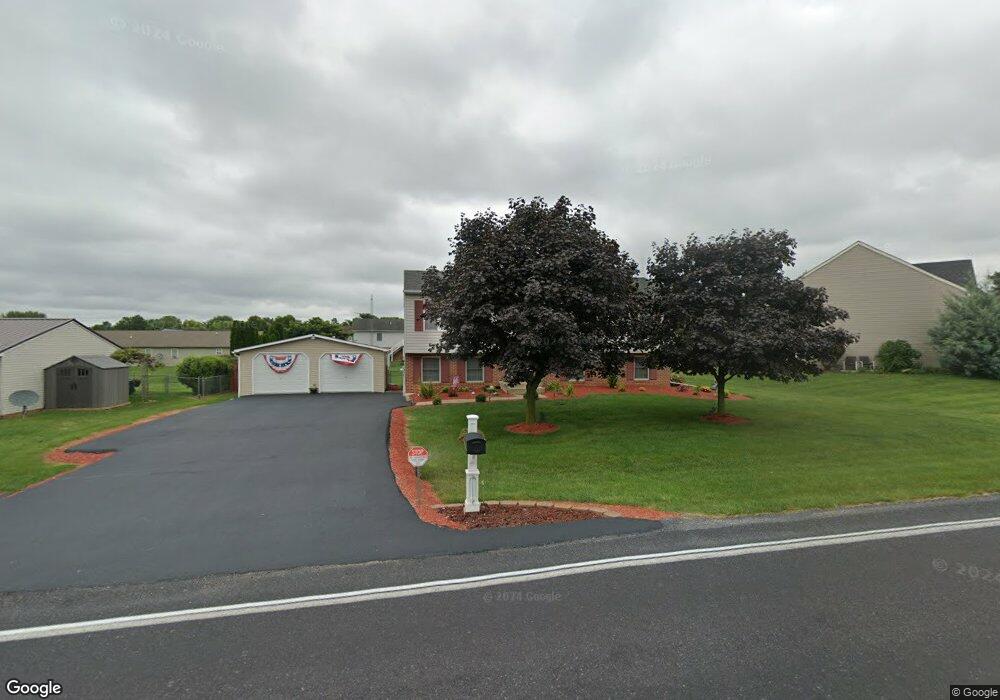
571 Leitersburg Rd Greencastle, PA 17225
Estimated Value: $146,947 - $341,000
--
Bed
--
Bath
1,770
Sq Ft
$153/Sq Ft
Est. Value
About This Home
This home is located at 571 Leitersburg Rd, Greencastle, PA 17225 and is currently estimated at $270,237, approximately $152 per square foot. 571 Leitersburg Rd is a home located in Franklin County with nearby schools including Greencastle-Antrim Primary School, Greencastle-Antrim Elementary School, and Greencastle-Antrim Middle School.
Ownership History
Date
Name
Owned For
Owner Type
Purchase Details
Closed on
Feb 10, 2023
Sold by
Wilson Joseph Allen
Bought by
Wilson Joseph Allen
Current Estimated Value
Home Financials for this Owner
Home Financials are based on the most recent Mortgage that was taken out on this home.
Original Mortgage
$221,245
Outstanding Balance
$214,036
Interest Rate
6.12%
Mortgage Type
FHA
Estimated Equity
$56,201
Purchase Details
Closed on
Jun 2, 2017
Sold by
Wilson Joseph Allen and Wilson Kimberly Kay
Bought by
Wilson Joseph Allen
Home Financials for this Owner
Home Financials are based on the most recent Mortgage that was taken out on this home.
Original Mortgage
$142,400
Interest Rate
4.02%
Mortgage Type
New Conventional
Create a Home Valuation Report for This Property
The Home Valuation Report is an in-depth analysis detailing your home's value as well as a comparison with similar homes in the area
Home Values in the Area
Average Home Value in this Area
Purchase History
| Date | Buyer | Sale Price | Title Company |
|---|---|---|---|
| Wilson Joseph Allen | -- | -- | |
| Wilson Joseph Allen | -- | None Available |
Source: Public Records
Mortgage History
| Date | Status | Borrower | Loan Amount |
|---|---|---|---|
| Open | Wilson Joseph Allen | $221,245 | |
| Previous Owner | Wilson Joseph Allen | $142,400 |
Source: Public Records
Tax History Compared to Growth
Tax History
| Year | Tax Paid | Tax Assessment Tax Assessment Total Assessment is a certain percentage of the fair market value that is determined by local assessors to be the total taxable value of land and additions on the property. | Land | Improvement |
|---|---|---|---|---|
| 2025 | $3,150 | $18,830 | $2,500 | $16,330 |
| 2024 | $2,858 | $18,830 | $2,500 | $16,330 |
| 2023 | $2,824 | $18,830 | $2,500 | $16,330 |
| 2022 | $2,824 | $18,830 | $2,500 | $16,330 |
| 2021 | $2,769 | $18,830 | $2,500 | $16,330 |
| 2020 | $2,697 | $18,830 | $2,500 | $16,330 |
| 2019 | $2,636 | $18,830 | $2,500 | $16,330 |
| 2018 | $2,608 | $18,830 | $2,500 | $16,330 |
| 2017 | $2,542 | $18,830 | $2,500 | $16,330 |
| 2016 | $539 | $18,830 | $2,500 | $16,330 |
| 2015 | $503 | $18,830 | $2,500 | $16,330 |
| 2014 | $503 | $18,830 | $2,500 | $16,330 |
Source: Public Records
Map
Nearby Homes
- 431 Leitersburg St
- 674 Lohman Ave
- 775 Lohman Ave
- 823 Buchanan Trail E
- 34.77 Acres Red Oak Estate S
- 0 Molly Pitcher Hwy Unit PAFL178468
- 0 Molly Pitcher Hwy Unit PAFL2030380
- 0 Molly Pitcher Hwy Unit PAFL178444
- 271 E Baltimore St
- 480 S Carlisle St
- 602 Brookview Dr
- 45 W Dahlgren St
- 763 Joy Dr
- 231 N Allison St Unit 1
- 101 N Carlisle St
- 148 N Carlisle St
- 375 Carolle St
- 12976 Daybreak Ln
- 1223 E Pebblebrook Dr
- 560 Meadowview Cir
- 569 Leitersburg Rd
- 569 Leitersburg Rd
- 11892 Waxwing Dr
- 567 Leitersburg Rd
- 572 Tall Cedar Ln
- 11869 Waxwing Dr
- 560 Tall Cedar Ln
- 11898 Waxwing Dr
- 11896 Waxwing Dr
- 0 Tall Cedar Ln
- 11864 Waxwing Dr
- 575 Tall Cedar Ln
- 567 Tall Cedar Ln
- 11856 Waxwing Dr
- 547 Leitersburg Rd
- 555 Tall Cedar Ln
- 11848 Waxwing Dr
- 541 Tall Cedar Ln
- 11817 Waxwing Dr
- 11795 Waxwing Dr