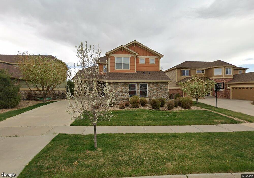
571 N Flat Rock Cir Aurora, CO 80018
Estimated Value: $571,579 - $602,000
3
Beds
3
Baths
2,346
Sq Ft
$250/Sq Ft
Est. Value
About This Home
This home is located at 571 N Flat Rock Cir, Aurora, CO 80018 and is currently estimated at $586,895, approximately $250 per square foot. 571 N Flat Rock Cir is a home located in Arapahoe County with nearby schools including Vista Peak Exploratory and Vista Peak 9-12 Preparatory.
Ownership History
Date
Name
Owned For
Owner Type
Purchase Details
Closed on
Sep 16, 2021
Sold by
Lake Jeannie L
Bought by
Johnson Edward K and Hernandez Henry P
Current Estimated Value
Home Financials for this Owner
Home Financials are based on the most recent Mortgage that was taken out on this home.
Original Mortgage
$512,000
Outstanding Balance
$462,825
Interest Rate
2.8%
Mortgage Type
New Conventional
Estimated Equity
$124,070
Purchase Details
Closed on
Apr 21, 2006
Sold by
Standard Pacific Of Colorado Inc
Bought by
Lake Jeannie L
Home Financials for this Owner
Home Financials are based on the most recent Mortgage that was taken out on this home.
Original Mortgage
$257,582
Interest Rate
7.5%
Mortgage Type
Balloon
Create a Home Valuation Report for This Property
The Home Valuation Report is an in-depth analysis detailing your home's value as well as a comparison with similar homes in the area
Purchase History
| Date | Buyer | Sale Price | Title Company |
|---|---|---|---|
| Johnson Edward K | $557,000 | Land Title Guarantee Company | |
| Lake Jeannie L | $322,977 | Land Title |
Source: Public Records
Mortgage History
| Date | Status | Borrower | Loan Amount |
|---|---|---|---|
| Open | Johnson Edward K | $512,000 | |
| Previous Owner | Lake Jeannie L | $257,582 |
Source: Public Records
Tax History
| Year | Tax Paid | Tax Assessment Tax Assessment Total Assessment is a certain percentage of the fair market value that is determined by local assessors to be the total taxable value of land and additions on the property. | Land | Improvement |
|---|---|---|---|---|
| 2025 | $5,120 | $37,938 | -- | -- |
| 2024 | $5,060 | $38,311 | -- | -- |
| 2023 | $5,060 | $38,311 | $0 | $0 |
| 2022 | $4,512 | $30,372 | $0 | $0 |
| 2021 | $4,651 | $30,372 | $0 | $0 |
| 2020 | $4,787 | $30,838 | $0 | $0 |
| 2019 | $4,769 | $30,838 | $0 | $0 |
| 2018 | $4,444 | $26,798 | $0 | $0 |
| 2017 | $4,367 | $26,798 | $0 | $0 |
| 2016 | $3,762 | $23,522 | $0 | $0 |
| 2015 | $3,686 | $23,522 | $0 | $0 |
| 2014 | $3,229 | $19,852 | $0 | $0 |
| 2013 | -- | $20,540 | $0 | $0 |
Source: Public Records
Map
Nearby Homes
- 465 N Flat Rock St
- 24346 E 5th Place
- 182 N de Gaulle St
- 25029 E 3rd Place
- Yorktown Plan at Harvest Crossing
- Hopewell Plan at Harvest Crossing
- Arlington Plan at Harvest Crossing
- Hemingway Plan at Harvest Crossing
- Coronado Plan at Harvest Crossing
- Seth Plan at Harvest Crossing
- Bedford Plan at Harvest Crossing
- 23626 E 5th Place
- 23614 E 5th Place
- 177 N Ider St
- 23627 E 5th Place
- 23584 E 5th Place
- 59 S de Gaulle St
- 23576 E 5th Place
- 23507 E 5th Place
- 463 N Jamestown Way
- 563 N Flat Rock Cir
- 573 N Flat Rock Cir
- 561 N Flat Rock Cir
- 560 N Flat Rock Cir
- 570 N Flat Rock Cir
- 550 N Flat Rock Cir
- 553 N Flat Rock Cir
- 540 N Flat Rock Cir
- 500 N Flat Rock Cir
- 510 N Flat Rock Cir
- 520 N Flat Rock Cir
- 551 N Flat Rock Cir
- 506 N Coolidge Way
- 530 N Flat Rock Cir
- 504 N Flat Rock St
- 543 N Flat Rock Cir
- 541 N Flat Rock Cir
- 496 N Coolidge Way
- 484 N Flat Rock St
- 533 N Flat Rock Cir
Your Personal Tour Guide
Ask me questions while you tour the home.