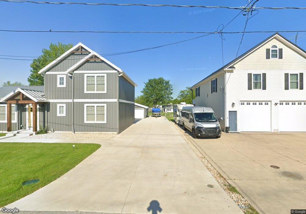
571 S Tiffin St Port Clinton, OH 43452
Estimated Value: $308,000 - $523,000
4
Beds
5
Baths
2,218
Sq Ft
$205/Sq Ft
Est. Value
About This Home
This home is located at 571 S Tiffin St, Port Clinton, OH 43452 and is currently estimated at $455,470, approximately $205 per square foot. 571 S Tiffin St is a home with nearby schools including Bataan Memorial Primary School, Bataan Memorial Intermediate School, and Port Clinton Middle School.
Ownership History
Date
Name
Owned For
Owner Type
Purchase Details
Closed on
Jan 19, 2021
Sold by
Pond Richard R and Pond Cameron M
Bought by
Pond Richard R and Pond Cameron M
Current Estimated Value
Purchase Details
Closed on
May 29, 2012
Sold by
Simpson Donald M and Simpson Connie S
Bought by
Pond Richard R and Pond Camerone M
Purchase Details
Closed on
Aug 6, 2001
Sold by
Thompson Gerald L
Bought by
Simpson Donald M and Simpson Connie S
Home Financials for this Owner
Home Financials are based on the most recent Mortgage that was taken out on this home.
Original Mortgage
$40,000
Interest Rate
5.75%
Mortgage Type
New Conventional
Purchase Details
Closed on
Dec 2, 1991
Sold by
Thompson Gerald and Thompson June
Bought by
Thompson Gerald Lee
Create a Home Valuation Report for This Property
The Home Valuation Report is an in-depth analysis detailing your home's value as well as a comparison with similar homes in the area
Home Values in the Area
Average Home Value in this Area
Purchase History
| Date | Buyer | Sale Price | Title Company |
|---|---|---|---|
| Pond Richard R | -- | None Available | |
| Pond Richard R | $52,000 | Attorney | |
| Simpson Donald M | $95,000 | -- | |
| Thompson Gerald Lee | -- | -- |
Source: Public Records
Mortgage History
| Date | Status | Borrower | Loan Amount |
|---|---|---|---|
| Previous Owner | Simpson Donald M | $40,000 |
Source: Public Records
Tax History Compared to Growth
Tax History
| Year | Tax Paid | Tax Assessment Tax Assessment Total Assessment is a certain percentage of the fair market value that is determined by local assessors to be the total taxable value of land and additions on the property. | Land | Improvement |
|---|---|---|---|---|
| 2024 | $5,343 | $162,505 | $32,872 | $129,633 |
| 2023 | $5,343 | $109,809 | $22,673 | $87,136 |
| 2022 | $1,976 | $54,240 | $22,673 | $31,567 |
| 2021 | $1,261 | $34,670 | $22,670 | $12,000 |
| 2020 | $1,067 | $28,110 | $17,440 | $10,670 |
| 2019 | $1,051 | $28,110 | $17,440 | $10,670 |
| 2018 | $1,049 | $28,110 | $17,440 | $10,670 |
| 2017 | $1,102 | $30,590 | $17,440 | $13,150 |
| 2016 | $1,105 | $30,590 | $17,440 | $13,150 |
| 2015 | $1,109 | $30,590 | $17,440 | $13,150 |
| 2014 | $1,119 | $30,590 | $17,440 | $13,150 |
| 2013 | $1,122 | $30,590 | $17,440 | $13,150 |
Source: Public Records
Map
Nearby Homes
- 2915 W Rising Sun Rd
- 2915 W Risingsun Rd
- 2860 W Rising Sun Rd
- 2400 Sandy Ln
- 3652 W Harbor Rd
- 3800 W Lakeshore Dr
- 1805 W Lakeshore Dr
- 51 N Schooner Point Dr
- 85 Schooner Point Dr
- 1340 W Lakeshore Dr Unit 1372
- 1254 W Fremont Rd
- 1090 W Richey Rd
- 5372 W Harbor Rd
- 439 Erie Ct
- 304 Clinton Reef Dr
- 306 Clinton Reef Dr Unit 306
- 326 Clinton Reef Dr
- 224 Clinton Reef Dr Unit 224
- 208 Clinton Reef Dr Unit 208
- 172 Clinton Reef Dr
- 585 S Tiffin St
- 1708 W Wonnell Rd
- 595 S Tiffin St
- 580 S Tiffin St
- 605 S Tiffin St
- 590 S Tiffin St
- 600 S Tiffin St
- 3160 W Canal Rd
- 3160 E Canal
- 3160 W Canal St
- 550 S Tiffin St
- 3150 W Canal Rd
- 3150 W Canal St
- 615 S Tiffin St
- 3140 W Canal Rd
- 590 S Fostoria Rd
- 3130 W Canal Rd
- 600 S Fostoria Rd
- 625 S Tiffin St
- 3120 W Canal Rd