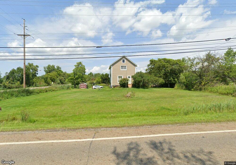
571 State Route 303 Streetsboro, OH 44241
Estimated Value: $157,462 - $273,000
3
Beds
2
Baths
1,280
Sq Ft
$166/Sq Ft
Est. Value
About This Home
This home is located at 571 State Route 303, Streetsboro, OH 44241 and is currently estimated at $211,866, approximately $165 per square foot. 571 State Route 303 is a home located in Portage County with nearby schools including Henry Defer Intermediate Elementary School, Streetsboro Middle School, and Streetsboro High School.
Ownership History
Date
Name
Owned For
Owner Type
Purchase Details
Closed on
Jan 22, 2019
Sold by
Chrzanowski Kenneth G
Bought by
Chrzanowski Kenneth G and Chrzanowski Shirley
Current Estimated Value
Purchase Details
Closed on
Jun 20, 2001
Sold by
Estate Of Rachelle M Laroche
Bought by
Chrzanowski Kenneth G
Purchase Details
Closed on
Jun 21, 1990
Bought by
Laroche Rachelle M
Create a Home Valuation Report for This Property
The Home Valuation Report is an in-depth analysis detailing your home's value as well as a comparison with similar homes in the area
Home Values in the Area
Average Home Value in this Area
Purchase History
| Date | Buyer | Sale Price | Title Company |
|---|---|---|---|
| Chrzanowski Kenneth G | -- | None Available | |
| Chrzanowski Kenneth G | -- | Approved Statewide Title Age | |
| Laroche Rachelle M | -- | -- |
Source: Public Records
Tax History Compared to Growth
Tax History
| Year | Tax Paid | Tax Assessment Tax Assessment Total Assessment is a certain percentage of the fair market value that is determined by local assessors to be the total taxable value of land and additions on the property. | Land | Improvement |
|---|---|---|---|---|
| 2024 | $1,231 | $39,590 | $13,650 | $25,940 |
| 2023 | $1,230 | $33,540 | $11,240 | $22,300 |
| 2022 | $1,253 | $33,540 | $11,240 | $22,300 |
| 2021 | $1,258 | $33,540 | $11,240 | $22,300 |
| 2020 | $1,140 | $29,370 | $11,240 | $18,130 |
| 2019 | $1,151 | $29,370 | $11,240 | $18,130 |
| 2018 | $1,033 | $29,580 | $11,240 | $18,340 |
| 2017 | $1,033 | $29,580 | $11,240 | $18,340 |
| 2016 | $1,468 | $29,580 | $11,240 | $18,340 |
| 2015 | $1,471 | $29,580 | $11,240 | $18,340 |
| 2014 | $1,484 | $29,580 | $11,240 | $18,340 |
| 2013 | $1,477 | $29,580 | $11,240 | $18,340 |
Source: Public Records
Map
Nearby Homes
- 9085 Sandpiper Dr
- 9011 Wood Thursh
- 9005 Sandpiper Dr
- 701 Gold Leaf Ct
- 8929 Falcon Dr
- 792 State Route 303
- 9381 Hickory Ridge Dr
- 939 State Route 303
- 9251 Chestnut Ct
- 9247 Chestnut Ct
- 1011 Ashwood Ln
- 1013 Ashwood Ln
- 139 Mccracken Rd
- 708 Diane Ave
- 1159 Shawnee Trail
- 572 David Dr
- 1401 Colony Dr
- 9740 Michael Dr
- 6167 Burr Oak Way
- 1041 Fronek Dr
- 0 Warbler Ct
- 9132 Warbler Ct
- 617 State Route 303
- 9121 Sandpiper Dr
- 9126 Sandpiper Dr
- 9137 Sandpiper Dr
- 9122 Sandpiper Dr
- 9131 Wood Duck Ct
- 9130 Sandpiper Dr
- 9113 Sandpiper Dr
- 9141 Sandpiper Dr
- 9130 Wood Duck Ct
- 641 State Route 303
- 655 State Route 303
- 9093 Sandpiper Dr
- 670 Hickory Hill Ct
- 664 Hickory Hill Ct
- 656 State Route 303
- 632 Teal Ct
- 672 Hickory Hill Ct