Estimated Value: $312,000 - $334,000
3
Beds
2
Baths
1,702
Sq Ft
$191/Sq Ft
Est. Value
About This Home
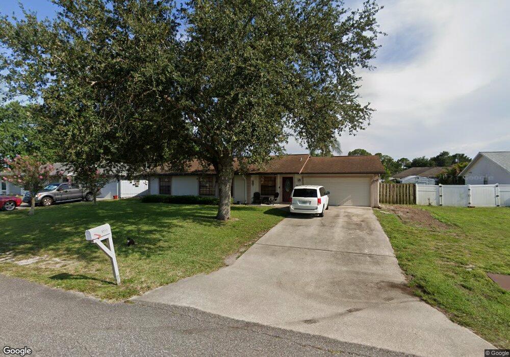
This home is located at 5711 Banos Ave, Cocoa, FL 32927 and is currently estimated at $324,850, approximately $190 per square foot. 5711 Banos Ave is a home located in Brevard County with nearby schools including Enterprise Elementary School, Space Coast Junior/Senior High School, and East Atlantic Prep of Brevard County.
Ownership History
Date
Name
Owned For
Owner Type
Purchase Details
Closed on
May 31, 1996
Sold by
Mosbrucker Marty T and Mosbrucker Linda T
Bought by
Burkett Jefrey R and Burkett Wendy S
Current Estimated Value
Home Financials for this Owner
Home Financials are based on the most recent Mortgage that was taken out on this home.
Original Mortgage
$94,760
Outstanding Balance
$6,016
Interest Rate
7.93%
Estimated Equity
$318,834
Create a Home Valuation Report for This Property
The Home Valuation Report is an in-depth analysis detailing your home's value as well as a comparison with similar homes in the area
Home Values in the Area
Average Home Value in this Area
Purchase History
| Date | Buyer | Sale Price | Title Company |
|---|---|---|---|
| Burkett Jefrey R | $92,000 | -- |
Source: Public Records
Mortgage History
| Date | Status | Borrower | Loan Amount |
|---|---|---|---|
| Open | Burkett Jefrey R | $94,760 |
Source: Public Records
Tax History Compared to Growth
Tax History
| Year | Tax Paid | Tax Assessment Tax Assessment Total Assessment is a certain percentage of the fair market value that is determined by local assessors to be the total taxable value of land and additions on the property. | Land | Improvement |
|---|---|---|---|---|
| 2025 | $1,456 | $106,360 | -- | -- |
| 2024 | $1,418 | $103,370 | -- | -- |
| 2023 | $1,418 | $100,360 | $0 | $0 |
| 2022 | $1,322 | $97,440 | $0 | $0 |
| 2021 | $1,320 | $94,610 | $0 | $0 |
| 2020 | $1,257 | $93,310 | $0 | $0 |
| 2019 | $1,192 | $91,220 | $0 | $0 |
| 2018 | $1,184 | $89,520 | $0 | $0 |
| 2017 | $1,177 | $87,680 | $0 | $0 |
| 2016 | $1,177 | $85,880 | $18,000 | $67,880 |
| 2015 | $1,189 | $85,290 | $15,000 | $70,290 |
| 2014 | $1,190 | $84,620 | $11,000 | $73,620 |
Source: Public Records
Map
Nearby Homes
- 5715 Fairbridge St
- 4650 N Highway 1 Hwy
- 6309 Alleghany Ave
- 5575 Curtis Blvd
- 5460 Holden Rd
- 6365 Homestead Ave
- 6581 Bancroft Ave
- 23-35-21-JX-B-2 Aruin St
- 5446 Jamaica Rd
- 6643 Emil Ave
- 5940 Flamingo Ave
- 6003 Gilson
- 6017 Flamingo Ave
- 6545 Addie Ave
- 6615 Dock Ave
- 6010 Fay Blvd
- 5997 Jenkins Ave
- 5275 Holden Rd
- 6665 Addie Ave
- 5946 Deer Ln