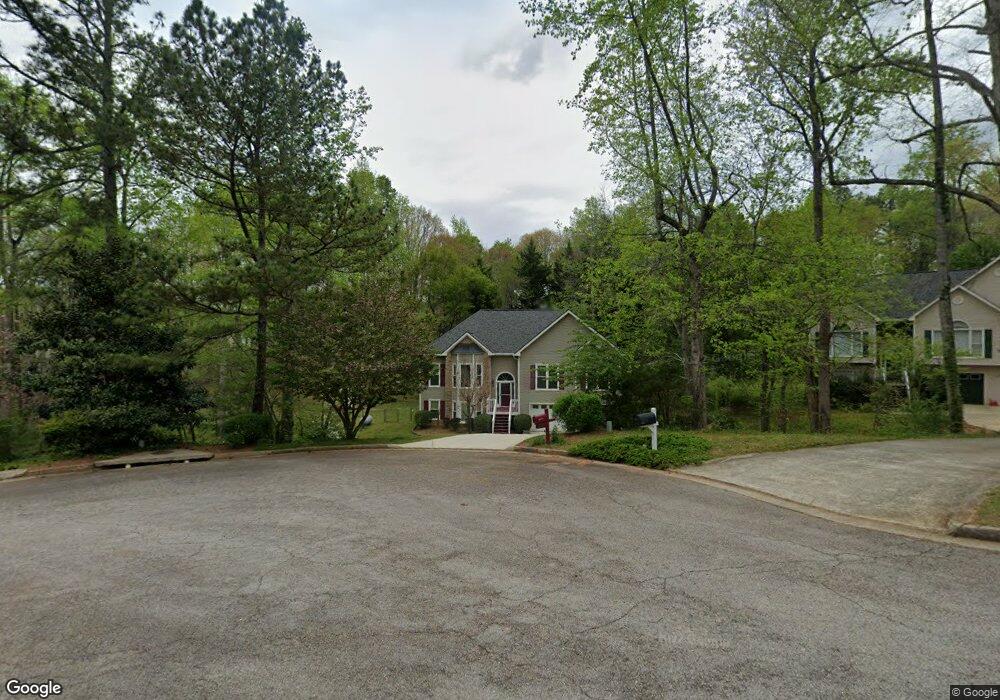
5712 Fir Ln Flowery Branch, GA 30542
Estimated Value: $339,660 - $457,000
3
Beds
2
Baths
1,854
Sq Ft
$211/Sq Ft
Est. Value
About This Home
This home is located at 5712 Fir Ln, Flowery Branch, GA 30542 and is currently estimated at $390,915, approximately $210 per square foot. 5712 Fir Ln is a home located in Hall County with nearby schools including Flowery Branch Elementary School, West Hall Middle School, and West Hall High School.
Ownership History
Date
Name
Owned For
Owner Type
Purchase Details
Closed on
Sep 3, 2003
Sold by
Barkus Bert and Barkus Susan
Bought by
Ford Robert W
Current Estimated Value
Home Financials for this Owner
Home Financials are based on the most recent Mortgage that was taken out on this home.
Original Mortgage
$172,380
Outstanding Balance
$81,120
Interest Rate
6.45%
Mortgage Type
VA
Estimated Equity
$309,795
Purchase Details
Closed on
Mar 15, 2002
Sold by
Wynn Richard E and Wynn Carol L
Bought by
Barkus Bert and Barkus Susan
Purchase Details
Closed on
Aug 22, 1996
Sold by
Great Southernresource Developm
Bought by
Wynn Richard Carol
Create a Home Valuation Report for This Property
The Home Valuation Report is an in-depth analysis detailing your home's value as well as a comparison with similar homes in the area
Home Values in the Area
Average Home Value in this Area
Purchase History
| Date | Buyer | Sale Price | Title Company |
|---|---|---|---|
| Ford Robert W | $169,000 | -- | |
| Barkus Bert | $170,000 | -- | |
| Wynn Richard Carol | $131,000 | -- |
Source: Public Records
Mortgage History
| Date | Status | Borrower | Loan Amount |
|---|---|---|---|
| Open | Ford Robert W | $172,380 | |
| Closed | Wynn Richard Carol | $0 |
Source: Public Records
Tax History Compared to Growth
Tax History
| Year | Tax Paid | Tax Assessment Tax Assessment Total Assessment is a certain percentage of the fair market value that is determined by local assessors to be the total taxable value of land and additions on the property. | Land | Improvement |
|---|---|---|---|---|
| 2024 | $2,394 | $112,640 | $11,560 | $101,080 |
| 2023 | $2,787 | $107,920 | $11,560 | $96,360 |
| 2022 | $2,674 | $99,120 | $11,560 | $87,560 |
| 2021 | $2,585 | $93,960 | $11,560 | $82,400 |
| 2020 | $2,556 | $90,160 | $11,560 | $78,600 |
| 2019 | $2,433 | $84,960 | $11,560 | $73,400 |
| 2018 | $2,296 | $77,280 | $11,560 | $65,720 |
| 2017 | $2,074 | $70,120 | $11,560 | $58,560 |
| 2016 | $1,844 | $63,428 | $10,194 | $53,234 |
| 2015 | $1,857 | $63,428 | $10,194 | $53,234 |
| 2014 | $1,857 | $63,428 | $10,194 | $53,234 |
Source: Public Records
Map
Nearby Homes
- 5708 Fir Ln
- 5704 Fir Ln
- 5716 Fir Ln
- 5707 Fir Ln
- 5613 Spruce Ln
- 6875 Spruce Ln
- 5711 Fir Ln
- 5670 Pipsissewa Dr
- 5603 Spruce Ln
- 5607 Spruce Ln
- 5710 Pipsissewa Dr
- 5632 Pipsissewa Dr
- 5628 Pipsissewa Dr
- 5666 Pipsissewa Dr
- 5675 Pipsissewa Dr
- 5705 Pipsissewa Dr
- 0 Pipsissewa Dr Unit 8486065
- 0 Pipsissewa Dr Unit 8335958
- 0 Pipsissewa Dr Unit 8332455
- 0 Pipsissewa Dr Unit 8033460