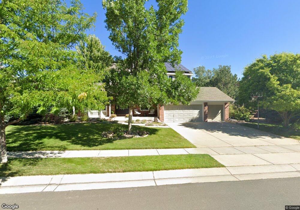
5717 Brook Hollow Dr Broomfield, CO 80020
Aspen Creek NeighborhoodEstimated Value: $1,079,000 - $1,159,000
5
Beds
5
Baths
4,605
Sq Ft
$245/Sq Ft
Est. Value
About This Home
This home is located at 5717 Brook Hollow Dr, Broomfield, CO 80020 and is currently estimated at $1,130,089, approximately $245 per square foot. 5717 Brook Hollow Dr is a home located in Broomfield County with nearby schools including Aspen Creek K-8 School, Broomfield High School, and Holy Family High School.
Ownership History
Date
Name
Owned For
Owner Type
Purchase Details
Closed on
Nov 19, 2018
Sold by
King Michael T and King Lyn A
Bought by
Lustick Chase and Ewing Jacqueline
Current Estimated Value
Home Financials for this Owner
Home Financials are based on the most recent Mortgage that was taken out on this home.
Original Mortgage
$453,100
Outstanding Balance
$397,596
Interest Rate
4.7%
Mortgage Type
New Conventional
Estimated Equity
$732,493
Purchase Details
Closed on
Jun 21, 2002
Sold by
Beazer Homes Holdings Corp
Bought by
King Michael T and King Lyn A
Home Financials for this Owner
Home Financials are based on the most recent Mortgage that was taken out on this home.
Original Mortgage
$349,050
Interest Rate
6.82%
Purchase Details
Closed on
Aug 2, 2001
Purchase Details
Closed on
Dec 21, 2000
Create a Home Valuation Report for This Property
The Home Valuation Report is an in-depth analysis detailing your home's value as well as a comparison with similar homes in the area
Home Values in the Area
Average Home Value in this Area
Purchase History
| Date | Buyer | Sale Price | Title Company |
|---|---|---|---|
| Lustick Chase | $654,500 | Heritage Title Co | |
| King Michael T | $436,331 | Land Title | |
| -- | -- | -- | |
| -- | -- | -- |
Source: Public Records
Mortgage History
| Date | Status | Borrower | Loan Amount |
|---|---|---|---|
| Open | Lustick Chase | $453,100 | |
| Previous Owner | King Michael T | $349,050 | |
| Closed | King Michael T | $5,400 |
Source: Public Records
Tax History Compared to Growth
Tax History
| Year | Tax Paid | Tax Assessment Tax Assessment Total Assessment is a certain percentage of the fair market value that is determined by local assessors to be the total taxable value of land and additions on the property. | Land | Improvement |
|---|---|---|---|---|
| 2025 | $5,621 | $65,450 | $14,740 | $50,710 |
| 2024 | $5,621 | $59,990 | $13,890 | $46,100 |
| 2023 | $5,610 | $66,050 | $15,290 | $50,760 |
| 2022 | $4,520 | $46,750 | $10,770 | $35,980 |
| 2021 | $4,497 | $48,100 | $11,080 | $37,020 |
| 2020 | $4,251 | $45,190 | $10,730 | $34,460 |
| 2019 | $4,243 | $45,500 | $10,800 | $34,700 |
| 2018 | $3,880 | $41,110 | $8,280 | $32,830 |
| 2017 | $3,822 | $45,450 | $9,150 | $36,300 |
| 2016 | $3,825 | $40,560 | $7,040 | $33,520 |
| 2015 | $3,693 | $37,300 | $7,040 | $30,260 |
| 2014 | $3,472 | $37,300 | $7,040 | $30,260 |
Source: Public Records
Map
Nearby Homes
- 13924 Quail Ridge Dr
- 13980 Willow Wood Dr
- 5704 W 141st Place
- Torrey Plan at Dillon Pointe
- Antero Plan at Dillon Pointe
- Evans Plan at Dillon Pointe
- 14111 Blue Stem St
- 14115 Blue Stem St
- 1747 Whistlepig Ln
- 1757 Whistlepig Ln
- 583 Redstone Dr
- 5625 W 141st Ln
- 5621 W 141st Ln
- 5632 W 142nd Ave
- 13961 Brookside Ct
- 5630 W 142nd Ave
- 5605 W 141st Ln
- Blanca Plan at Dillon Pointe - Dillon Pointe - Skyview
- Columbia Plan at Dillon Pointe - Dillon Pointe - Skyview
- Antora Plan at Dillon Pointe - Dillon Pointe - Skyview
- 5697 Brook Hollow Dr
- 5767 Brook Hollow Dr
- 5706 Aspen Creek Dr
- 5756 Brook Hollow Dr
- 5786 Aspen Creek Dr
- 5677 Brook Hollow Dr
- 5837 Brook Hollow Dr
- 5706 Brook Hollow Dr
- 5786 Brook Hollow Dr
- 5686 Aspen Creek Dr
- 5806 Aspen Creek Dr
- 5846 Brook Hollow Dr
- 5877 Brook Hollow Dr
- 5656 Brook Hollow Dr
- 13853 Fox Ridge Dr
- 13883 Fox Ridge Dr
- 5886 Brook Hollow Dr
- 5606 Brook Hollow Dr
- 5856 Aspen Creek Dr
- 5927 Brook Hollow Dr