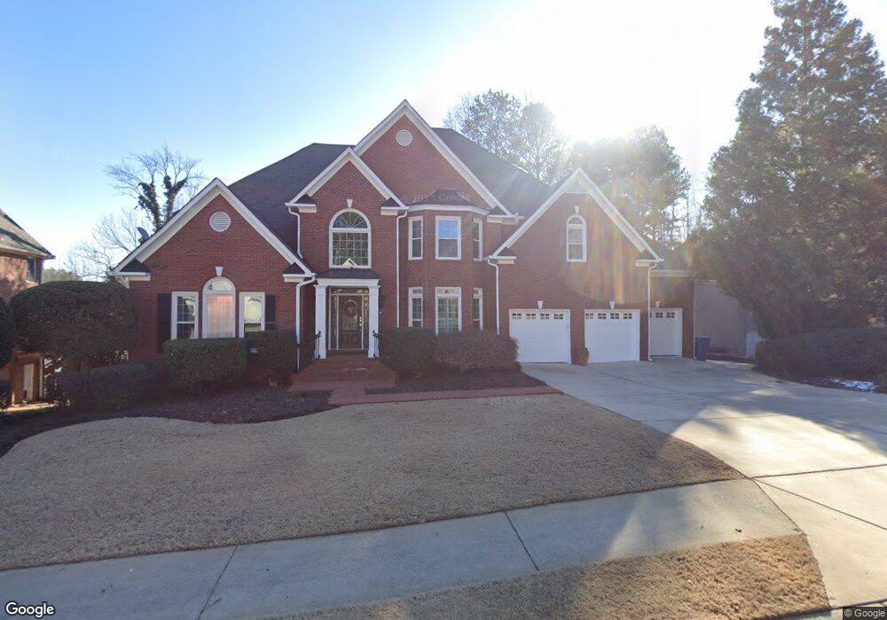
5719 Brookstone Dr NW Unit 11 Acworth, GA 30101
Estimated Value: $760,000 - $993,000
4
Beds
4
Baths
5,171
Sq Ft
$159/Sq Ft
Est. Value
About This Home
This home is located at 5719 Brookstone Dr NW Unit 11, Acworth, GA 30101 and is currently estimated at $822,619, approximately $159 per square foot. 5719 Brookstone Dr NW Unit 11 is a home located in Cobb County with nearby schools including Ford Elementary School, Durham Middle School, and Harrison High School.
Ownership History
Date
Name
Owned For
Owner Type
Purchase Details
Closed on
Nov 4, 2024
Sold by
Dods Arthur S and Dods Terris E
Bought by
Dods Family Trust and Dods
Current Estimated Value
Purchase Details
Closed on
Jul 26, 2000
Sold by
Douglass Stephen P and Douglass Deborah J
Bought by
Dods Arthur S
Home Financials for this Owner
Home Financials are based on the most recent Mortgage that was taken out on this home.
Original Mortgage
$499,900
Interest Rate
8.12%
Mortgage Type
New Conventional
Purchase Details
Closed on
Jul 31, 1995
Sold by
Sewell Assoc
Bought by
Douglass Stephen P Deborah
Create a Home Valuation Report for This Property
The Home Valuation Report is an in-depth analysis detailing your home's value as well as a comparison with similar homes in the area
Home Values in the Area
Average Home Value in this Area
Purchase History
| Date | Buyer | Sale Price | Title Company |
|---|---|---|---|
| Dods Family Trust | -- | None Listed On Document | |
| Dods Family Trust | -- | None Listed On Document | |
| Dods Arthur S | $499,900 | -- | |
| Douglass Stephen P Deborah | $405,000 | -- |
Source: Public Records
Mortgage History
| Date | Status | Borrower | Loan Amount |
|---|---|---|---|
| Previous Owner | Dods Arthur S | $499,900 | |
| Closed | Douglass Stephen P Deborah | $0 |
Source: Public Records
Tax History Compared to Growth
Tax History
| Year | Tax Paid | Tax Assessment Tax Assessment Total Assessment is a certain percentage of the fair market value that is determined by local assessors to be the total taxable value of land and additions on the property. | Land | Improvement |
|---|---|---|---|---|
| 2024 | $2,336 | $355,640 | $68,000 | $287,640 |
| 2023 | $1,945 | $293,876 | $42,000 | $251,876 |
| 2022 | $2,151 | $293,876 | $42,000 | $251,876 |
| 2021 | $1,991 | $240,264 | $42,000 | $198,264 |
| 2020 | $1,952 | $227,148 | $42,000 | $185,148 |
| 2019 | $1,952 | $227,148 | $42,000 | $185,148 |
| 2018 | $1,816 | $181,820 | $42,000 | $139,820 |
| 2017 | $1,579 | $181,820 | $42,000 | $139,820 |
| 2016 | $1,601 | $187,692 | $40,000 | $147,692 |
| 2015 | $1,694 | $183,688 | $35,200 | $148,488 |
| 2014 | $1,724 | $183,688 | $0 | $0 |
Source: Public Records
Map
Nearby Homes
- 1670 Knob Creek Ct NW
- 002 Knob Creek Ct NW
- 5654 Brookstone Dr NW
- The Ashburn Plan at Woodford
- The Rebecca Plan at Woodford
- The Dillard Plan at Woodford
- The Oxford Plan at Woodford
- The Pinehurst Plan at Woodford
- The Trenton Plan at Woodford
- The Vinings Plan at Woodford
- The Bainbridge Plan at Woodford
- The Brooks Plan at Woodford
- The Evans Plan at Woodford
- 1377 Downington Ln NW
- 1390 Downington View NW Unit VI
- 1509 Downington Run NW
- 5807 Brookstone Walk NW
- 1500 Downington Run NW
- 1313 Fallsbrook Terrace NW
- 1314 Fallsbrook Terrace NW
- 5717 Brookstone Dr NW
- 5721 Brookstone Dr NW
- 5721 Brookstone Dr NW Unit 40
- 5723 Brookstone Dr NW Unit 11
- 5715 Brookstone Dr NW
- 5722 Brookstone Dr NW Unit 11
- 5720 Brookstone Dr NW
- 5718 Brookstone Dr NW
- 5940 Downington Ridge NW
- 5725 Brookstone Dr NW
- 5944 Downington Ridge NW Unit 9/60
- 5944 Downington Ridge NW
- 5983 Downington Point NW
- 5727 Brookstone Dr NW
- 5948 Downington Ridge NW Unit 11
- 5941 Downington Ridge NW
- 5716 Brookstone Dr NW
- 5985 Downington Point NW Unit 11
- 5729 Brookstone Dr NW
- 5982 Downington Point NW