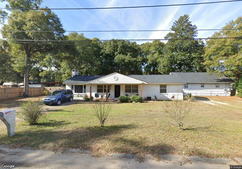
5719 Clark Cir W Satsuma, AL 36572
Estimated Value: $202,824 - $248,000
3
Beds
2
Baths
1,475
Sq Ft
$154/Sq Ft
Est. Value
About This Home
This home is located at 5719 Clark Cir W, Satsuma, AL 36572 and is currently estimated at $226,706, approximately $153 per square foot. 5719 Clark Cir W is a home located in Mobile County with nearby schools including Robert E. Lee Elementary School, Satsuma High School, and Satsuma Christian School.
Ownership History
Date
Name
Owned For
Owner Type
Purchase Details
Closed on
Sep 22, 2022
Sold by
Jerri Furlick
Bought by
West April and Coleman Cheryl Kay
Current Estimated Value
Purchase Details
Closed on
Aug 20, 2004
Sold by
Wells Fargo Bank Minnesota Na
Bought by
Coleman Cheryl K
Home Financials for this Owner
Home Financials are based on the most recent Mortgage that was taken out on this home.
Original Mortgage
$76,000
Interest Rate
5.91%
Mortgage Type
New Conventional
Create a Home Valuation Report for This Property
The Home Valuation Report is an in-depth analysis detailing your home's value as well as a comparison with similar homes in the area
Home Values in the Area
Average Home Value in this Area
Purchase History
| Date | Buyer | Sale Price | Title Company |
|---|---|---|---|
| West April | $198,000 | -- | |
| Coleman Cheryl K | $76,000 | -- |
Source: Public Records
Mortgage History
| Date | Status | Borrower | Loan Amount |
|---|---|---|---|
| Previous Owner | Coleman Cheryl K | $76,000 |
Source: Public Records
Tax History Compared to Growth
Tax History
| Year | Tax Paid | Tax Assessment Tax Assessment Total Assessment is a certain percentage of the fair market value that is determined by local assessors to be the total taxable value of land and additions on the property. | Land | Improvement |
|---|---|---|---|---|
| 2024 | -- | $14,960 | $1,800 | $13,160 |
| 2023 | $465 | $11,340 | $1,280 | $10,060 |
| 2022 | $465 | $9,260 | $1,280 | $7,980 |
| 2021 | $429 | $8,610 | $1,280 | $7,330 |
| 2020 | $432 | $8,670 | $640 | $8,030 |
| 2019 | $426 | $8,560 | $0 | $0 |
| 2018 | $461 | $8,660 | $0 | $0 |
| 2017 | $481 | $8,980 | $0 | $0 |
| 2016 | $494 | $9,200 | $0 | $0 |
| 2013 | $449 | $8,280 | $0 | $0 |
Source: Public Records
Map
Nearby Homes
- 459 Daphne V St
- 5901 Vaughn Dr W
- 211 Magnolia Ave
- 550 Vaughn Dr S
- 567 Vaughn Dr S
- 5619 1st St
- 6158 Granada Ave
- 207 Maple Ave E
- 571 Margiana Dr
- 0 Travelers Ct Unit 34 315632
- 150 Orange Ave E
- 5859 Northgate Dr W
- 0 Baldwin Rd Unit 2 374664
- 0 Baldwin Rd
- 5454 3rd St
- 5303 U S 43
- 0 Kalifield Blvd Unit 25 384900
- 0 Kalifield Blvd Unit 7646196
- 6453 Gilbert Dr W
- 39 Brice Ave
- 5721 Clark Cir W
- 5723 Clark Cir W
- 362 Clark Cir S
- 5716 Clark Cir W
- 355 Juniper Ave
- 5758 Ryals St
- 357 Juniper Ave
- 364 Clark Cir S
- 5762 Ryals St
- 5751 Clark Cir W
- 5750 Ryals St
- 400 Juniper Ave
- 5750 Clark Cir W
- 5764 Ryals St
- 351 Juniper Ave
- 406 Clark Cir S
- 5751 Clark Cir E
- 5757 Clark Cir W
- 5776 Ryals St
- 410 Clark Cir S