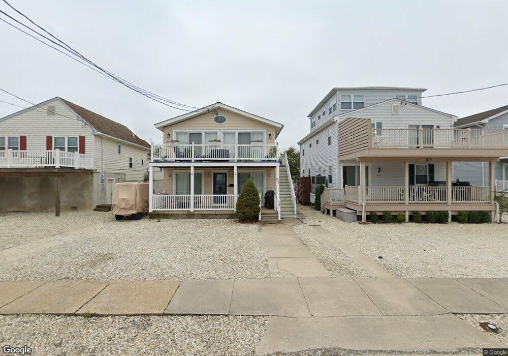
572 21st St Avalon, NJ 08202
Estimated Value: $1,459,768 - $1,626,000
Studio
--
Bath
1,056
Sq Ft
$1,459/Sq Ft
Est. Value
About This Home
This home is located at 572 21st St, Avalon, NJ 08202 and is currently estimated at $1,540,692, approximately $1,458 per square foot. 572 21st St is a home located in Cape May County with nearby schools including Avalon Elementary School.
Ownership History
Date
Name
Owned For
Owner Type
Purchase Details
Closed on
Apr 28, 2022
Sold by
Francis Barry Kevin and Flagg Kristen
Bought by
Bartosch Michael and Bartosch Linda Ann
Current Estimated Value
Home Financials for this Owner
Home Financials are based on the most recent Mortgage that was taken out on this home.
Original Mortgage
$1,026,785
Outstanding Balance
$949,852
Interest Rate
2.75%
Mortgage Type
New Conventional
Estimated Equity
$590,840
Purchase Details
Closed on
Aug 31, 2018
Sold by
Meitner Susan
Bought by
Flagg Barry Kevin F and Flagg Barry
Home Financials for this Owner
Home Financials are based on the most recent Mortgage that was taken out on this home.
Original Mortgage
$453,500
Interest Rate
4.1%
Mortgage Type
Adjustable Rate Mortgage/ARM
Purchase Details
Closed on
Apr 2, 2007
Sold by
Mele Robert and Mele Margaret
Bought by
Meiter Susan
Home Financials for this Owner
Home Financials are based on the most recent Mortgage that was taken out on this home.
Original Mortgage
$169,000
Interest Rate
5.93%
Mortgage Type
Stand Alone Second
Create a Home Valuation Report for This Property
The Home Valuation Report is an in-depth analysis detailing your home's value as well as a comparison with similar homes in the area
Home Values in the Area
Average Home Value in this Area
Purchase History
| Date | Buyer | Sale Price | Title Company |
|---|---|---|---|
| Bartosch Michael | $1,150,000 | Title Partners | |
| Bartosch Michael | $1,150,000 | Title Partners | |
| Flagg Barry Kevin F | $615,000 | -- | |
| Meiter Susan | $617,500 | None Available |
Source: Public Records
Mortgage History
| Date | Status | Borrower | Loan Amount |
|---|---|---|---|
| Open | Bartosch Michael | $1,026,785 | |
| Closed | Bartosch Michael | $1,026,785 | |
| Previous Owner | Flagg Barry Kevin F | $453,500 | |
| Previous Owner | Meiter Susan | $169,000 | |
| Previous Owner | Meiter Susan | $417,000 |
Source: Public Records
Tax History
| Year | Tax Paid | Tax Assessment Tax Assessment Total Assessment is a certain percentage of the fair market value that is determined by local assessors to be the total taxable value of land and additions on the property. | Land | Improvement |
|---|---|---|---|---|
| 2025 | $3,287 | $535,300 | $450,000 | $85,300 |
| 2024 | $3,287 | $535,300 | $450,000 | $85,300 |
Source: Public Records
Map
Nearby Homes
- 647 Barry Rd
- 447 24th St
- 890 21st St
- 415 20th St
- 389 22nd St
- 386 24th St
- 386 24th St Unit Upper
- 2425 Harbor Ave Unit 2425
- 1668 Ocean Dr Unit B1
- 211 23rd St
- 16 4th Ave
- 212 25th St Unit End Unit
- 2023 Dune Dr Unit R6
- 178 19th St
- 2928 Ocean Dr Unit C-N
- 174 23rd St
- 2934 Ocean Dr Unit North
- 285 14th St Unit 285
- 285 14th St
- 118 22nd St
- 576 21st St Unit C2
- 576 21st St Unit C1
- 576 21st St Unit C-1, Front
- 572 21st St Unit 2nd Floor
- 570 21st St
- 570 21st St Unit 1st Floor
- 580 21st St
- 560 21st St
- 575 22nd St
- 558 21st St
- 592 21st St
- 559 22nd St
- 567 22nd St
- 556 21st St
- 565 22nd St Unit 565
- 2101 6th Ave Unit 2101
- 579 22nd St Unit A
- 579 22nd St Unit B
- 579 22nd St
- 561 21st St
Your Personal Tour Guide
Ask me questions while you tour the home.