Estimated Value: $296,000 - $333,964
--
Bed
1
Bath
1,782
Sq Ft
$177/Sq Ft
Est. Value
About This Home
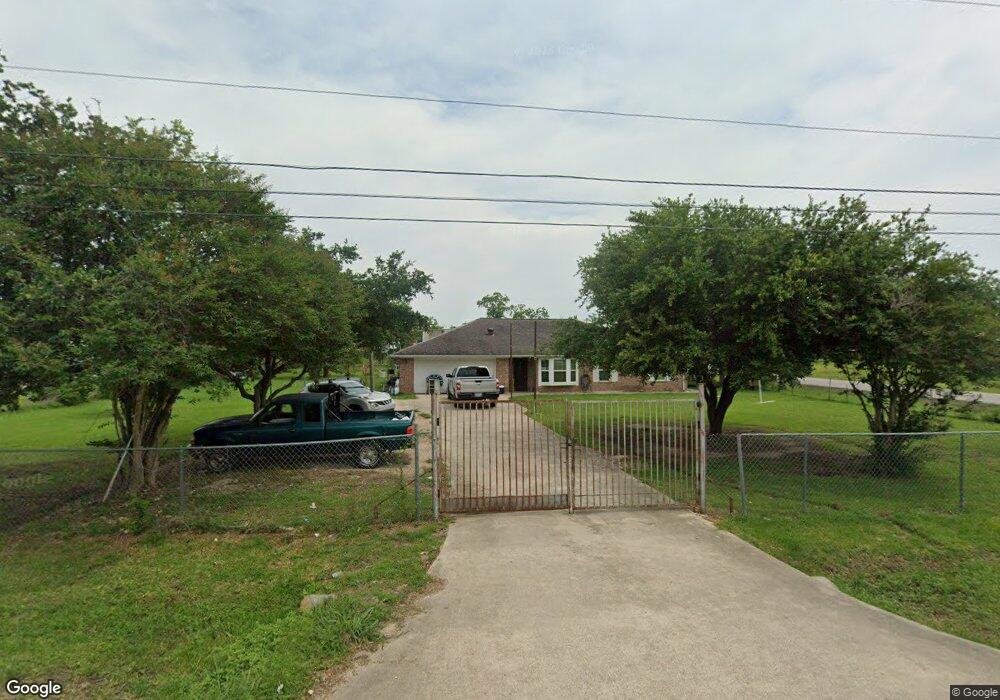
This home is located at 572 County Road 296, Alvin, TX 77511 and is currently estimated at $315,991, approximately $177 per square foot. 572 County Road 296 is a home located in Brazoria County with nearby schools including Mark Twain Elementary School, G.W. Harby Junior High School, and Alvin High School.
Ownership History
Date
Name
Owned For
Owner Type
Purchase Details
Closed on
May 27, 2015
Sold by
Torres Hector Cantu and Torres Christina B
Bought by
Vargas Roberto G and Vargas Lucila S
Current Estimated Value
Home Financials for this Owner
Home Financials are based on the most recent Mortgage that was taken out on this home.
Original Mortgage
$110,000
Outstanding Balance
$63,642
Interest Rate
3.68%
Mortgage Type
Purchase Money Mortgage
Estimated Equity
$252,349
Create a Home Valuation Report for This Property
The Home Valuation Report is an in-depth analysis detailing your home's value as well as a comparison with similar homes in the area
Home Values in the Area
Average Home Value in this Area
Purchase History
| Date | Buyer | Sale Price | Title Company |
|---|---|---|---|
| Vargas Roberto G | -- | None Available |
Source: Public Records
Mortgage History
| Date | Status | Borrower | Loan Amount |
|---|---|---|---|
| Open | Vargas Roberto G | $110,000 |
Source: Public Records
Tax History Compared to Growth
Tax History
| Year | Tax Paid | Tax Assessment Tax Assessment Total Assessment is a certain percentage of the fair market value that is determined by local assessors to be the total taxable value of land and additions on the property. | Land | Improvement |
|---|---|---|---|---|
| 2025 | $1,697 | $269,530 | $89,150 | $218,500 |
| 2023 | $1,697 | $226,178 | $89,150 | $216,380 |
| 2022 | $4,367 | $204,951 | $78,020 | $139,560 |
| 2021 | $4,115 | $185,420 | $66,870 | $118,550 |
| 2020 | $4,170 | $185,420 | $66,870 | $118,550 |
| 2019 | $3,402 | $146,970 | $20,320 | $126,650 |
| 2018 | $3,411 | $146,970 | $20,320 | $126,650 |
| 2017 | $3,055 | $130,030 | $19,480 | $110,550 |
| 2016 | $2,949 | $127,320 | $20,320 | $107,000 |
| 2014 | -- | $118,700 | $16,940 | $101,760 |
Source: Public Records
Map
Nearby Homes
- 432 Kendall Crest Dr
- 424 Kendall Crest Dr
- 415 Kendall Crest Dr
- 406 Kendall Crest Dr
- 396 Kendall Crest Dr
- 394 Kendall Crest Dr
- 431 Kendall Crest Dr
- 418 Kendall Crest Dr
- 414 Kendall Crest Dr
- 404 Kendall Crest Dr
- 390 Kendall Crest Dr
- 397 Kendall Crest Dr
- 380 Kendall Crest Dr
- 368 Selah Ct
- 103 Cline Dr
- 356 Selah Ct
- 350 Selah Ct
- 5330 Latigo Ct
- 340 Kendall Crest Dr
- 726 Rim Water Dr
- 572 Cline Dr
- 325 Oliver
- 638 County Road 296
- 296 Cline Dr
- 543 County Road 296
- 196 S County Rd
- 196 County Road 296a
- 502 Cline Dr
- 502 County Road 296
- 647 County Road 296d
- 513 County Road 296d
- 515 County Road 296
- 656 County Road 296 Unit 296
- 407 Mattes Ln
- 328 County Road 296
- 656 Cline Dr
- 503 County Road 296
- 503 County Rd
- 659 County Road 296d
- 655 County Road 296