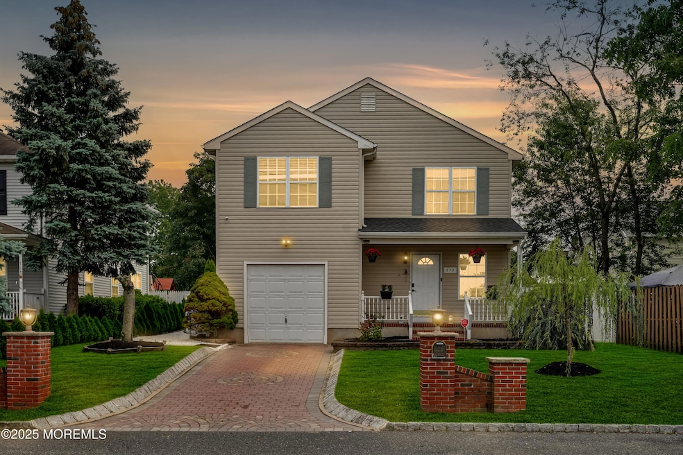
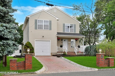
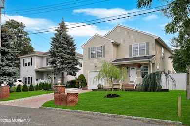
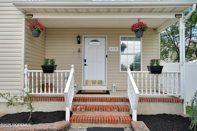
572 Jay St Long Branch, NJ 07740
Estimated payment $5,058/month
Highlights
- Home Theater
- Colonial Architecture
- Granite Countertops
- Outdoor Pool
- Deck
- No HOA
About This Home
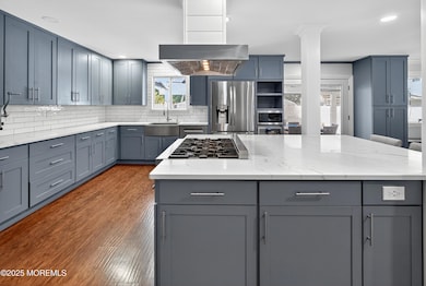
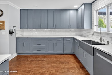
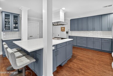
This coastal retreat is tucked away on a quiet dead-end street and just two miles from the sun and surf of Seven Presidents Oceanfront Park in Long Branch and three miles from the new Netflix studios. Sleek and sophisticated, this gourmet kitchen features shaker style cabinetry, white quartz countertops, a large center island with seating, and stainless steel appliances—all accented by a subway tile backsplash. Rounding out this main level is a formal dining room surrounded by windows, a spacious living room, a full bathroom and a bonus room that would lend well to a variety of uses. Upstairs, you will notice the spacious primary en suite, featuring a custom walk-in closet and a private full bath. Two additional oversized bedrooms, a full guest bathroom, and a convenient laundry room completes this second floor. Your backyard oasis awaits, featuring a 17' x 30' covered Trex deck outfitted with ceiling fans and built-in surround sound, perfect for relaxing or entertaining in any season. The oversized layout easily accommodates both a dining area and a lounge sectional, creating the ultimate outdoor living room. A thoughtfully designed walkway leads to the saltwater semi-above ground pool, installed in 2023, framed by low-maintenance landscaping and surrounded by crisp white vinyl privacy fencing for total seclusion. Whether you're hosting summer BBQs or enjoying a quiet morning coffee, this backyard is your private coastal escape. Additional highlights include a new Timberline roof (2023) and a new hot water heater (2025), offering style, comfort, and peace of mind.
Home Details
Home Type
- Single Family
Est. Annual Taxes
- $7,199
Year Built
- Built in 1997
Lot Details
- 6,970 Sq Ft Lot
- Lot Dimensions are 46 x 150
- Level Lot
Parking
- 1 Car Direct Access Garage
- Driveway
Home Design
- Colonial Architecture
- Asphalt Rolled Roof
- Vinyl Siding
Interior Spaces
- 2,360 Sq Ft Home
- 2-Story Property
- Recessed Lighting
- French Doors
- Living Room
- Dining Room
- Home Theater
- Linoleum Flooring
- Pull Down Stairs to Attic
- Storm Doors
Kitchen
- Eat-In Kitchen
- Stove
- Dishwasher
- Kitchen Island
- Granite Countertops
Bedrooms and Bathrooms
- 3 Bedrooms
- Primary bedroom located on second floor
- Walk-In Closet
- 3 Full Bathrooms
- Dual Vanity Sinks in Primary Bathroom
- Primary Bathroom includes a Walk-In Shower
Laundry
- Laundry Room
- Dryer
- Washer
Pool
- Outdoor Pool
- Saltwater Pool
Outdoor Features
- Deck
- Covered Patio or Porch
- Shed
- Storage Shed
Schools
- L. W. Conrow Elementary School
- Long Branch Middle School
- Long Branch High School
Utilities
- Forced Air Heating and Cooling System
- Heating System Uses Natural Gas
- Natural Gas Water Heater
Community Details
- No Home Owners Association
Listing and Financial Details
- Exclusions: Personal Belongings
- Assessor Parcel Number 27-00353-0000-00006-01
Map
Home Values in the Area
Average Home Value in this Area
Tax History
| Year | Tax Paid | Tax Assessment Tax Assessment Total Assessment is a certain percentage of the fair market value that is determined by local assessors to be the total taxable value of land and additions on the property. | Land | Improvement |
|---|---|---|---|---|
| 2025 | $7,199 | $518,800 | $166,100 | $352,700 |
| 2024 | $7,367 | $468,400 | $131,100 | $337,300 |
| 2023 | $7,367 | $474,400 | $126,100 | $348,300 |
| 2022 | $7,542 | $403,400 | $103,400 | $300,000 |
| 2021 | $7,542 | $376,900 | $96,400 | $280,500 |
| 2020 | $7,572 | $362,300 | $83,400 | $278,900 |
| 2019 | $7,300 | $347,300 | $81,400 | $265,900 |
| 2018 | $7,031 | $332,600 | $76,400 | $256,200 |
| 2017 | $6,412 | $311,100 | $73,400 | $237,700 |
| 2016 | $6,223 | $307,900 | $73,400 | $234,500 |
| 2015 | $5,922 | $265,900 | $79,100 | $186,800 |
| 2014 | $5,551 | $262,700 | $84,900 | $177,800 |
Property History
| Date | Event | Price | List to Sale | Price per Sq Ft |
|---|---|---|---|---|
| 09/04/2025 09/04/25 | Price Changed | $850,000 | -2.9% | $360 / Sq Ft |
| 08/07/2025 08/07/25 | For Sale | $875,000 | -- | $371 / Sq Ft |
Purchase History
| Date | Type | Sale Price | Title Company |
|---|---|---|---|
| Deed | $260,000 | -- | |
| Deed | $134,000 | -- |
Mortgage History
| Date | Status | Loan Amount | Loan Type |
|---|---|---|---|
| Previous Owner | $242,000 | No Value Available | |
| Previous Owner | $132,000 | FHA |
Source: MOREMLS (Monmouth Ocean Regional REALTORS®)
MLS Number: 22523726
APN: 27-00353-0000-00006-01
Disclaimer: Certain information contained herein is derived from information provided by parties other than Homes.com. All information provided is deemed reliable, but is not guaranteed to be accurate and should be independently verified.
![]() IDX information is provided exclusively for personal, non-commercial use, and may not be used for any purpose other than to identify prospective properties consumers may be interested in purchasing.
IDX information is provided exclusively for personal, non-commercial use, and may not be used for any purpose other than to identify prospective properties consumers may be interested in purchasing.
Information is deemed reliable but not guaranteed.
- 565 Joline Ave
- 238 Branchport Ave
- 631 Irving Place
- 119 Washington St
- 222 Coleman Ave
- 401 Joline Ave
- 190 Spruce St Unit 4
- 11 Clay St
- 13 Morris Place
- 395 Broadway
- 430 Broadway
- 28 Norwood Ave
- 139 Sixth Ave
- 14 Slocum Place
- 151 N 5th Ave
- 399 Willow Ave
- 40 N 5th Ave
- 211 Rockwell Ave
- 88 Norwood Ave
- 11 Golf St
- 649 Mcclellan St
- 604 Irving Place
- 186 Coleman Ave Unit D
- 190 Spruce St Unit 8
- 56 Myrtle Ave
- 346 Chelsea Ave
- 380 Division St Unit 2A
- 15 Golf St
- 74 Seneca Place
- 245 Atlantic Ave
- 393 Bath Ave
- 298 Liberty St
- 20 3rd Ave Unit 309
- 20 3rd Ave Unit 208
- 20 3rd Ave Unit 305
- 20 3rd Ave Unit 209
- 79 4th Ave Unit 1
- 193 Union Ave Unit 2
- 27 3rd Ave Unit 304
- 286 Cleveland Ave Unit 1
