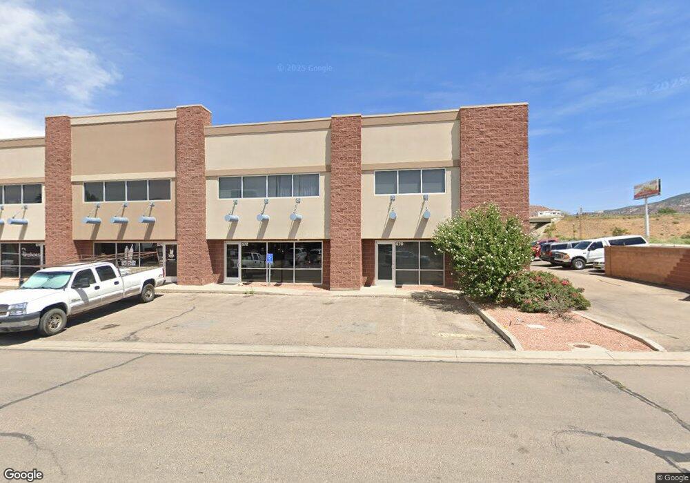
572 N 1450 W Cedar City, UT 84721
--
Bed
--
Bath
1,800
Sq Ft
1,742
Sq Ft Lot
About This Home
This home is located at 572 N 1450 W, Cedar City, UT 84721. 572 N 1450 W is a home located in Iron County with nearby schools including Cedar North School, Cedar Middle School, and Cedar City High School.
Ownership History
Date
Name
Owned For
Owner Type
Purchase Details
Closed on
Aug 27, 2020
Sold by
Quinones Eduardo and Quinones Cynthia
Bought by
Shine On Llc
Home Financials for this Owner
Home Financials are based on the most recent Mortgage that was taken out on this home.
Original Mortgage
$170,866
Outstanding Balance
$151,632
Interest Rate
2.9%
Mortgage Type
Future Advance Clause Open End Mortgage
Purchase Details
Closed on
Jun 1, 2017
Sold by
Cedar Development Llc
Bought by
Quinones Eduardo
Purchase Details
Closed on
May 30, 2017
Sold by
Quinones Eduardo
Bought by
Quinones Eduardo and Quinones Cynthia
Create a Home Valuation Report for This Property
The Home Valuation Report is an in-depth analysis detailing your home's value as well as a comparison with similar homes in the area
Home Values in the Area
Average Home Value in this Area
Purchase History
| Date | Buyer | Sale Price | Title Company |
|---|---|---|---|
| Shine On Llc | -- | Inwest Title Services Layton | |
| Quinones Eduardo | -- | Cedar Land Title Inc | |
| Quinones Eduardo | -- | Cedar Land Title Inc |
Source: Public Records
Mortgage History
| Date | Status | Borrower | Loan Amount |
|---|---|---|---|
| Open | Shine On Llc | $170,866 |
Source: Public Records
Tax History Compared to Growth
Tax History
| Year | Tax Paid | Tax Assessment Tax Assessment Total Assessment is a certain percentage of the fair market value that is determined by local assessors to be the total taxable value of land and additions on the property. | Land | Improvement |
|---|---|---|---|---|
| 2025 | $1,749 | $224,912 | $16,008 | $208,904 |
| 2023 | $1,565 | $12,805 | $12,805 | $0 |
| 2022 | $1,596 | $173,575 | $12,805 | $160,770 |
| 2021 | $1,239 | $134,725 | $12,805 | $121,920 |
| 2020 | $1,224 | $118,825 | $12,805 | $106,020 |
| 2019 | $1,254 | $115,735 | $12,805 | $102,930 |
| 2018 | $1,297 | $115,735 | $12,805 | $102,930 |
| 2017 | $1,414 | $115,735 | $12,805 | $102,930 |
Source: Public Records
Map
Nearby Homes
- 1120 Bulloch Cir
- 374 N 1500 W
- 364 N 1500 W
- 6333 N 1600 W
- 325 N 1500 W
- 0 1 Af Water (Wr # 73-999) Unit 25-265506
- 272 N 1500 W
- 4961 N 900 W Unit lot 68
- 240 N 1400 W
- 465 N 800 W Unit 3
- 465 N 800 W Unit 7
- 465 N 800 W Unit 2
- 147.9141 Acre Ft Water Right 73-1201
- 4.12 Acre Water Rights
- 960 N 1400 W
- 495 N 2150 W
- 2904 W Oak Springs Rd
- 1.75 Acres 200 North Corner Lot Unit Zoned Commercial
- 0.69 Acre Lot W Skyview Dr
- 1770 W Harding Ave
- 572 N 1450 W
- 572 Fort Cedar Blvd
- 570-578 N 1450 W
- 574 N 1450 W
- 574 N 1450 W
- 576 N 1450 W
- 572 1450 W
- Un.18 Ph.2 1400 W Industrial Rd
- Un.9 Ph.2 1400 W Industrial Rd
- Un.17 Ph.2 1400 W Industrial Rd
- Un.10 Ph.2 1400 W Industrial Rd
- 631 N 1450 W
- Un.12 Ph.2 1400 W Industrial Rd
- 573 N 1450 W
- Un.20 Ph.2 1400 W Industrial Rd
- 593 N 1450 W
- 593 N 1450 W Unit B
- 800 W Industrial Rd
- Un.16 Ph.2 1400 W Industrial Rd
- Un.5 Ph.2 1400 W Industrial Rd