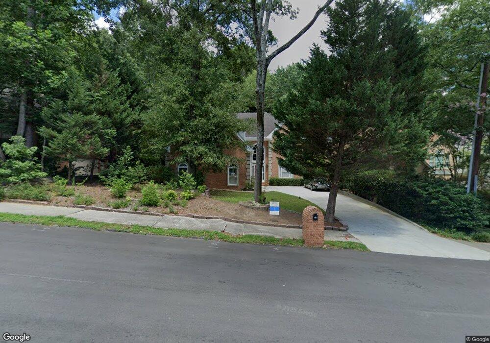
572 Pelham Rd NE Atlanta, GA 30324
Morningside NeighborhoodEstimated Value: $1,374,432 - $1,653,000
4
Beds
4
Baths
3,750
Sq Ft
$417/Sq Ft
Est. Value
About This Home
This home is located at 572 Pelham Rd NE, Atlanta, GA 30324 and is currently estimated at $1,563,108, approximately $416 per square foot. 572 Pelham Rd NE is a home located in Fulton County with nearby schools including Morningside Elementary School, Midtown High School, and Kindezi Old 4th Ward.
Ownership History
Date
Name
Owned For
Owner Type
Purchase Details
Closed on
Apr 22, 1999
Sold by
Woods Larry K
Bought by
Hamki Mohamad A
Current Estimated Value
Home Financials for this Owner
Home Financials are based on the most recent Mortgage that was taken out on this home.
Original Mortgage
$392,000
Outstanding Balance
$98,931
Interest Rate
7%
Mortgage Type
New Conventional
Estimated Equity
$1,464,177
Purchase Details
Closed on
Apr 24, 1998
Sold by
Woods Larry K and Woods Larry K
Bought by
Woods Larry K
Create a Home Valuation Report for This Property
The Home Valuation Report is an in-depth analysis detailing your home's value as well as a comparison with similar homes in the area
Home Values in the Area
Average Home Value in this Area
Purchase History
| Date | Buyer | Sale Price | Title Company |
|---|---|---|---|
| Hamki Mohamad A | $490,000 | -- | |
| Woods Larry K | -- | -- | |
| Woods Larry K | $1,000 | -- |
Source: Public Records
Mortgage History
| Date | Status | Borrower | Loan Amount |
|---|---|---|---|
| Open | Woods Larry K | $392,000 |
Source: Public Records
Tax History Compared to Growth
Tax History
| Year | Tax Paid | Tax Assessment Tax Assessment Total Assessment is a certain percentage of the fair market value that is determined by local assessors to be the total taxable value of land and additions on the property. | Land | Improvement |
|---|---|---|---|---|
| 2025 | $11,678 | $546,480 | $165,280 | $381,200 |
| 2023 | $18,498 | $446,800 | $122,000 | $324,800 |
| 2022 | $14,400 | $446,800 | $122,000 | $324,800 |
| 2021 | $12,431 | $446,800 | $122,000 | $324,800 |
| 2020 | $12,475 | $364,480 | $92,240 | $272,240 |
| 2019 | $490 | $364,480 | $92,240 | $272,240 |
| 2018 | $9,792 | $364,480 | $92,240 | $272,240 |
| 2017 | $10,202 | $265,000 | $69,080 | $195,920 |
| 2016 | $10,228 | $265,000 | $69,080 | $195,920 |
| 2015 | $10,258 | $265,000 | $69,080 | $195,920 |
| 2014 | $9,635 | $284,000 | $69,080 | $214,920 |
Source: Public Records
Map
Nearby Homes
- 1705 Monroe Dr NE Unit C05
- 1705 Monroe Dr NE Unit B4
- 1803 White Oak Hollow NE
- 534 Allen Rd NE
- 1761 Monroe Dr NE
- 1779 Beckham Place NE
- 621 E Morningside Dr NE
- 1835 Rock Springs Ln NE
- 1822 N Rock Springs Rd NE Unit 24
- 1821 N Rock Springs Rd NE
- 601 Sherwood Rd NE
- 1751 N Pelham Rd NE
- 1845 Windemere Dr NE
- 388 Beverly Rd NE
- 602 Yorkshire Rd NE
- 576 Pelham Rd NE
- 568 Pelham Rd NE
- 566 Pelham Rd NE
- 575 Pelham Rd NE
- 577 Pelham Rd NE
- 573 Pelham Rd NE
- 584 Pelham Rd NE
- 545 Montgomery Ferry Dr NE
- 571 Pelham Rd NE
- 581 Pelham Rd NE
- 1825 Gotham Ln NE
- 1839 Gotham Ln NE
- 1823 Gotham Ln NE
- 1801 Gotham Ln NE
- 1839 Gotham Ln NE
- 1839 Gotham Ln NE
- 1815 Gotham Ln NE
- 1831 Gotham Ln NE
- 1823 Gotham Ln NE