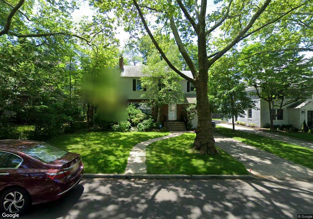
572 Rutland Ave Teaneck, NJ 07666
Estimated Value: $934,515 - $1,088,000
--
Bed
--
Bath
2,629
Sq Ft
$381/Sq Ft
Est. Value
About This Home
This home is located at 572 Rutland Ave, Teaneck, NJ 07666 and is currently estimated at $1,002,879, approximately $381 per square foot. 572 Rutland Ave is a home located in Bergen County with nearby schools including Teaneck Senior High School, Grace Lutheran School, and Yeshivat He'atid.
Ownership History
Date
Name
Owned For
Owner Type
Purchase Details
Closed on
Aug 22, 2008
Current Estimated Value
Home Financials for this Owner
Home Financials are based on the most recent Mortgage that was taken out on this home.
Original Mortgage
$140,000
Interest Rate
6.69%
Mortgage Type
New Conventional
Purchase Details
Closed on
Jul 29, 2002
Sold by
Redelheim Phillip
Bought by
Wolf Daniel and Wolf Rebecca
Home Financials for this Owner
Home Financials are based on the most recent Mortgage that was taken out on this home.
Original Mortgage
$492,000
Interest Rate
6.73%
Purchase Details
Closed on
May 14, 1999
Sold by
Wolfberg Matthew and Lawson Barbara
Bought by
Redelheim Phillip and Redelheim Roselee
Home Financials for this Owner
Home Financials are based on the most recent Mortgage that was taken out on this home.
Original Mortgage
$224,000
Interest Rate
7.39%
Mortgage Type
Stand Alone First
Create a Home Valuation Report for This Property
The Home Valuation Report is an in-depth analysis detailing your home's value as well as a comparison with similar homes in the area
Home Values in the Area
Average Home Value in this Area
Purchase History
| Date | Buyer | Sale Price | Title Company |
|---|---|---|---|
| -- | -- | -- | |
| Nachbar Isaac | -- | -- | |
| Wolf Daniel | $615,000 | -- | |
| Redelheim Phillip | $280,000 | -- |
Source: Public Records
Mortgage History
| Date | Status | Borrower | Loan Amount |
|---|---|---|---|
| Previous Owner | Nachbar Isaac | $140,000 | |
| Previous Owner | Wolf Daniel | $492,000 | |
| Previous Owner | Redelheim Phillip | $28,000 | |
| Previous Owner | Redelheim Phillip | $224,000 |
Source: Public Records
Tax History Compared to Growth
Tax History
| Year | Tax Paid | Tax Assessment Tax Assessment Total Assessment is a certain percentage of the fair market value that is determined by local assessors to be the total taxable value of land and additions on the property. | Land | Improvement |
|---|---|---|---|---|
| 2025 | $18,756 | $858,800 | $492,000 | $366,800 |
| 2024 | $19,518 | $858,800 | $492,000 | $366,800 |
| 2023 | $19,134 | $591,100 | $316,000 | $275,100 |
| 2022 | $19,134 | $591,100 | $316,000 | $275,100 |
| 2021 | $19,246 | $591,100 | $316,000 | $275,100 |
| 2020 | $19,116 | $591,100 | $316,000 | $275,100 |
| 2019 | $18,897 | $591,100 | $316,000 | $275,100 |
| 2018 | $18,756 | $591,100 | $316,000 | $275,100 |
| 2017 | $18,578 | $591,100 | $316,000 | $275,100 |
| 2016 | $18,300 | $591,100 | $316,000 | $275,100 |
| 2015 | $18,011 | $591,100 | $316,000 | $275,100 |
| 2014 | $15,683 | $610,000 | $376,000 | $234,000 |
Source: Public Records
Map
Nearby Homes
- 526 Rutland Ave
- 591 Warwick Ave
- 532 Winthrop Rd
- 364 Rutland Ave
- 711 Camperdown Rd
- 565 N Forest Dr
- 21 Briarcliffe Rd
- 506 Sunderland Rd
- 1329 Dickerson Rd
- 1328 Taft Rd
- 665 Northumberland Rd
- 48 Sussex Rd
- 1106 Bromley Ave
- 325 New Bridge Rd
- 98 John Place
- 654 Suffern Rd
- 1105 Belle Ave
- 1093 Sheridan St
- 55 Maiden Ln
- 179 Huguenot Dr
- 580 Rutland Ave
- 564 Rutland Ave
- 584 Rutland Ave
- 581 Ogden Ave
- 565 Rutland Ave
- 567 Ogden Ave
- 577 Rutland Ave
- 590 Rutland Ave
- 583 Rutland Ave
- 1435 Hudson Rd
- 1429 Hudson Rd
- 589 Ogden Ave
- 1425 Hudson Rd
- 1454 Hudson Rd
- 591 Rutland Ave
- 596 Rutland Ave
- 1445 Hudson Rd
- 1421 Hudson Rd
- 595 Ogden Ave
- 1414 Hudson Rd