Estimated Value: $555,691 - $603,000
3
Beds
2
Baths
1,876
Sq Ft
$309/Sq Ft
Est. Value
About This Home
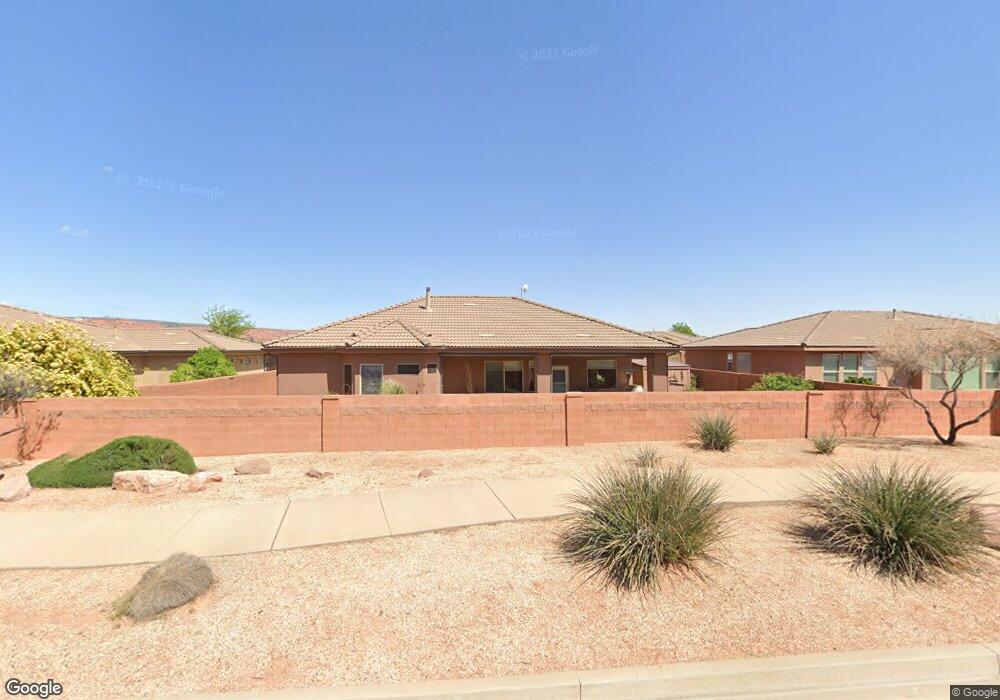
This home is located at 572 S 170 W, Ivins, UT 84738 and is currently estimated at $578,923, approximately $308 per square foot. 572 S 170 W is a home located in Washington County with nearby schools including Snow Canyon Middle School, Lava Ridge Intermediate School, and Snow Canyon High School.
Ownership History
Date
Name
Owned For
Owner Type
Purchase Details
Closed on
Apr 16, 2025
Sold by
Pridie Lawrence J and Pridie Barbara J
Bought by
Lawrence J Pridie Jr And Barbara J Pridie Tru and Pridie
Current Estimated Value
Purchase Details
Closed on
Nov 2, 2020
Sold by
Furest Shelby J and Furest Nathan D
Bought by
Pridie Lawrence J and Pridie Barbara J
Purchase Details
Closed on
Feb 28, 2014
Sold by
Pridie Lawrence J and Pridie Barbara J
Bought by
Fuerst Shelby J
Purchase Details
Closed on
Oct 12, 2005
Sold by
Saddleback Land Development Inc
Bought by
Pridie Lawrence J and Pridie Barbara J
Home Financials for this Owner
Home Financials are based on the most recent Mortgage that was taken out on this home.
Original Mortgage
$150,000
Interest Rate
5.24%
Mortgage Type
New Conventional
Create a Home Valuation Report for This Property
The Home Valuation Report is an in-depth analysis detailing your home's value as well as a comparison with similar homes in the area
Home Values in the Area
Average Home Value in this Area
Purchase History
| Date | Buyer | Sale Price | Title Company |
|---|---|---|---|
| Lawrence J Pridie Jr And Barbara J Pridie Tru | -- | None Listed On Document | |
| Pridie Lawrence J | -- | None Available | |
| Fuerst Shelby J | -- | None Available | |
| Pridie Lawrence J | -- | Southern Utah Title Co |
Source: Public Records
Mortgage History
| Date | Status | Borrower | Loan Amount |
|---|---|---|---|
| Previous Owner | Pridie Lawrence J | $150,000 |
Source: Public Records
Tax History Compared to Growth
Tax History
| Year | Tax Paid | Tax Assessment Tax Assessment Total Assessment is a certain percentage of the fair market value that is determined by local assessors to be the total taxable value of land and additions on the property. | Land | Improvement |
|---|---|---|---|---|
| 2025 | $1,969 | $304,315 | $101,750 | $202,565 |
| 2023 | $2,014 | $295,185 | $82,500 | $212,685 |
| 2022 | $1,960 | $270,380 | $63,250 | $207,130 |
| 2021 | $1,896 | $388,500 | $105,000 | $283,500 |
| 2020 | $1,766 | $342,500 | $105,000 | $237,500 |
| 2019 | $1,695 | $321,400 | $75,000 | $246,400 |
| 2018 | $1,718 | $167,695 | $0 | $0 |
| 2017 | $1,674 | $158,950 | $0 | $0 |
| 2016 | $1,667 | $146,245 | $0 | $0 |
| 2015 | $1,715 | $144,815 | $0 | $0 |
| 2014 | $85 | $141,845 | $0 | $0 |
Source: Public Records
Map
Nearby Homes
- 253 United Way
- 713 S 230 W
- 712 S 230 W Unit 15
- 690 S 230 W Unit (lot 18)
- 635 S 230 W
- 686 S 230 W Unit (lot 19)
- Dearborn Plan at Vista Estates
- 673 S 230 W
- 693 S 230 W
- Daniel II Plan at Vista Estates
- 673 S 230 W Unit (lot 9)
- 705 S 230 W
- Helena Plan at Vista Estates
- 693 S 230 W Unit Lot 12
- 704 W 230 W Unit (lot 17)
- 623 S 230 W
- 689 S 230 W
- 697 S 230 W Unit Lot 13
- 697 S 230 W
- Melody Plan at Vista Estates
- 572 S 170 W Unit 45
- 584 S 170 W
- 584 S 170 W Unit 38
- 558 S 170 W
- 558 S 170 W Unit 46
- 567 S 170 W
- 567 S 170 W Unit 44
- 581 S 170 W
- 581 S 170 W Unit 39
- 553 S 170 W
- 553 S 170 W Unit 47
- 586 S 170 W
- 586 S 170 W Unit 37
- 588 S 170 W Unit 37
- 548 S 170 W
- 548 S 170 W Unit 53
- 541 S 170 W
- 541 S 170 W Unit 52
- 593 S 170 W
- 593 S 170 W Unit 36