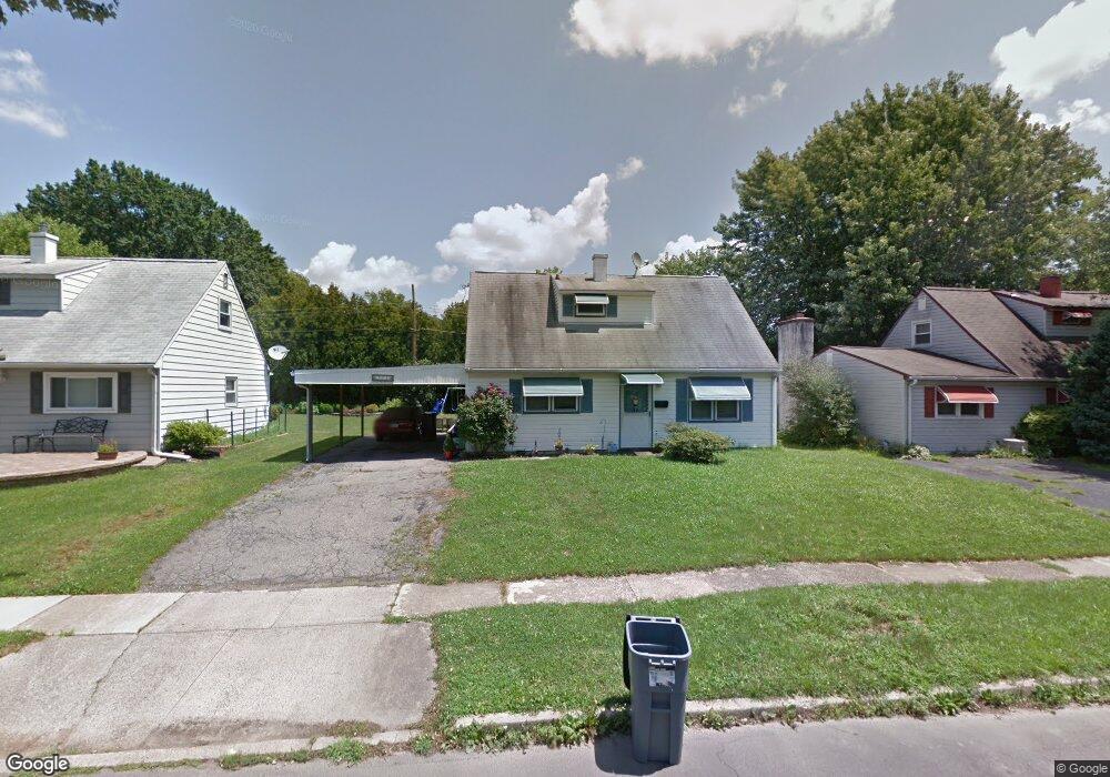
572 Sherman Ln Morrisville, PA 19067
Estimated Value: $353,591 - $390,000
3
Beds
2
Baths
1,248
Sq Ft
$294/Sq Ft
Est. Value
About This Home
This home is located at 572 Sherman Ln, Morrisville, PA 19067 and is currently estimated at $366,398, approximately $293 per square foot. 572 Sherman Ln is a home located in Bucks County with nearby schools including Grandview Elementary School, Morrisville High School, and Foundation Academy Charter School.
Ownership History
Date
Name
Owned For
Owner Type
Purchase Details
Closed on
Mar 17, 2006
Sold by
Daniel Linda T and Martin Dawn C
Bought by
Moundir Mustapha and Moundir Laura
Current Estimated Value
Home Financials for this Owner
Home Financials are based on the most recent Mortgage that was taken out on this home.
Original Mortgage
$70,000
Interest Rate
6.53%
Mortgage Type
Purchase Money Mortgage
Purchase Details
Closed on
Nov 22, 1960
Bought by
Thomson Elwood R and Thomson Mary E
Create a Home Valuation Report for This Property
The Home Valuation Report is an in-depth analysis detailing your home's value as well as a comparison with similar homes in the area
Home Values in the Area
Average Home Value in this Area
Purchase History
| Date | Buyer | Sale Price | Title Company |
|---|---|---|---|
| Moundir Mustapha | $209,900 | None Available | |
| Thomson Elwood R | -- | -- |
Source: Public Records
Mortgage History
| Date | Status | Borrower | Loan Amount |
|---|---|---|---|
| Open | Moundir Mustapha | $97,920 | |
| Previous Owner | Moundir Mustapha | $70,000 |
Source: Public Records
Tax History Compared to Growth
Tax History
| Year | Tax Paid | Tax Assessment Tax Assessment Total Assessment is a certain percentage of the fair market value that is determined by local assessors to be the total taxable value of land and additions on the property. | Land | Improvement |
|---|---|---|---|---|
| 2025 | $5,023 | $15,600 | $3,960 | $11,640 |
| 2024 | $5,023 | $15,600 | $3,960 | $11,640 |
| 2023 | $4,976 | $15,600 | $3,960 | $11,640 |
| 2022 | $4,868 | $15,600 | $3,960 | $11,640 |
| 2021 | $4,653 | $15,600 | $3,960 | $11,640 |
| 2020 | $4,557 | $15,600 | $3,960 | $11,640 |
| 2019 | $4,338 | $15,600 | $3,960 | $11,640 |
| 2018 | $4,247 | $15,600 | $3,960 | $11,640 |
| 2017 | $4,238 | $15,600 | $3,960 | $11,640 |
| 2016 | -- | $15,600 | $3,960 | $11,640 |
| 2015 | -- | $15,600 | $3,960 | $11,640 |
| 2014 | -- | $15,600 | $3,960 | $11,640 |
Source: Public Records
Map
Nearby Homes
- 6 Carolina Ave
- 21 Lynns Ct
- 505 Carmela Way
- 9 Lynns Ct
- 606 Prospect Ave
- 688 Carlisle Dr
- 320 Melvin Ave N
- 531 Prospect Ave
- 118 Althea Ave
- 365 Jefferson Ave
- 603 Jefferson Ave
- 331 N Lafayette Ave
- 423 Barclay Ave
- 227 W Ferry Rd
- 0 Walnut Ln
- 227 W Franklin St
- 494 Keating Dr
- 3 Ridge Ave
- 389 Mckinley Ave
- 1 E Maple Ave