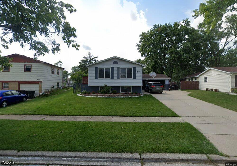
5720 Lancaster Dr Oak Forest, IL 60452
Estimated Value: $276,000 - $316,000
3
Beds
2
Baths
1,008
Sq Ft
$291/Sq Ft
Est. Value
About This Home
This home is located at 5720 Lancaster Dr, Oak Forest, IL 60452 and is currently estimated at $293,806, approximately $291 per square foot. 5720 Lancaster Dr is a home located in Cook County with nearby schools including Lee R Foster Elementary School, Jack Hille Middle School, and Oak Forest High School.
Ownership History
Date
Name
Owned For
Owner Type
Purchase Details
Closed on
Jun 25, 2002
Sold by
Burklow Norman F and Burklow Gloria C
Bought by
Montes Gustavo and Montes Alma S
Current Estimated Value
Home Financials for this Owner
Home Financials are based on the most recent Mortgage that was taken out on this home.
Original Mortgage
$125,000
Outstanding Balance
$53,226
Interest Rate
6.91%
Estimated Equity
$240,580
Create a Home Valuation Report for This Property
The Home Valuation Report is an in-depth analysis detailing your home's value as well as a comparison with similar homes in the area
Home Values in the Area
Average Home Value in this Area
Purchase History
| Date | Buyer | Sale Price | Title Company |
|---|---|---|---|
| Montes Gustavo | $183,000 | Stewart Title |
Source: Public Records
Mortgage History
| Date | Status | Borrower | Loan Amount |
|---|---|---|---|
| Open | Montes Gustavo | $125,000 |
Source: Public Records
Tax History Compared to Growth
Tax History
| Year | Tax Paid | Tax Assessment Tax Assessment Total Assessment is a certain percentage of the fair market value that is determined by local assessors to be the total taxable value of land and additions on the property. | Land | Improvement |
|---|---|---|---|---|
| 2024 | $5,786 | $21,808 | $3,122 | $18,686 |
| 2023 | $5,210 | $21,808 | $3,122 | $18,686 |
| 2022 | $5,210 | $15,829 | $2,775 | $13,054 |
| 2021 | $5,118 | $15,828 | $2,774 | $13,054 |
| 2020 | $5,502 | $17,077 | $2,774 | $14,303 |
| 2019 | $3,808 | $12,883 | $2,601 | $10,282 |
| 2018 | $3,741 | $12,883 | $2,601 | $10,282 |
| 2017 | $4,491 | $14,677 | $2,601 | $12,076 |
| 2016 | $4,237 | $12,809 | $2,427 | $10,382 |
| 2015 | $4,085 | $12,809 | $2,427 | $10,382 |
| 2014 | $4,773 | $14,825 | $2,427 | $12,398 |
| 2013 | $4,285 | $14,906 | $2,427 | $12,479 |
Source: Public Records
Map
Nearby Homes
- 5756 Lancaster Dr
- 15251 Colina Ave
- 15143 Geoffrey Rd
- 5568 Natalie Dr
- 5735 Dover Rd
- 5653 Dover Rd
- 5823 Stuart Ln
- 16207 Long Ave
- 5341 Crescent Ln Unit D
- 5340 Crescent Ln Unit C
- 15027 Park Ave
- 6066 Forestview Dr
- 15001 Park Ave
- 15100 Crescent Green Dr
- 15705 Peggy Ln
- 15701 Peggy Ln Unit 3
- 15700 Reynolds Ln
- 14825 Parkside Ave
- 15711 Peggy Ln Unit 7
- 15718 Peggy Ln Unit 2
- 5716 Lancaster Dr
- 5726 Lancaster Dr
- 15249 Rob Roy Dr
- 5730 Lancaster Dr
- 15253 Rob Roy Dr
- 5715 Gainsborough Place
- 5729 Gainsborough Place
- 5721 Gainsborough Place
- 5721 Lancaster Dr
- 5717 Lancaster Dr
- 5725 Lancaster Dr
- 5735 Gainsborough Place
- 15257 Rob Roy Dr
- 5736 Lancaster Dr
- 5711 Lancaster Dr
- 5731 Lancaster Dr
- 5737 Lancaster Dr
- 5744 Lancaster Dr
- 15252 Rob Roy Dr
- 15261 Rob Roy Dr