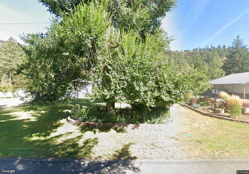
5720 N 17th St Dalton Gardens, ID 83815
Estimated Value: $800,000 - $994,000
3
Beds
2
Baths
1,638
Sq Ft
$556/Sq Ft
Est. Value
About This Home
This home is located at 5720 N 17th St, Dalton Gardens, ID 83815 and is currently estimated at $910,687, approximately $555 per square foot. 5720 N 17th St is a home located in Kootenai County with nearby schools including Dalton Elementary School, Canfield Middle School, and Coeur d'Alene High School.
Ownership History
Date
Name
Owned For
Owner Type
Purchase Details
Closed on
Oct 12, 2018
Sold by
Hosier Robert L and Hosier Donna M
Bought by
Hosier Robert L and Hosier Donna Marie
Current Estimated Value
Purchase Details
Closed on
Aug 9, 2017
Sold by
Mcgrath Phillip J and Mcgrath Janice
Bought by
Hosier Robert L
Home Financials for this Owner
Home Financials are based on the most recent Mortgage that was taken out on this home.
Original Mortgage
$390,000
Outstanding Balance
$323,935
Interest Rate
3.88%
Mortgage Type
VA
Estimated Equity
$586,752
Purchase Details
Closed on
Sep 19, 2016
Sold by
Zielinski Ronald E and Zielinski Shelley
Bought by
Mcgrath Phillip J and Mcgrath Janice C
Home Financials for this Owner
Home Financials are based on the most recent Mortgage that was taken out on this home.
Original Mortgage
$451,421
Interest Rate
3.43%
Mortgage Type
VA
Create a Home Valuation Report for This Property
The Home Valuation Report is an in-depth analysis detailing your home's value as well as a comparison with similar homes in the area
Home Values in the Area
Average Home Value in this Area
Purchase History
| Date | Buyer | Sale Price | Title Company |
|---|---|---|---|
| Hosier Robert L | -- | Accommodation | |
| Hosier Robert L | -- | Alliance Title & Escrow Corp | |
| Mcgrath Phillip J | -- | Kootenai County Title Compan |
Source: Public Records
Mortgage History
| Date | Status | Borrower | Loan Amount |
|---|---|---|---|
| Open | Hosier Robert L | $390,000 | |
| Previous Owner | Mcgrath Phillip J | $451,421 |
Source: Public Records
Tax History Compared to Growth
Tax History
| Year | Tax Paid | Tax Assessment Tax Assessment Total Assessment is a certain percentage of the fair market value that is determined by local assessors to be the total taxable value of land and additions on the property. | Land | Improvement |
|---|---|---|---|---|
| 2025 | $2,772 | $803,048 | $434,729 | $368,319 |
| 2024 | $2,772 | $803,241 | $426,256 | $376,985 |
| 2023 | $2,772 | $867,559 | $459,729 | $407,830 |
| 2022 | $2,609 | $888,122 | $459,729 | $428,393 |
| 2021 | $2,958 | $536,837 | $292,364 | $244,473 |
| 2020 | $2,935 | $468,287 | $230,307 | $237,980 |
| 2019 | $2,931 | $439,327 | $214,307 | $225,020 |
| 2018 | $2,871 | $397,527 | $190,307 | $207,220 |
| 2017 | $2,652 | $358,666 | $161,756 | $196,910 |
| 2016 | $2,329 | $313,936 | $154,046 | $159,890 |
| 2015 | $2,052 | $253,340 | $115,040 | $138,300 |
| 2013 | $1,871 | $239,198 | $112,208 | $126,990 |
Source: Public Records
Map
Nearby Homes
- 5960 N 17th St
- 5519 N Wade St
- 2066 E Goldleaf Ln
- 5189 Hague Ct
- 4404 N Huntercrest Dr
- 2320 N Mountain Vista Dr
- 4252 N Magnolia Dr
- 5687 N 15th St
- 1337 N Center Green Loop
- 1772 E Hanley Ave
- 4860 N Cuprum Ct
- 1363 N Center Green Loop
- 1283 N Center Green Loop
- 4095 E Erickson Dr
- 5069 N Webster St
- 2153 E Thomas Hill Dr
- 3749 N Miners Loop
- 2177 E Totten Ln
- 1213 E Fernwood Ct
- 850 E Trinity Ct
- 5760 N 17th St
- 5711 N 17th St
- 5671 N 17th St
- 2423 E Dalton Ave
- 5800 N 17th St
- 5783 N 17th St
- 2355 E Dalton Ave
- 5880 N 17th St
- 5415 N Martha Loop
- 2547 E Dalton Ave
- 5419 N Martha Loop
- 5411 N Martha Loop
- 2091 E Berrywood St
- 5423 N Martha Loop
- 5879 N 17th St
- 2077 E Berrywood St
- 2287 E Dalton Ave
- 5427 N Martha Loop
- 5869 N 18th St
- 5407 N Martha Loop