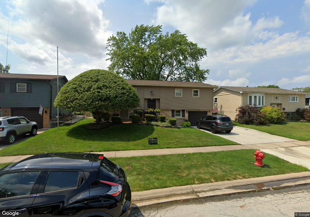
5720 Victoria Dr Oak Forest, IL 60452
Estimated Value: $280,067 - $303,000
3
Beds
1
Bath
1,008
Sq Ft
$290/Sq Ft
Est. Value
About This Home
This home is located at 5720 Victoria Dr, Oak Forest, IL 60452 and is currently estimated at $292,767, approximately $290 per square foot. 5720 Victoria Dr is a home located in Cook County with nearby schools including Lee R Foster Elementary School, Jack Hille Middle School, and Oak Forest High School.
Ownership History
Date
Name
Owned For
Owner Type
Purchase Details
Closed on
Nov 19, 2020
Sold by
Mangan Edward M and Mangan Colleen A
Bought by
Mangan Edward M and Mangan Colleen A
Current Estimated Value
Create a Home Valuation Report for This Property
The Home Valuation Report is an in-depth analysis detailing your home's value as well as a comparison with similar homes in the area
Home Values in the Area
Average Home Value in this Area
Purchase History
| Date | Buyer | Sale Price | Title Company |
|---|---|---|---|
| Mangan Edward M | -- | None Available |
Source: Public Records
Tax History Compared to Growth
Tax History
| Year | Tax Paid | Tax Assessment Tax Assessment Total Assessment is a certain percentage of the fair market value that is determined by local assessors to be the total taxable value of land and additions on the property. | Land | Improvement |
|---|---|---|---|---|
| 2024 | $5,846 | $20,570 | $2,970 | $17,600 |
| 2023 | $5,234 | $22,000 | $2,970 | $19,030 |
| 2022 | $5,234 | $15,886 | $2,640 | $13,246 |
| 2021 | $5,141 | $15,885 | $2,640 | $13,245 |
| 2020 | $5,388 | $16,787 | $2,640 | $14,147 |
| 2019 | $3,627 | $12,434 | $2,475 | $9,959 |
| 2018 | $3,563 | $12,434 | $2,475 | $9,959 |
| 2017 | $3,599 | $12,434 | $2,475 | $9,959 |
| 2016 | $4,739 | $14,030 | $2,310 | $11,720 |
| 2015 | $4,575 | $14,030 | $2,310 | $11,720 |
| 2014 | $4,463 | $14,030 | $2,310 | $11,720 |
| 2013 | $4,916 | $16,713 | $2,310 | $14,403 |
Source: Public Records
Map
Nearby Homes
- 5756 Lancaster Dr
- 15251 Colina Ave
- 15143 Geoffrey Rd
- 5568 Natalie Dr
- 5735 Dover Rd
- 5653 Dover Rd
- 5823 Stuart Ln
- 16207 Long Ave
- 5341 Crescent Ln Unit D
- 5340 Crescent Ln Unit C
- 15701 Peggy Ln Unit 3
- 15700 Reynolds Ln
- 15711 Peggy Ln Unit 7
- 15718 Peggy Ln Unit 2
- 15027 Park Ave
- 15100 Crescent Green Dr
- 15001 Park Ave
- 6066 Forestview Dr
- 15730 Revere Ct Unit D
- 5237 Diamond Dr Unit B
- 5716 Victoria Dr
- 5722 Victoria Dr
- 5743 Lancaster Dr
- 5737 Lancaster Dr
- 5712 Victoria Dr
- 5724 Victoria Dr
- 5749 Lancaster Dr
- 5731 Lancaster Dr
- 5711 Victoria Dr
- 5708 Victoria Dr
- 5728 Victoria Dr
- 5717 Victoria Dr
- 5709 Victoria Dr
- 5725 Lancaster Dr
- 5730 Merlin Ct
- 5705 Victoria Dr
- 5732 Victoria Dr
- 5704 Victoria Dr
- 15325 James Dr
- 5755 Lancaster Dr