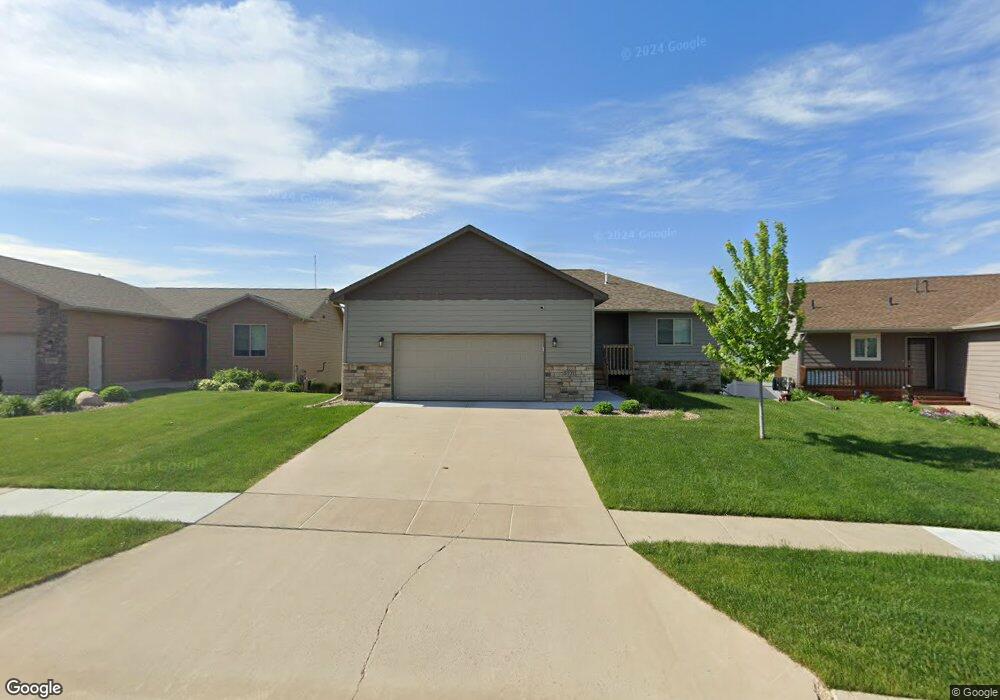
5721 Bream Ct Sioux Falls, SD 57107
Northwest Sioux Falls NeighborhoodEstimated Value: $378,497 - $400,000
4
Beds
3
Baths
2,035
Sq Ft
$192/Sq Ft
Est. Value
About This Home
This home is located at 5721 Bream Ct, Sioux Falls, SD 57107 and is currently estimated at $390,374, approximately $191 per square foot. 5721 Bream Ct is a home located in Minnehaha County with nearby schools including Renberg Elementary School, George McGovern Middle School, and Jefferson High School - 67.
Ownership History
Date
Name
Owned For
Owner Type
Purchase Details
Closed on
Jul 1, 2025
Sold by
Lang Kaylor N
Bought by
Laqua Travis G and Laqua Jennifer N
Current Estimated Value
Purchase Details
Closed on
Jun 22, 2020
Sold by
Lang Rick J
Bought by
Lang Kaylor N
Home Financials for this Owner
Home Financials are based on the most recent Mortgage that was taken out on this home.
Original Mortgage
$210,000
Interest Rate
3.2%
Mortgage Type
New Conventional
Purchase Details
Closed on
Apr 18, 2019
Sold by
Niewald Gail
Bought by
Lang Rick
Create a Home Valuation Report for This Property
The Home Valuation Report is an in-depth analysis detailing your home's value as well as a comparison with similar homes in the area
Home Values in the Area
Average Home Value in this Area
Purchase History
| Date | Buyer | Sale Price | Title Company |
|---|---|---|---|
| Laqua Travis G | $385,000 | Getty Abstract & Title Co | |
| Laqua Travis G | $385,000 | Getty Abstract & Title Co | |
| Lang Kaylor N | $265,000 | None Available | |
| Lang Rick | $261,000 | Stewart Title Company |
Source: Public Records
Mortgage History
| Date | Status | Borrower | Loan Amount |
|---|---|---|---|
| Previous Owner | Lang Kaylor N | $210,000 | |
| Closed | Laqua Travis G | -- |
Source: Public Records
Tax History
| Year | Tax Paid | Tax Assessment Tax Assessment Total Assessment is a certain percentage of the fair market value that is determined by local assessors to be the total taxable value of land and additions on the property. | Land | Improvement |
|---|---|---|---|---|
| 2024 | $6,153 | $372,300 | $25,400 | $346,900 |
| 2023 | $6,056 | $348,700 | $25,400 | $323,300 |
| 2022 | $5,701 | $310,200 | $25,400 | $284,800 |
| 2021 | $4,393 | $262,600 | $0 | $0 |
| 2020 | $4,393 | $229,300 | $0 | $0 |
| 2019 | $3,179 | $201,548 | $0 | $0 |
| 2018 | $2,144 | $187,248 | $0 | $0 |
| 2017 | $559 | $107,325 | $24,235 | $83,090 |
| 2016 | $559 | $24,235 | $24,235 | $0 |
| 2015 | $524 | $22,888 | $22,888 | $0 |
| 2014 | -- | $23,134 | $23,134 | $0 |
Source: Public Records
Map
Nearby Homes
- 5612 W Holbrook Cir
- 1010 N Crape Place
- 1203 N Fir Place Unit 42
- 1213 N Pekin Place
- 5813 W Hemlock Dr
- 5601 W Oakcrest Dr
- 1030 N Holbrook Ave Unit 4
- 5809 W Oakcrest Dr Dr
- 1017 N Crestfield Place
- 1127 N Lalley Ln
- 1249 N Marion Rd Unit 5
- 1249 N Marion Rd Unit 2
- 1249 N Marion Rd Unit 4
- 1249 N Marion Rd Unit 3
- 1263 N Marion Rd Unit 2
- 1263 N Marion Rd Unit 4
- 1263 N Marion Rd Unit 5
- 1263 N Marion Rd Unit 3
- 1263 N Marion Rd Unit 1
- 6101 W Maxwell Place
- 5717 Bream Ct
- 5616 W Holbrook Cir
- 5720 Bream Ct
- 5720 W Bream Ct
- 5732 Bream Ct
- 5708 W Bream Ct
- 5733 Bream Ct
- 5709 Bream Ct
- 5621 W Holbrook Cir
- 5705 W Bream Ct
- 5737 Bream Ct
- 5737 W Bream Ct
- 5740 W Bream Ct
- 5705 W Bream Dr
- 5705 W Bream Dr Dr
- 5701 Bream Dr
- 5729 W Bream Dr
- 5608 Holbrook Ave
- 5709 W Bream Dr
- 5709 W Bream Dr Dr
Your Personal Tour Guide
Ask me questions while you tour the home.