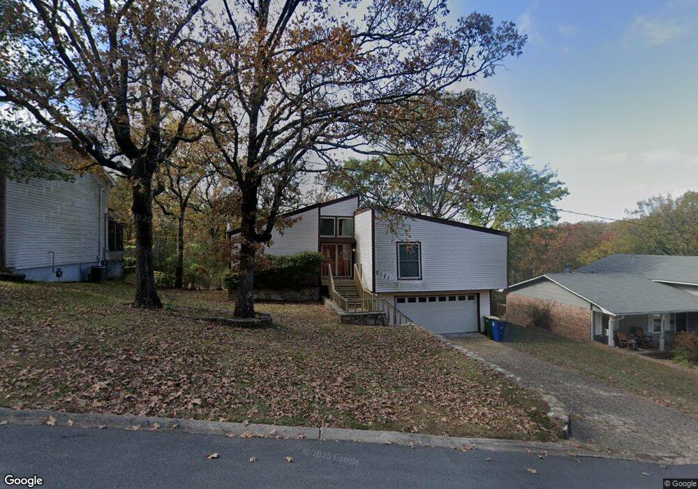
5721 N Locust St North Little Rock, AR 72116
Amboy NeighborhoodEstimated Value: $198,847 - $225,000
--
Bed
2
Baths
1,561
Sq Ft
$133/Sq Ft
Est. Value
About This Home
This home is located at 5721 N Locust St, North Little Rock, AR 72116 and is currently estimated at $206,962, approximately $132 per square foot. 5721 N Locust St is a home located in Pulaski County with nearby schools including Crestwood Elementary School, North Little Rock Middle School 6th Grade Campus, and North Little Rock High School.
Ownership History
Date
Name
Owned For
Owner Type
Purchase Details
Closed on
Apr 6, 2017
Sold by
Matlock Phillip Dwayne
Bought by
Talley Sylvia
Current Estimated Value
Home Financials for this Owner
Home Financials are based on the most recent Mortgage that was taken out on this home.
Original Mortgage
$5,012,047
Outstanding Balance
$4,155,103
Interest Rate
4.16%
Mortgage Type
New Conventional
Estimated Equity
-$3,948,141
Create a Home Valuation Report for This Property
The Home Valuation Report is an in-depth analysis detailing your home's value as well as a comparison with similar homes in the area
Home Values in the Area
Average Home Value in this Area
Purchase History
| Date | Buyer | Sale Price | Title Company |
|---|---|---|---|
| Talley Sylvia | $128,500 | American Abstract & Title Co |
Source: Public Records
Mortgage History
| Date | Status | Borrower | Loan Amount |
|---|---|---|---|
| Open | Talley Sylvia | $5,012,047 |
Source: Public Records
Tax History Compared to Growth
Tax History
| Year | Tax Paid | Tax Assessment Tax Assessment Total Assessment is a certain percentage of the fair market value that is determined by local assessors to be the total taxable value of land and additions on the property. | Land | Improvement |
|---|---|---|---|---|
| 2025 | $1,847 | $34,367 | $7,000 | $27,367 |
| 2024 | $1,693 | $34,367 | $7,000 | $27,367 |
| 2023 | $1,693 | $34,367 | $7,000 | $27,367 |
| 2022 | $1,617 | $34,367 | $7,000 | $27,367 |
| 2021 | $1,540 | $23,050 | $6,900 | $16,150 |
| 2020 | $1,165 | $23,050 | $6,900 | $16,150 |
| 2019 | $1,165 | $23,050 | $6,900 | $16,150 |
| 2018 | $1,190 | $23,050 | $6,900 | $16,150 |
| 2017 | $1,190 | $23,050 | $6,900 | $16,150 |
| 2016 | $1,471 | $22,020 | $5,600 | $16,420 |
| 2015 | $1,471 | $22,020 | $5,600 | $16,420 |
| 2014 | $1,471 | $22,017 | $5,600 | $16,417 |
Source: Public Records
Map
Nearby Homes
- 5709 N Cedar St
- 801 Green Hills Dr
- 5605 N Walnut Rd
- 5513 N Walnut Rd
- 5600 N Locust St
- 813 Silver Hill Rd
- 5600 Belle Point Rd
- 5508 Belle Point Rd
- 6317 Rolling Hills Dr
- 6312 Allwood Dr
- 6324 Allwood Dr
- 0 W Hill Ct
- 9 Blackstone Cir
- 1013 Kierre Dr
- 5212 N Walnut Rd
- 5820 Greenhurst Dr
- 0 Timberline Dr
- 5104 N Cedar St
- 1115 Claycut Cir
- 1010 Claycut Cir
- 5801 N Locust St
- 5717 N Locust St
- 5805 N Locust St
- 0 N Locust Unit 20020345
- 5709 N Locust St
- 5716 N Locust St
- 5720 N Locust St
- 5712 N Locust St
- 5804 N Locust St
- 5809 N Locust St
- 5708 N Locust St
- 5808 N Locust St
- 5705 N Locust St
- 5701 N Locust St
- 5812 N Locust St
- 5625 Westview Dr
- 905 E 57th Place
- 5705 N Cedar St
- 900 Green Hills Dr