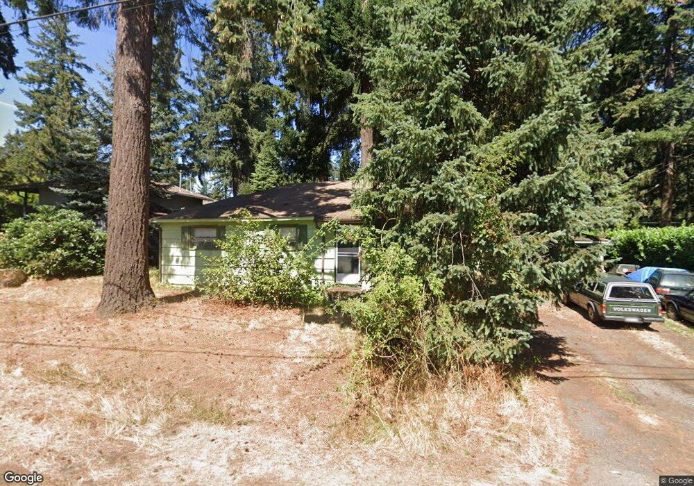
5725 Mcewan Rd Lake Oswego, OR 97035
Rosewood NeighborhoodEstimated Value: $484,000 - $538,000
3
Beds
1
Bath
975
Sq Ft
$533/Sq Ft
Est. Value
About This Home
This home is located at 5725 Mcewan Rd, Lake Oswego, OR 97035 and is currently estimated at $519,352, approximately $532 per square foot. 5725 Mcewan Rd is a home located in Clackamas County with nearby schools including River Grove Elementary School, Lakeridge Middle School, and Lakeridge High School.
Ownership History
Date
Name
Owned For
Owner Type
Purchase Details
Closed on
Jul 6, 2012
Sold by
Gillingham Brian D
Bought by
Baxter Dan and Baxter David Michael
Current Estimated Value
Home Financials for this Owner
Home Financials are based on the most recent Mortgage that was taken out on this home.
Original Mortgage
$150,000
Outstanding Balance
$63,520
Interest Rate
3.74%
Mortgage Type
Seller Take Back
Estimated Equity
$455,832
Purchase Details
Closed on
Oct 6, 1998
Sold by
Gillingham Patricia C
Bought by
Gillingham Patricia C and Gillingham Living Trust
Create a Home Valuation Report for This Property
The Home Valuation Report is an in-depth analysis detailing your home's value as well as a comparison with similar homes in the area
Home Values in the Area
Average Home Value in this Area
Purchase History
| Date | Buyer | Sale Price | Title Company |
|---|---|---|---|
| Baxter Dan | $170,000 | Ticor Title Company | |
| Gillingham Patricia C | -- | -- |
Source: Public Records
Mortgage History
| Date | Status | Borrower | Loan Amount |
|---|---|---|---|
| Open | Baxter Dan | $150,000 |
Source: Public Records
Tax History Compared to Growth
Tax History
| Year | Tax Paid | Tax Assessment Tax Assessment Total Assessment is a certain percentage of the fair market value that is determined by local assessors to be the total taxable value of land and additions on the property. | Land | Improvement |
|---|---|---|---|---|
| 2025 | $3,409 | $196,376 | -- | -- |
| 2024 | $3,320 | $190,657 | -- | -- |
| 2023 | $3,320 | $185,104 | $0 | $0 |
| 2022 | $3,132 | $179,713 | $0 | $0 |
| 2021 | $2,871 | $174,479 | $0 | $0 |
| 2020 | $2,798 | $169,398 | $0 | $0 |
| 2019 | $2,730 | $164,465 | $0 | $0 |
| 2018 | $2,626 | $159,675 | $0 | $0 |
| 2017 | $2,531 | $155,024 | $0 | $0 |
| 2016 | $2,280 | $150,509 | $0 | $0 |
| 2015 | $2,195 | $146,125 | $0 | $0 |
| 2014 | $2,165 | $141,869 | $0 | $0 |
Source: Public Records
Map
Nearby Homes
- 19222 Benfield Ave
- 18581 Timbergrove Ct
- 6050 Fernbrook St
- 18978 Arrowwood Ave
- 18541 Waxwing Way
- 18411 Longfellow Ave
- 19368 Riverwood Ln
- 17928 Royal Ct
- 6401 Mcewan Rd
- 6375 SW Dawn St
- 5513 Rachel Ln
- 18863 Indian Springs Rd
- 5650 Lakeview Blvd
- 18434 Sandpiper Cir
- 5225 Jean Rd Unit 307
- 5393 SW Wichita St
- 19130 SW 51st Ave
- 17401 Hill Way
- 4201 Childs Rd
- 19200 SW 46th Ave
- 5775 Mcewan Rd
- 5711 Mcewan Rd
- 18721 Pilkington Rd
- 0 Reao Ct
- 18667 Pilkington Rd
- 5540 Mcewan Rd
- 18745 Pilkington Rd
- 18782 Benfield Ave
- 18810 Reao Ct
- 18744 Benfield Ave
- 18717 Pilkington Rd
- 5500 Mcewan Rd
- 18811 Reao Ct
- 18698 Benfield Ave
- 18635 Pilkington Rd
- 18653 Pilkington Rd
- 18639 Pilkington Rd
- 18851 SW Pilkington
- 18851 Pilkington Rd
- 5750 Mcewan Rd