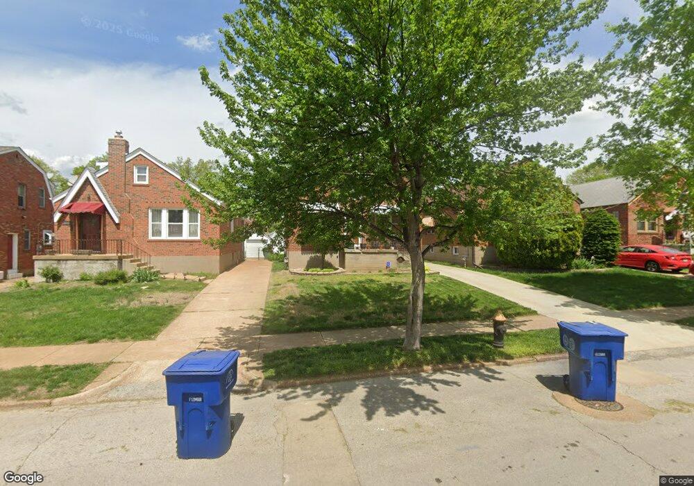
5725 Pernod Ave Saint Louis, MO 63139
Northampton NeighborhoodEstimated Value: $255,626 - $281,000
--
Bed
1
Bath
2,000
Sq Ft
$135/Sq Ft
Est. Value
About This Home
This home is located at 5725 Pernod Ave, Saint Louis, MO 63139 and is currently estimated at $269,907, approximately $134 per square foot. 5725 Pernod Ave is a home located in St. Louis City with nearby schools including Mason Elementary School, Long International Middle School, and Roosevelt High School.
Ownership History
Date
Name
Owned For
Owner Type
Purchase Details
Closed on
Nov 8, 2002
Sold by
Reeve Marion Johanna and Clark Carol Lou
Bought by
Benn Andrew R
Current Estimated Value
Home Financials for this Owner
Home Financials are based on the most recent Mortgage that was taken out on this home.
Original Mortgage
$122,550
Outstanding Balance
$50,839
Interest Rate
5.89%
Mortgage Type
Purchase Money Mortgage
Estimated Equity
$219,068
Create a Home Valuation Report for This Property
The Home Valuation Report is an in-depth analysis detailing your home's value as well as a comparison with similar homes in the area
Home Values in the Area
Average Home Value in this Area
Purchase History
| Date | Buyer | Sale Price | Title Company |
|---|---|---|---|
| Benn Andrew R | -- | -- |
Source: Public Records
Mortgage History
| Date | Status | Borrower | Loan Amount |
|---|---|---|---|
| Open | Benn Andrew R | $122,550 |
Source: Public Records
Tax History Compared to Growth
Tax History
| Year | Tax Paid | Tax Assessment Tax Assessment Total Assessment is a certain percentage of the fair market value that is determined by local assessors to be the total taxable value of land and additions on the property. | Land | Improvement |
|---|---|---|---|---|
| 2025 | $2,867 | $40,130 | $2,810 | $37,320 |
| 2024 | $2,727 | $33,910 | $2,810 | $31,100 |
| 2023 | $2,727 | $33,910 | $2,810 | $31,100 |
| 2022 | $2,619 | $31,340 | $2,810 | $28,530 |
| 2021 | $2,615 | $31,340 | $2,810 | $28,530 |
| 2020 | $2,383 | $28,750 | $2,810 | $25,940 |
| 2019 | $2,375 | $28,750 | $2,810 | $25,940 |
| 2018 | $2,106 | $24,680 | $2,810 | $21,870 |
| 2017 | $2,070 | $24,680 | $2,810 | $21,870 |
| 2016 | $1,898 | $22,310 | $2,810 | $19,490 |
| 2015 | $1,721 | $22,300 | $2,810 | $19,490 |
| 2014 | $1,677 | $22,300 | $2,810 | $19,490 |
| 2013 | -- | $21,730 | $2,810 | $18,920 |
Source: Public Records
Map
Nearby Homes
- 5701 Pernod Ave
- 5816 Mardel Ave
- 5736 Lindenwood Ave
- 5700 Chippewa St
- 5500 Mardel Ave
- 5524 Lindenwood Ave
- 5723 Winona Ave
- 5500 Lindenwood Ave
- 6214 Oleatha Ave
- 7082 Oleatha Ave
- 6228 Marquette Ave
- 5630 Fyler Ave
- 5425 Pernod Ave
- 5614 Bancroft Ave
- 5655 Sutherland Ave
- 6325 Marquette Ave
- 5340 Tholozan Ave
- 5329 Tholozan Ave
- 3443 Sublette Ave
- 3905 Tamm Ave
- 5721 Pernod Ave
- 5727 Pernod Ave
- 5719 Pernod Ave
- 5715 Pernod Ave
- 5735 Pernod Ave
- 5724 Oleatha Ave
- 5720 Oleatha Ave
- 5728 Oleatha Ave
- 5709 Pernod Ave
- 5716 Oleatha Ave
- 5739 Pernod Ave
- 5732 Oleatha Ave
- 5712 Oleatha Ave
- 5736 Oleatha Ave
- 5705 Pernod Ave
- 5718 Pernod Ave
- 5722 Pernod Ave
- 5716 Pernod Ave
- 5743 Pernod Ave
- 5726 Pernod Ave