A
Seller's Agent in 2019
Ann Thomas
Frison Realty & Construction Co
(229) 347-2457
43 Total Sales
Estimated Value: $119,000 - $188,000
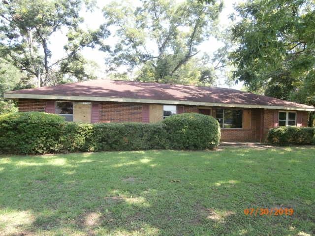
Nice lot size for all family activities. Near airport. Nice rear screened porch.
Last Agent to Sell the Property
Frison Realty & Construction Co Brokerage Phone: 2294366628 License #43940 Listed on: 08/19/2019
Last Buyer's Agent
Frison Realty & Construction Co Brokerage Phone: 2294366628 License #43940 Listed on: 08/19/2019
| Date | Buyer | Sale Price | Title Company |
|---|---|---|---|
| Bryant William J | $30,000 | -- | |
| Us Bank National Association Trustee | -- | -- | |
| Woods Donald K | $90,000 | -- | |
| Cox Bobby Ray | $65,000 | -- | |
| Carlton Co A Ga Corp | $85,000 | -- | |
| Mears Betty M | -- | -- |
| Date | Status | Borrower | Loan Amount |
|---|---|---|---|
| Previous Owner | Woods Donald K | $90,000 |
| Date | Event | Price | List to Sale | Price per Sq Ft |
|---|---|---|---|---|
| 09/10/2019 09/10/19 | Sold | $30,000 | -- | $17 / Sq Ft |
| 08/19/2019 08/19/19 | Pending | -- | -- | -- |
| Year | Tax Paid | Tax Assessment Tax Assessment Total Assessment is a certain percentage of the fair market value that is determined by local assessors to be the total taxable value of land and additions on the property. | Land | Improvement |
|---|---|---|---|---|
| 2024 | $1,562 | $33,805 | $3,360 | $30,445 |
| 2023 | $1,563 | $33,805 | $3,360 | $30,445 |
| 2022 | $1,566 | $33,805 | $3,360 | $30,445 |
| 2021 | $1,450 | $33,805 | $3,360 | $30,445 |
| 2020 | $516 | $33,805 | $3,360 | $30,445 |
| 2019 | $1,456 | $33,805 | $3,360 | $30,445 |
| 2018 | $1,459 | $33,805 | $3,360 | $30,445 |
| 2017 | $1,358 | $33,805 | $3,360 | $30,445 |
| 2016 | $1,359 | $33,805 | $3,360 | $30,445 |
| 2015 | $1,361 | $33,805 | $3,360 | $30,445 |
| 2014 | $1,315 | $33,120 | $2,680 | $30,440 |
A
Seller's Agent in 2019
Ann Thomas
Frison Realty & Construction Co
(229) 347-2457
43 Total Sales
Source: Albany Board of REALTORS®
MLS Number: 143580
APN: 00208-00001-104
