Estimated Value: $306,000 - $335,000
4
Beds
2
Baths
1,056
Sq Ft
$306/Sq Ft
Est. Value
About This Home
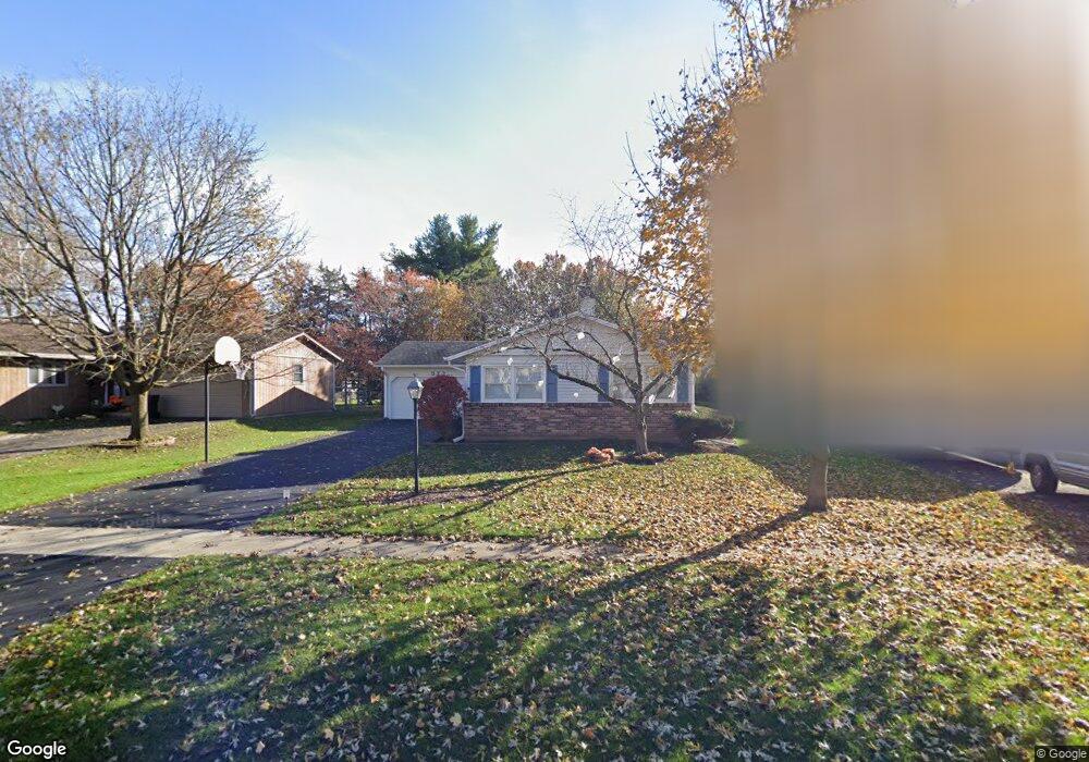
This home is located at 573 Alida Dr Unit 3, Cary, IL 60013 and is currently estimated at $323,579, approximately $306 per square foot. 573 Alida Dr Unit 3 is a home located in McHenry County with nearby schools including Briargate Elementary School, Cary Jr High School, and Cary Grove High School.
Ownership History
Date
Name
Owned For
Owner Type
Purchase Details
Closed on
Jun 14, 2017
Sold by
Singleton Jean
Bought by
Sawdey David and Sawdey Randie
Current Estimated Value
Home Financials for this Owner
Home Financials are based on the most recent Mortgage that was taken out on this home.
Original Mortgage
$179,790
Outstanding Balance
$149,548
Interest Rate
4.02%
Mortgage Type
New Conventional
Estimated Equity
$174,031
Purchase Details
Closed on
Oct 21, 2010
Sold by
Singleton Michael N
Bought by
Singleton Jean
Purchase Details
Closed on
Oct 31, 1996
Sold by
Petersen William J and Petersen Karyn A
Bought by
Singleton Michael N and Singleton Jean
Home Financials for this Owner
Home Financials are based on the most recent Mortgage that was taken out on this home.
Original Mortgage
$130,675
Interest Rate
8.23%
Mortgage Type
FHA
Create a Home Valuation Report for This Property
The Home Valuation Report is an in-depth analysis detailing your home's value as well as a comparison with similar homes in the area
Home Values in the Area
Average Home Value in this Area
Purchase History
| Date | Buyer | Sale Price | Title Company |
|---|---|---|---|
| Sawdey David | $189,253 | Heritage Title Co | |
| Singleton Jean | -- | None Available | |
| Singleton Michael N | $132,500 | First American Title |
Source: Public Records
Mortgage History
| Date | Status | Borrower | Loan Amount |
|---|---|---|---|
| Open | Sawdey David | $179,790 | |
| Previous Owner | Singleton Michael N | $130,675 |
Source: Public Records
Tax History Compared to Growth
Tax History
| Year | Tax Paid | Tax Assessment Tax Assessment Total Assessment is a certain percentage of the fair market value that is determined by local assessors to be the total taxable value of land and additions on the property. | Land | Improvement |
|---|---|---|---|---|
| 2024 | $6,501 | $85,191 | $17,171 | $68,020 |
| 2023 | $6,312 | $76,192 | $15,357 | $60,835 |
| 2022 | $5,738 | $67,277 | $17,250 | $50,027 |
| 2021 | $5,453 | $62,676 | $16,070 | $46,606 |
| 2020 | $5,284 | $60,457 | $15,501 | $44,956 |
| 2019 | $5,170 | $57,864 | $14,836 | $43,028 |
| 2018 | $4,855 | $53,454 | $13,705 | $39,749 |
| 2017 | $4,747 | $50,357 | $12,911 | $37,446 |
| 2016 | $4,694 | $47,230 | $12,109 | $35,121 |
| 2013 | -- | $49,522 | $11,296 | $38,226 |
Source: Public Records
Map
Nearby Homes
- 589 Arthur Dr
- 641 Alida Dr
- 550 Norman Dr
- 2 Daybreak Ridge Trail
- Lots 2,3,4 Northwest Hwy
- 411 Park Ave
- 60 S Seebert St
- 226 Aberdeen Rd
- 368 Copper Canyon Trail
- 204 Country Commons Rd
- 324 Alma Terrace
- 780 Merrimac St
- 341 Cold Spring St
- 331 Cold Spring St
- 321 Cold Spring St
- 763 Blazing Star Trail
- 340 W Margaret Terrace
- 26 Wagner Dr
- 336 W Margaret Terrace
- 413 Haber Rd Unit 5